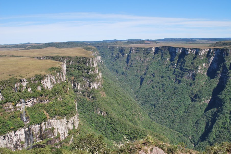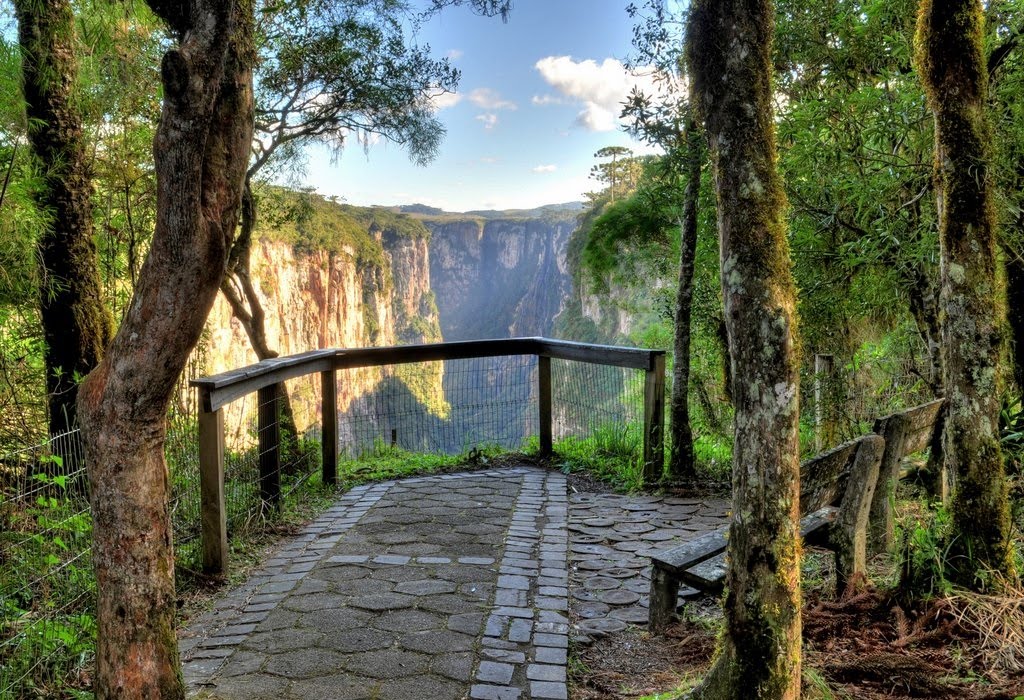

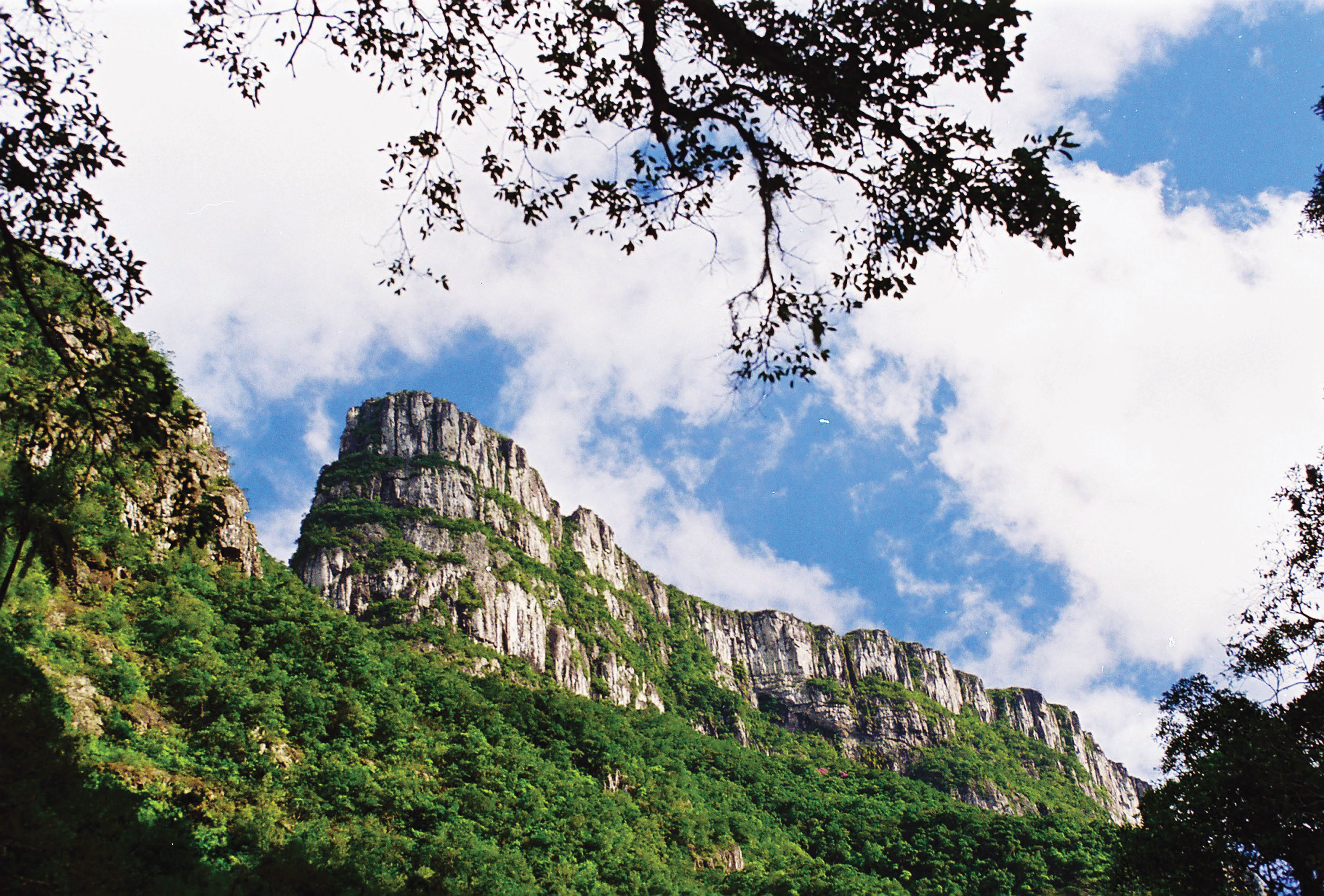
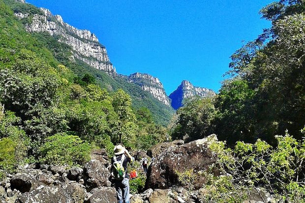
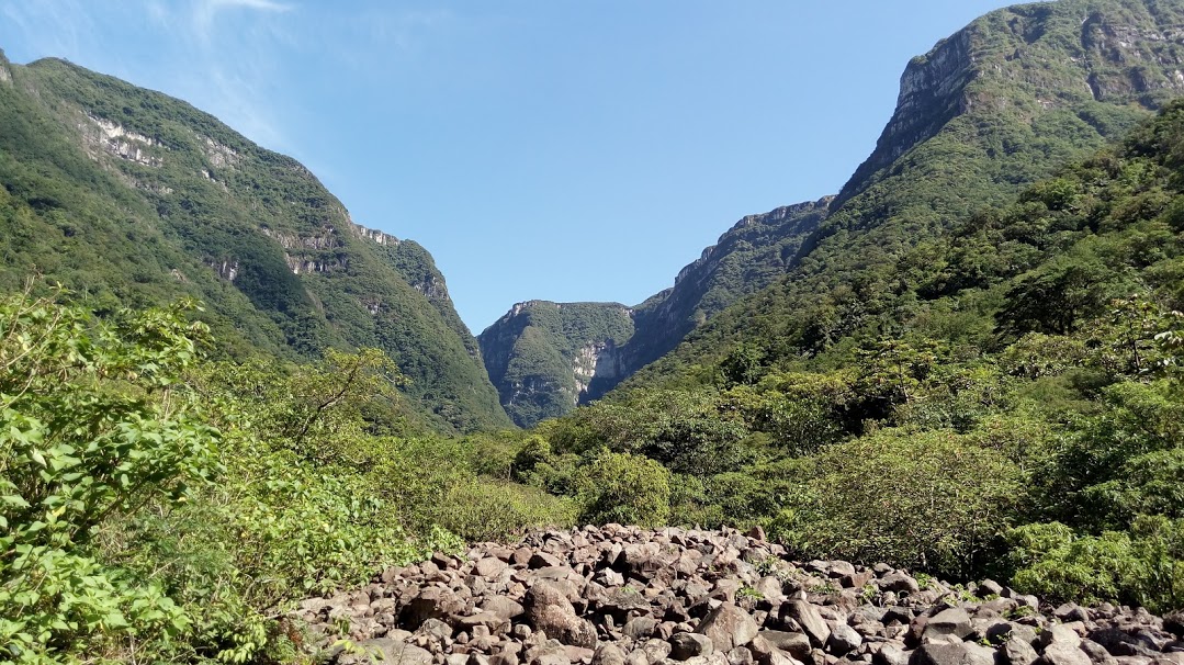
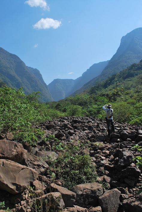
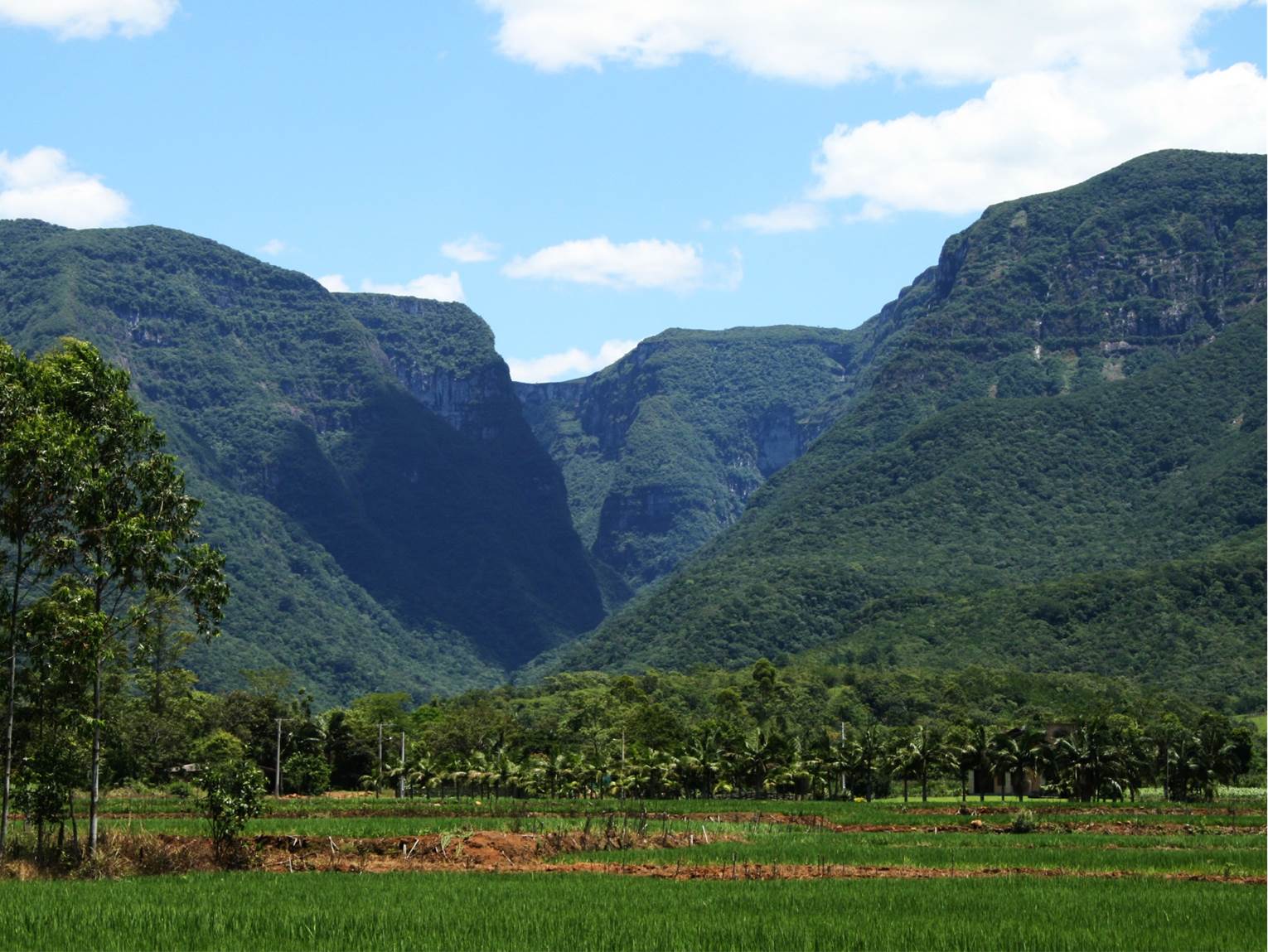
Fortaleza Canyon
Located in the Serra Geral National Park, the Fortaleza Canyon geosite is characterized by a deep and strikin V- shaped valley, about 8 km long. The canyon acquired these characteristics due to the action of the local drainage system and the consequent carving that followed the tectonic structures (fractures and faults) existing in the volcanic rocks of the Serra Geral formation.
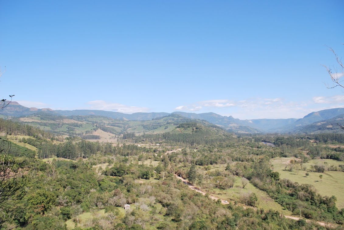
This geosite can also be considered a panoramic point for the observation and interpretation of landscape elements, with views to both the Serra Geral escarpments and the coastal plain.
Visiting the geosite:
Fortaleza Canyon, located 23 km from Cambará do Sul city, is open to the public from Monday to Sunday, from 08h00 to 17h00, and permanence is allowed until one hour after the closing of the access gate.
In this canyon, two trails are offered to visitors: Pedra do Segredo trail, with a 3km round trip, passing by the Tigre Preto waterfall; and the Mirante trail, also with a 3km round trip. While in the Mirante you can see the whole canyon, the city of Torres and, on days with good visibility and low cloud coverage, even the coastline.
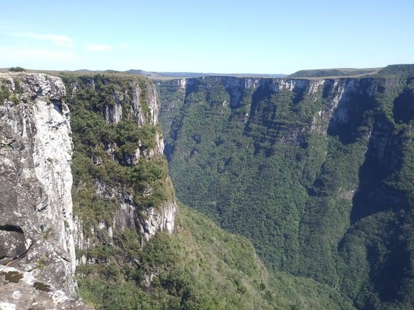
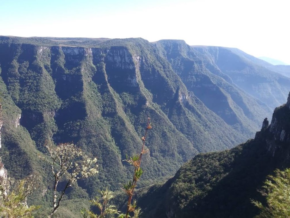
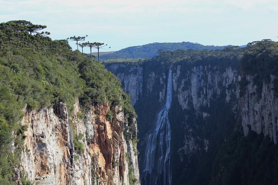
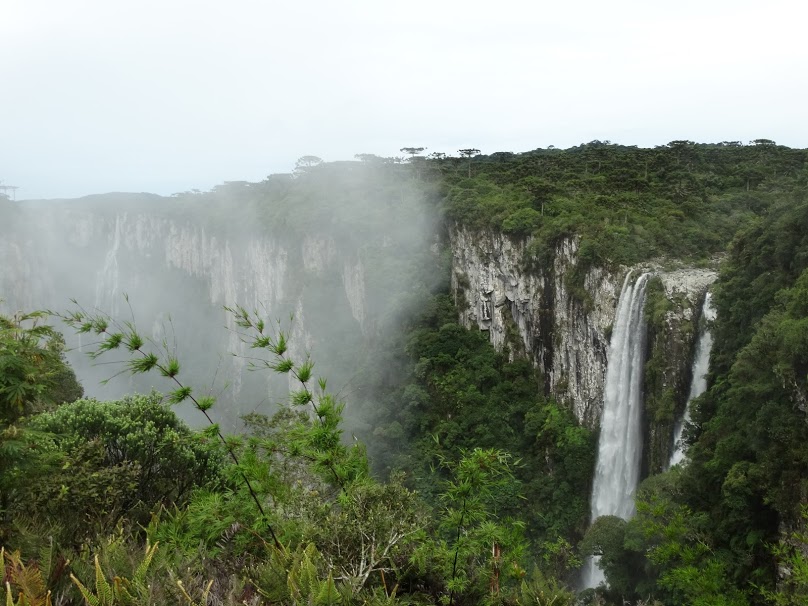
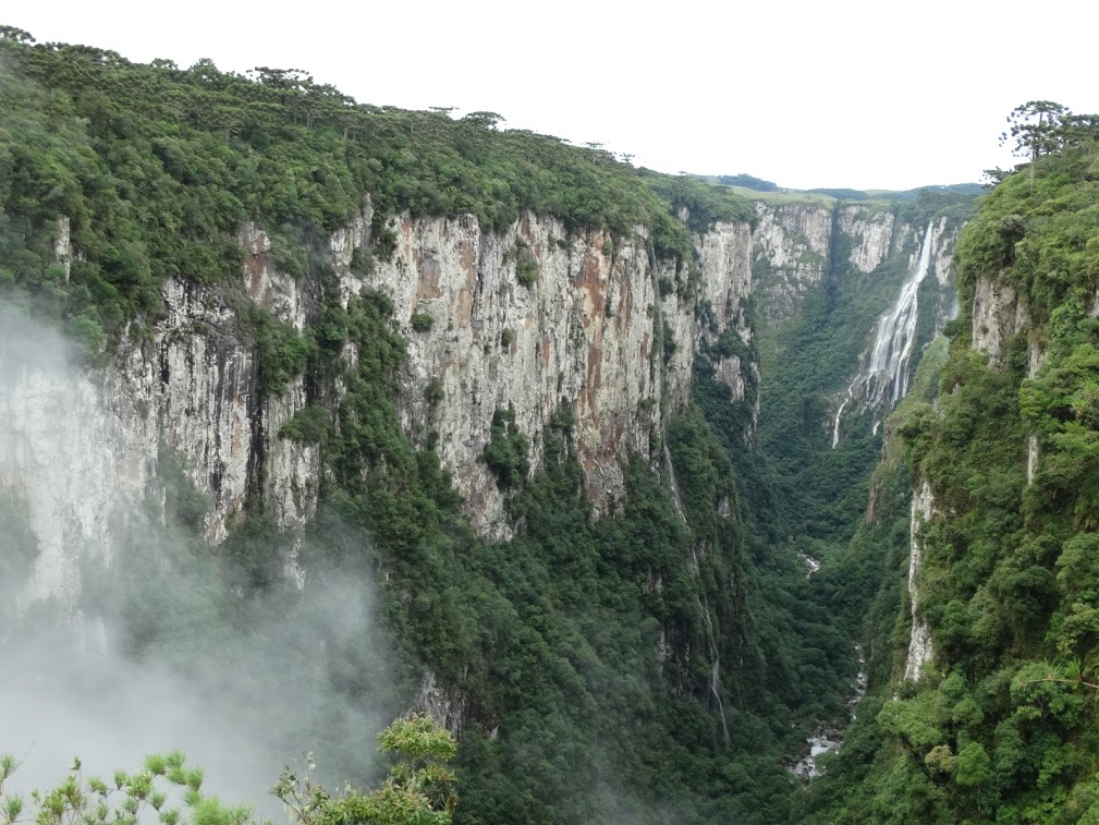
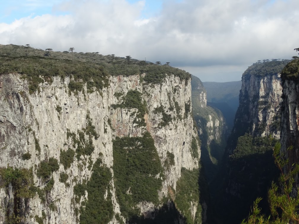
Itaimbezinho Canyon
Located in the Aparados da Serra National Park, the Itaimbezinho Canyon geosite is the best example in the region of how the tectonic structures (faults and fractures) in the volcanic rocks of the Serra Geral formation controlled the canyon morphology.
These structures configure discontinuities of the rock, considered areas of weakness, which facilitate the percolation of water and allowing vertical erosion by the drainage system forming a closed valley that reaches 720m of height disparity.
Visiting the geosite:
Access to Itaimbezinho Canyon, home of the Aparados da Serra National Park, is located at a distance of 23km from the city of Praia Grande and 18km from Cambará do Sul, both by unpaved road.
The Park is open for visitation all year round, from 8am to 5pm, from Tuesday to Sunday (opening on Mondays preceding national holidays, Carnival, Christmas and New Year).
To view the Itaimbezinho Canyon there are 2 trails: Vertice Trail (1.5 km round trip) and Elbow Trail (6km round trip). The presence of a guide is not required.
Carasal Hill
The Morro Carasal geosite presents an altitude of 965 meters and is characterized as an elevated relief feature that divides two important hydrographic basins in the region : The Ararangua river and the Mampituba river . It is considered a panoramic point for the observation and interpretation of landscape elements, with a view of those escarpments – the Serra Geral , coastal plain and the lagoon system, specially the Sombrio lagoon
Visiting the geosite:
The Carasal hill is located 20 km from the center of Jacinto Machado.
The pedestrian path is 3 km on a steep trail, with stretches of fields and stretches of vegetation, being advisable to be accompanied by guides of the region, as a way to preserve the site and minimize the risk of visitor accidents.

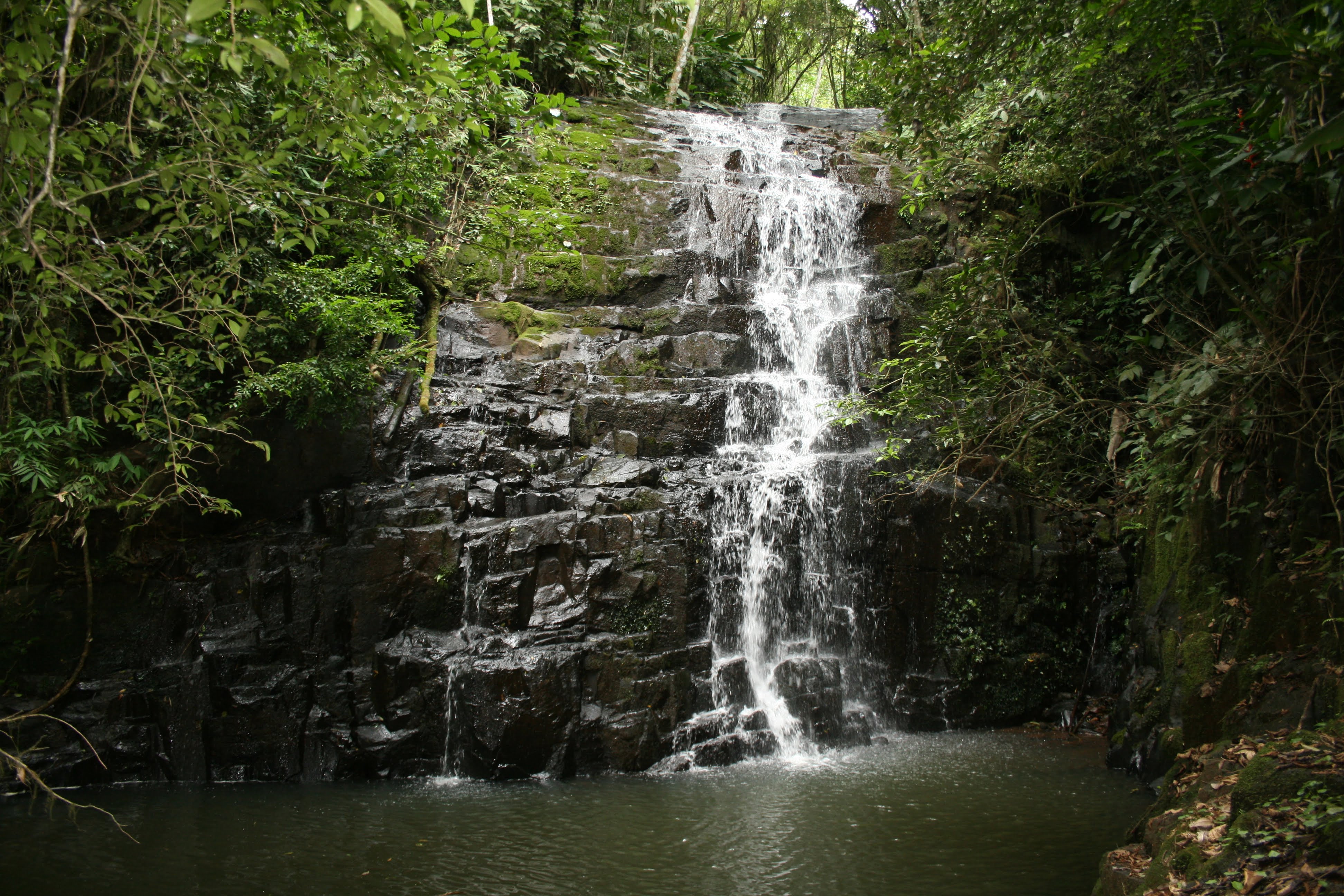
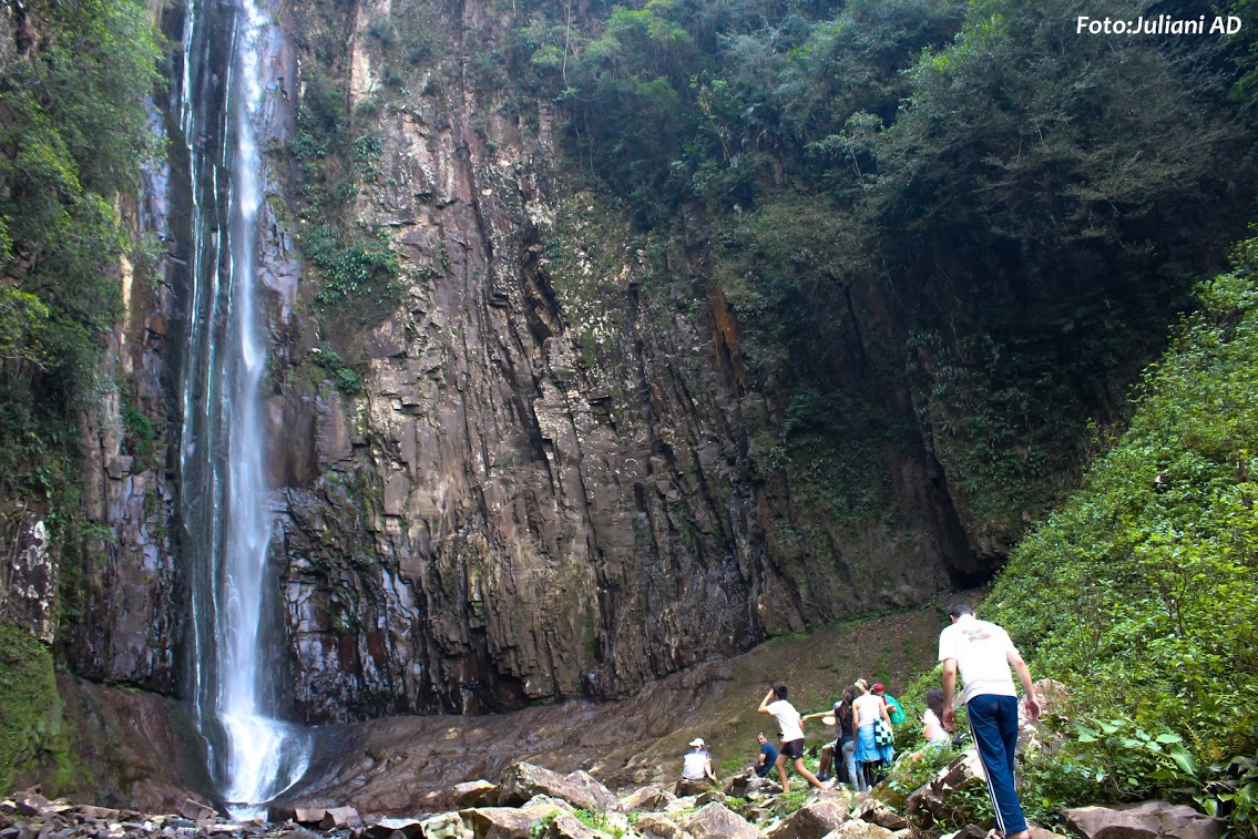
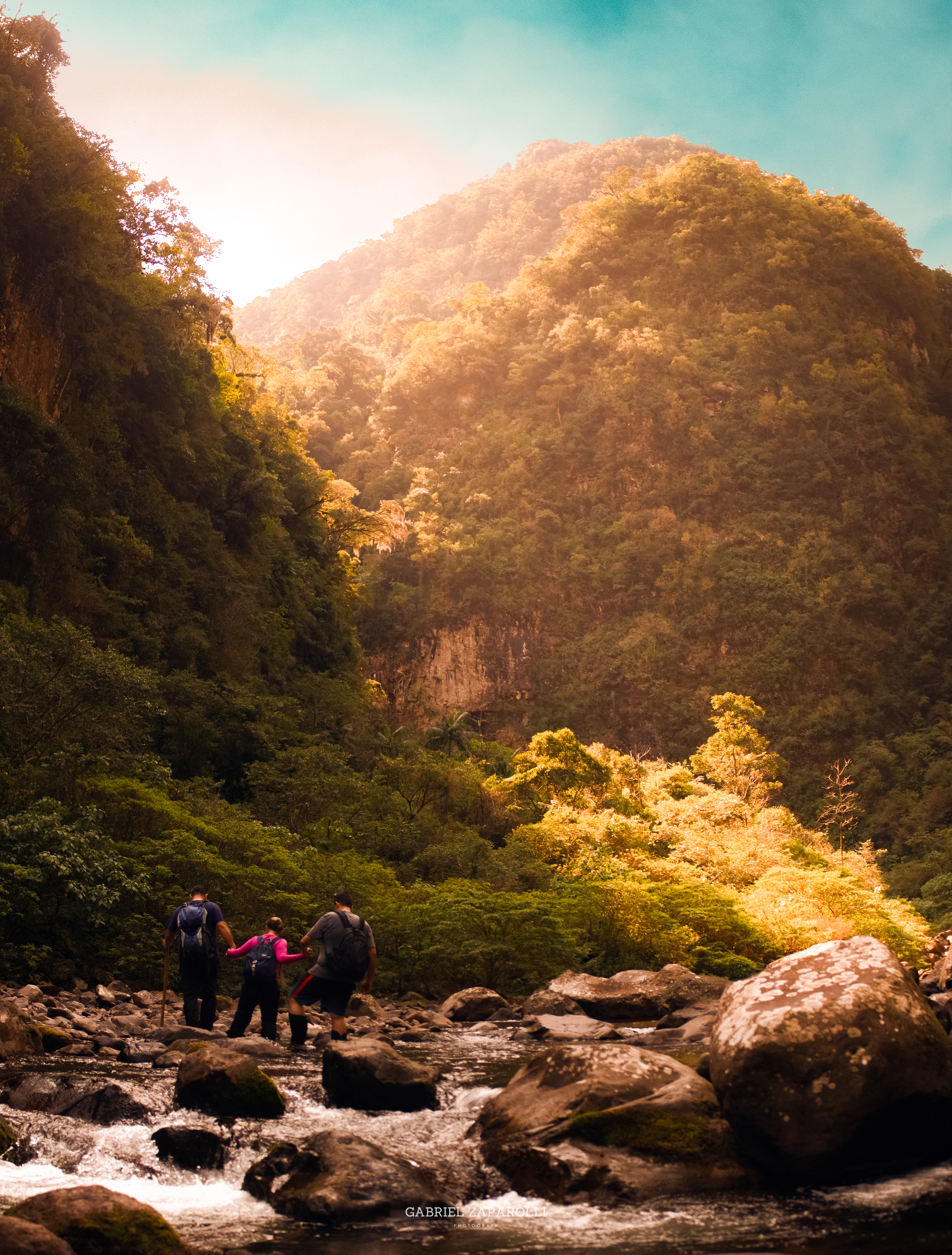
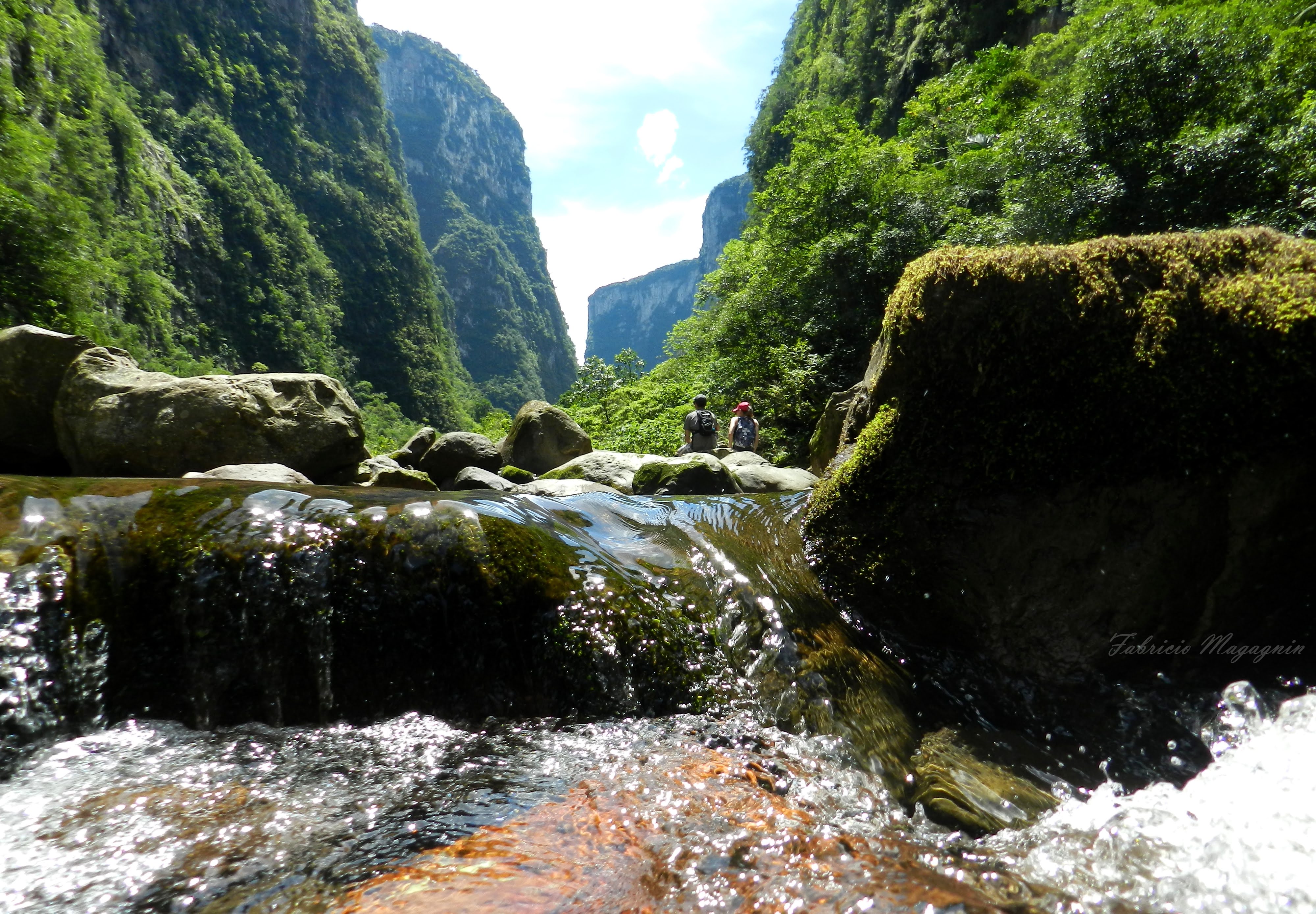
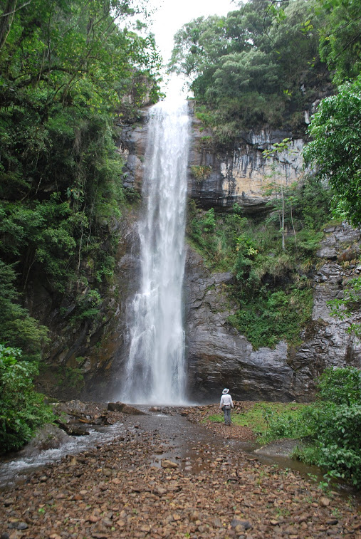
Rio Tigre Preto
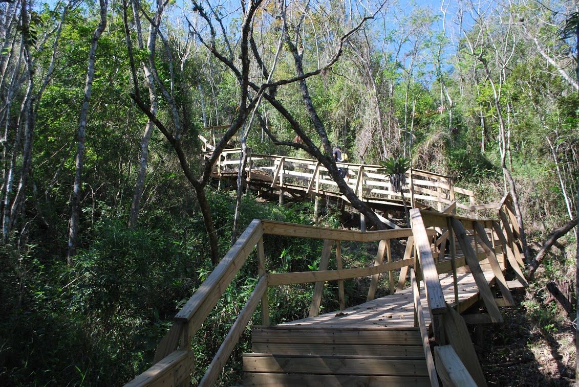
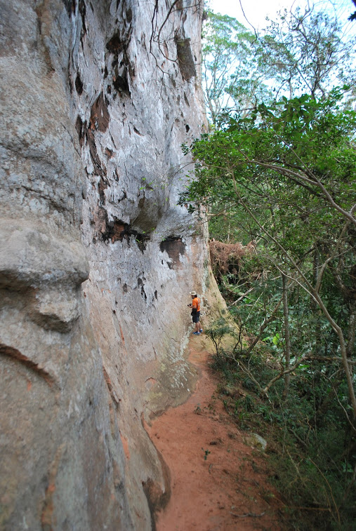
The Tigre preto ( Black tiger) river geosite comprises a trail in the middle of Foraleza ( Fortress) Canyon, almost 7 km long, mostly following the river with water wells ( natural pools) in tourist conditions to the Beija flor Rock
On this track, various outcrops and cliffs show the sequences of volcanic spills and in the river the pebbles show the geodes of various minerals with different collors.
Visiting the geosite:
The access to the Tigre Preto trail is located at about 19 km from the center of Jacinto Machado.
The pedestrian path made in the geosite comprises a 3,4 km track, wich 900 m in trail in the middle of vegetation and the remaining 2,5 km of the total distance on a wet track, following the Pedra ( stone ) river.
To hike the trail it is advisable to be accompanied by guides registered on ICMBio as a way to preserve the site and minimize the risk of accidents with visitors.


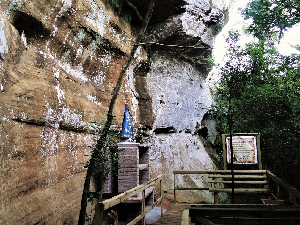
Nossa Senhora Aparecida Shrine
The hill consists of sandstone from the Botucatu formation. On this site, the religious context adds value to the location , due to the presence of an altar with an image of Nossa Senhora Aparecida, wich made this one of the most visited places in the town of Mampituba today by devotees of the patron saint of Brazil.
Visiting the geosite:
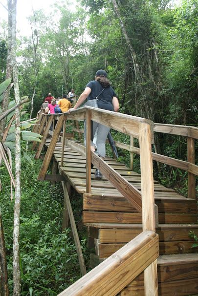
The site is located 3,6 km from the Mampituba city downtown , in the community of Villa Brocca, being its path through wooden walkways that have a total lenght of 272 meters, with high inclination.
It is also contemplated by a belvedere where an enjoyment of the Serra Geral and the Mampituba River is possible .

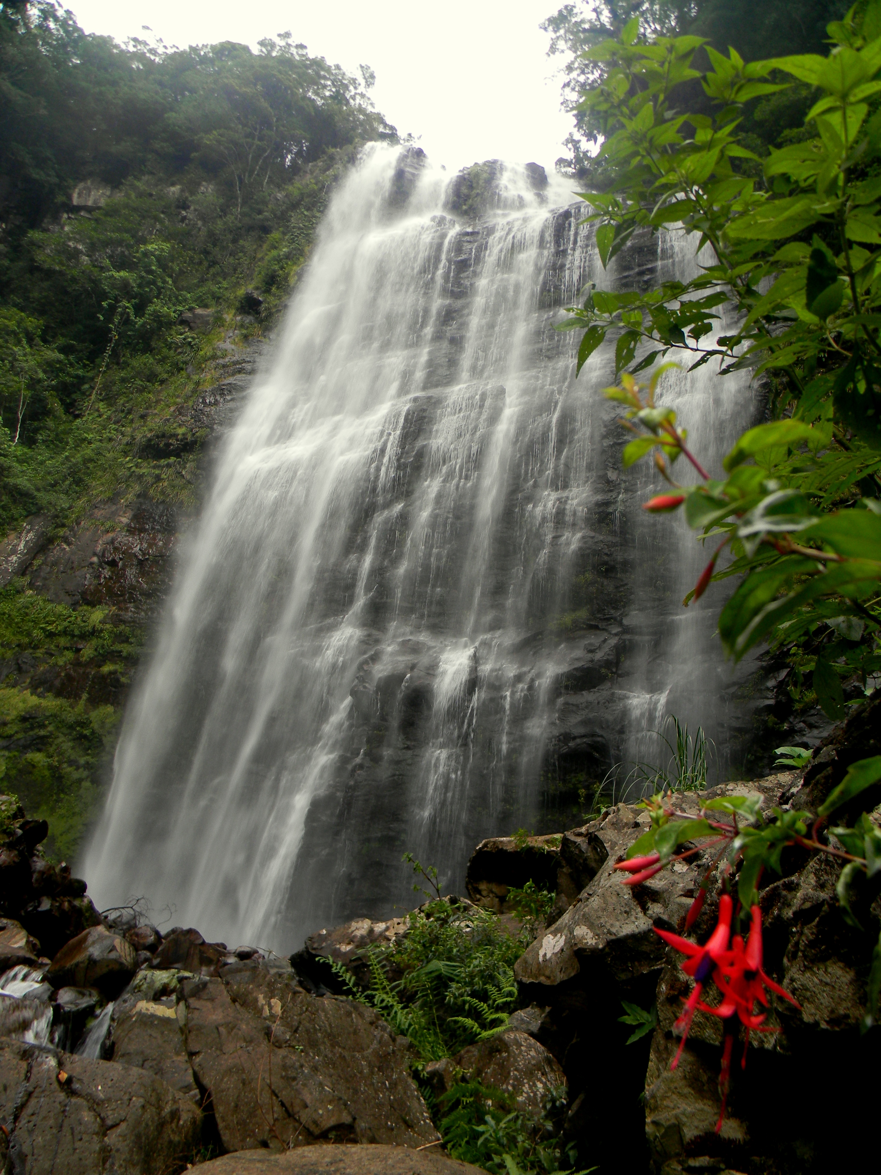
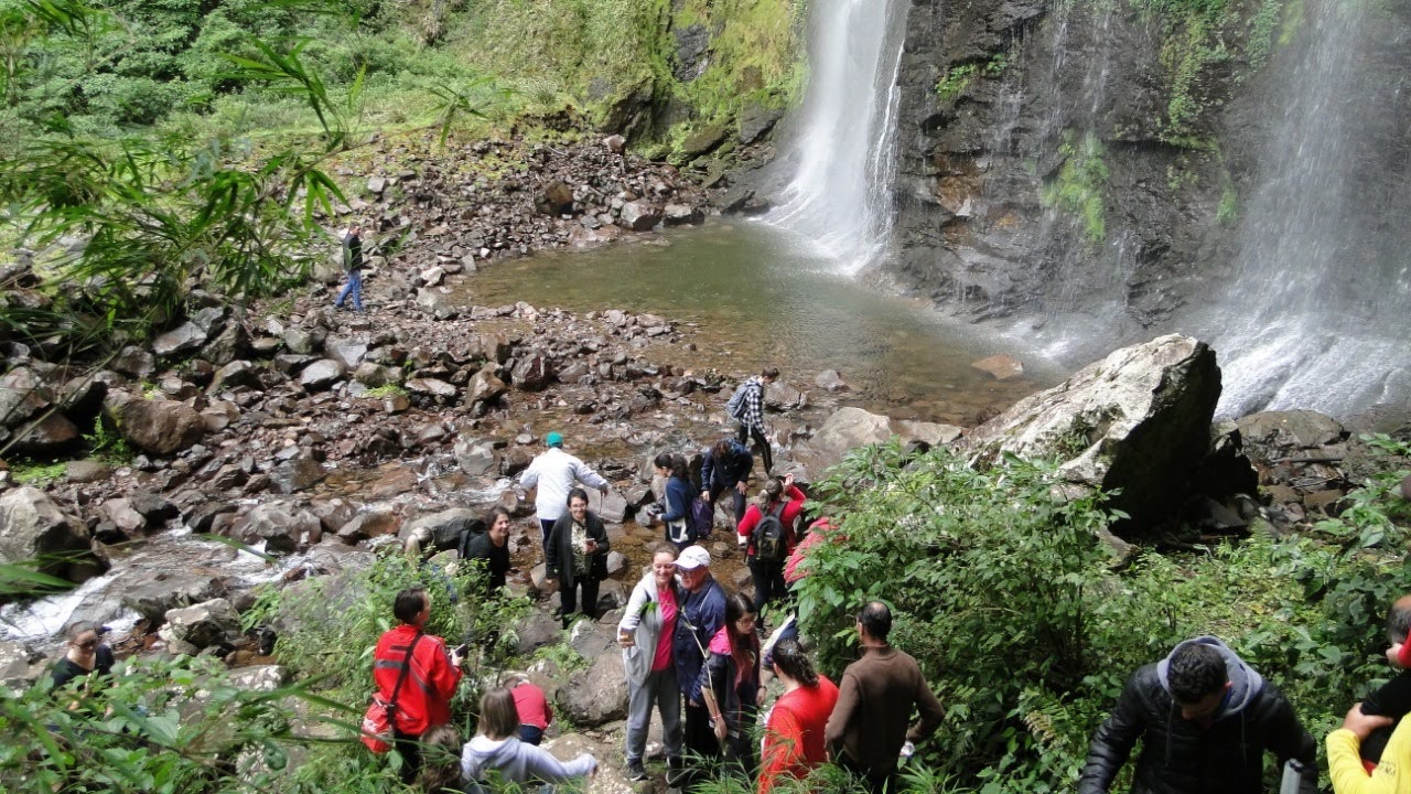
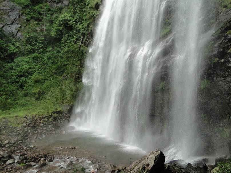
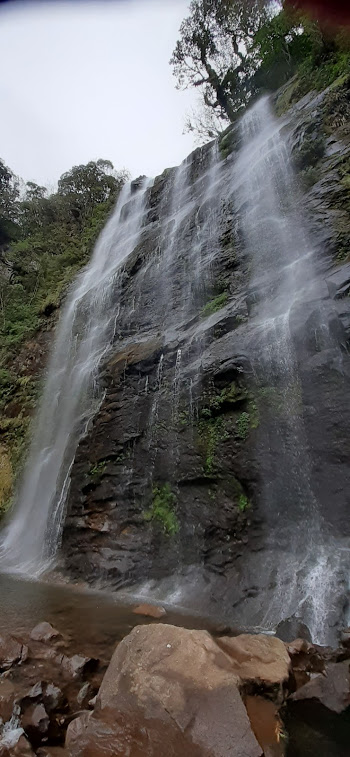
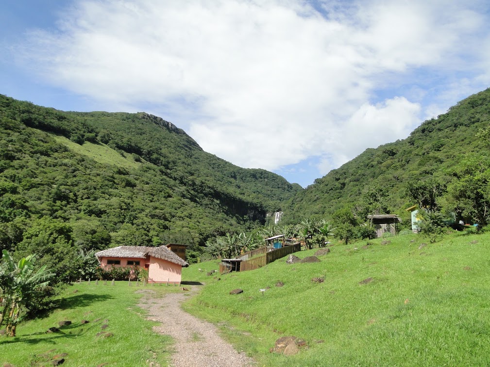
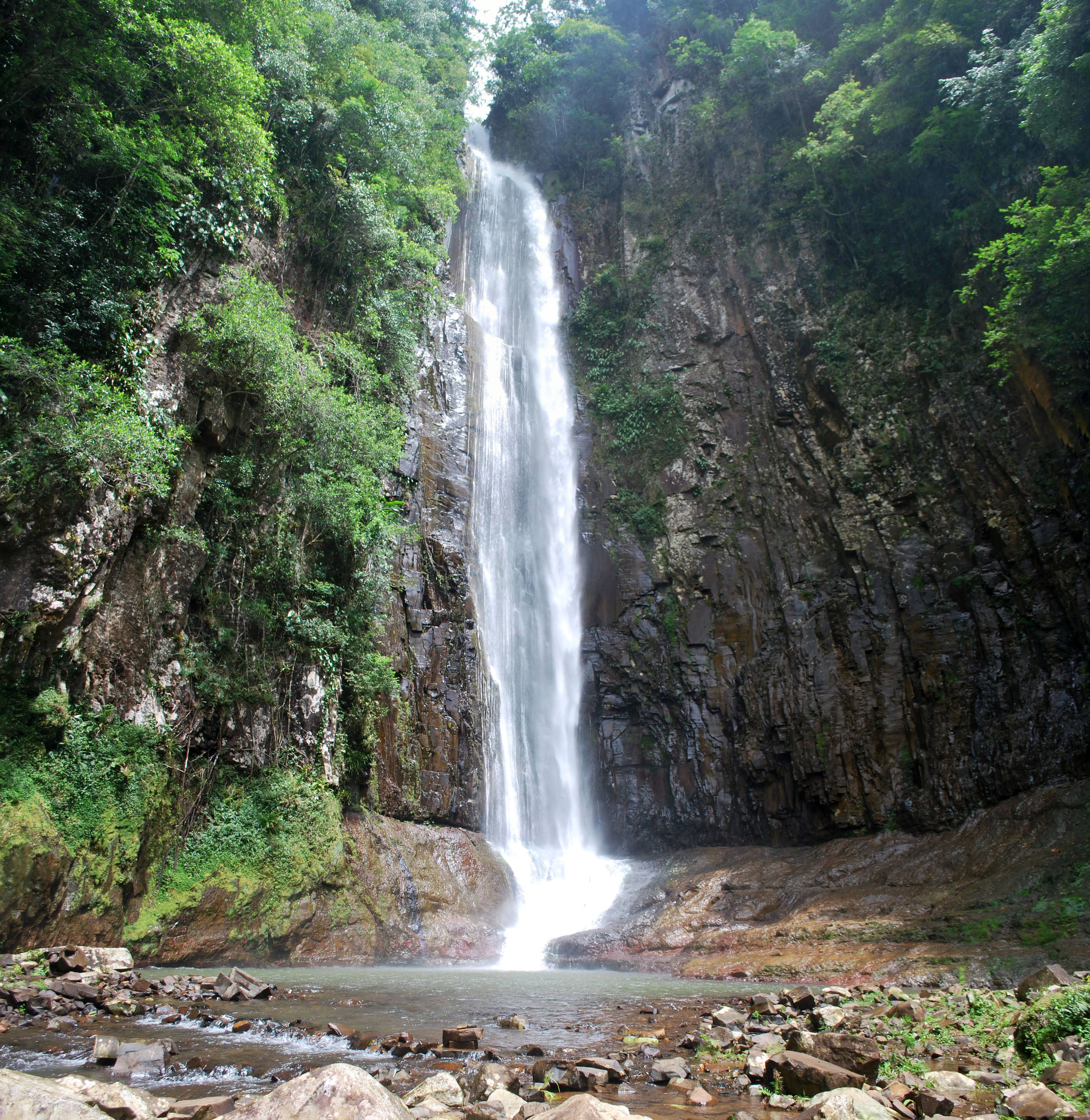
Borges Waterfall
With aproximately 70 meters high, the Borges Waterfall is one of the main visiting points of Mampituba, where you can also contemplate the wild forest that grows along the Invernada River, placed between the Bicudo and the Barbaqua hills, in relief marked by basalt rocks.
Visiting the geosite:
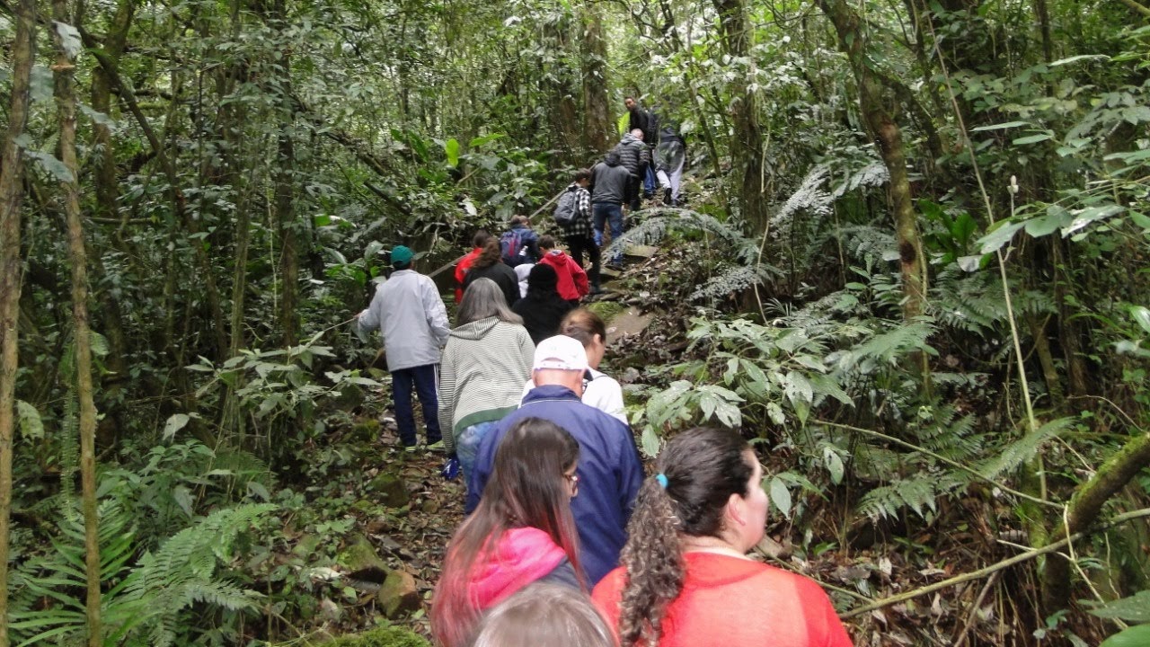
Located 20 km from the centre of Mampituba town on the Invernada River community, the borges Waterfall is part of the Cachoeira dos Borges- camping and park complex. The trail to the waterfall is self guided, meaning that you cando it without a guide. It is of medium difficulty, lasting approximately 30-40 minutes to the base of the waterfall. There are obstacles such as climbs, descents, fallen trees and the final stretch over rocks.
Arriving at the destination, the adventurer is confronted with a beautiful waterfall, embedded in a remnant area of primary Atlantic forest, in a area surrounding the Aparados da Serra National Park. Enjoy a delicious bathing in the waterfall and its natural pools !
Trail entrance fee : R$ 15,00 per person
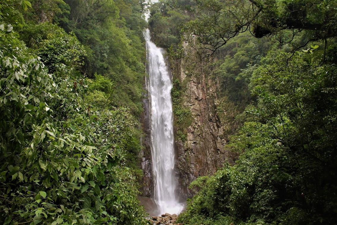
Cachoeira do Bizungo
With around 100 m of waterfalls , the Bizungo Waterfall Geopark evolution is conditioned by the intercession of different rock types that resist erosion in different types.
The special highlight of this geosite is the visible sub- horizontal geological contact of two rock units, of different origins and geological ages.
Visiting the geosite:
The access trail to the geosite is located approximately 14,2 km from the city of Morro Grande downtown..
The pedestrian path comprises an approximate total distance of 3,4 km ( round trip ), the company of the region´s guides being advisable, as a way to preserve the place and reduce the risk of accidents with the visitors.
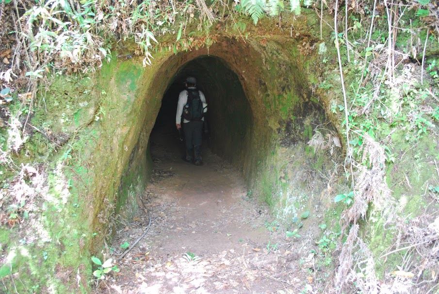
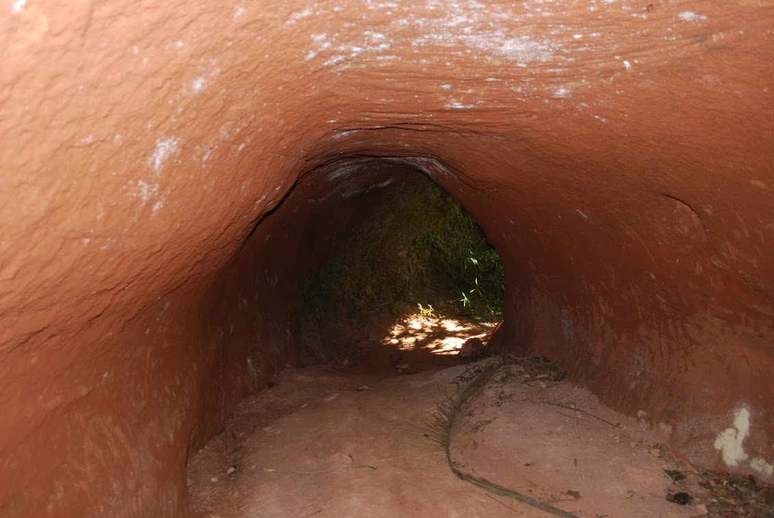
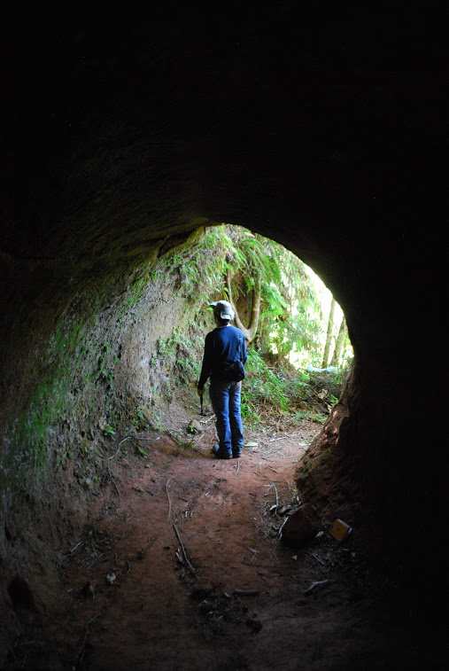
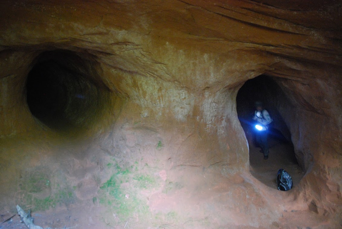
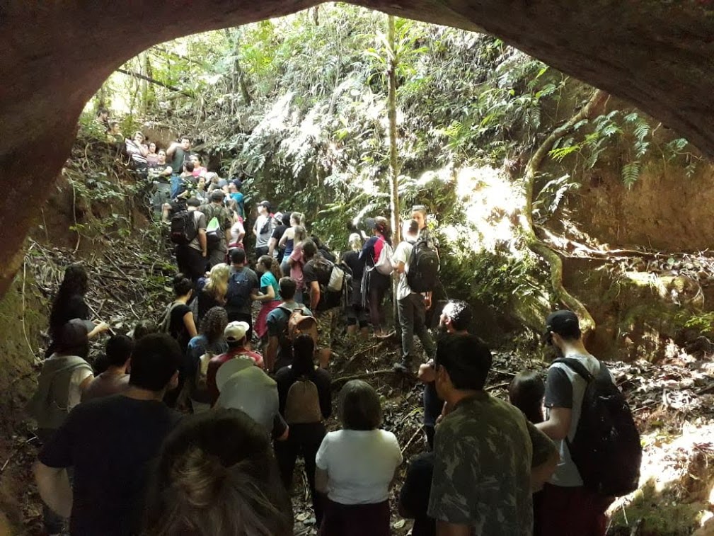
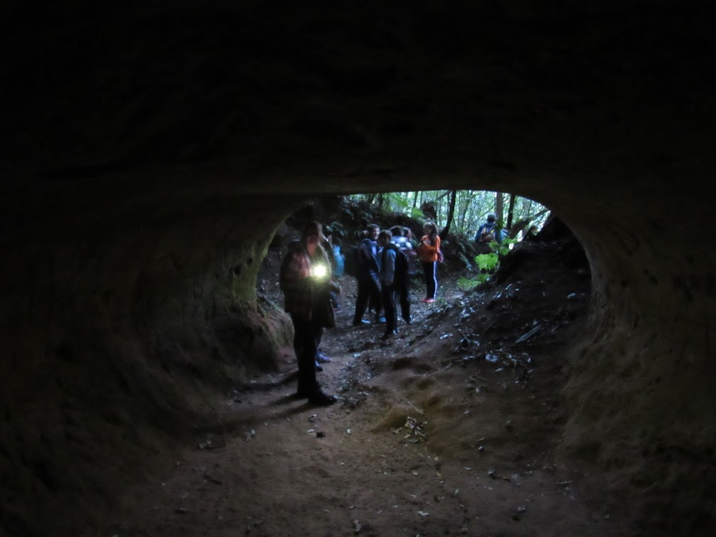
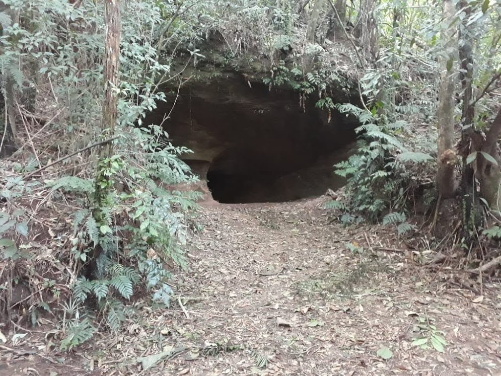
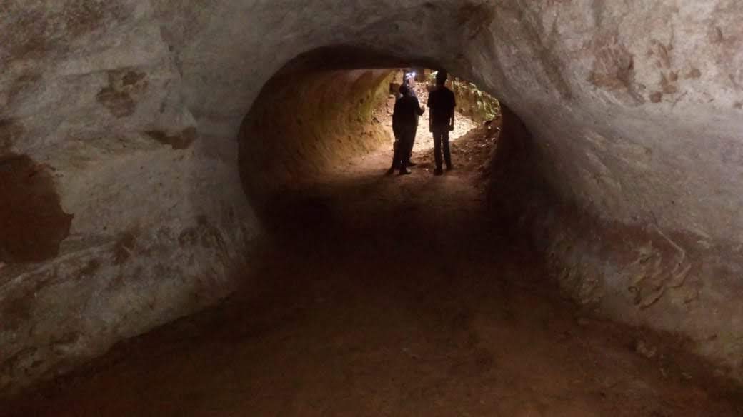
Xoclemg Paleoburrow
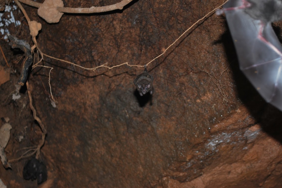
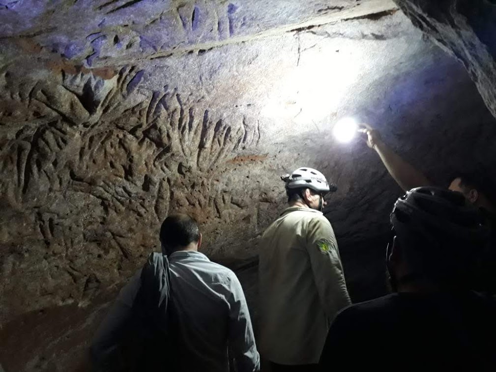
The Xocleng paleoburrow geosite comprises a set of 3 subterranean structures very close to each other, wich total of more than 100m of linear development, being the biggest paleoburrow on the Canions do Sul Geopark up to now. This set of paleoburrows features overlapping galleries at different levels, bifurcated tunnels and galleries of different sizes and shapes.
Previous studies carried out in the region suggest that, due to the characteristics of these galleries, their origin could be associated with excavations made by giant sloths on the bigger galleries and by armadillos in the smaller gallerries, The claw marks of these animals are spread in the galleries of the paleo burrow set, although some are more evident than others.
Learn about the paleoburrows, but contribute to the conservation of the place !
Visiting the geosite:
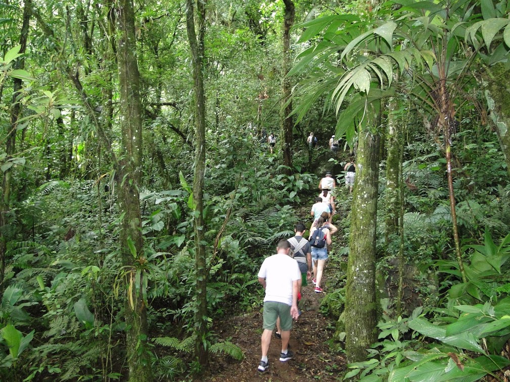
The access trail to the geopark is located approximately 18 km from the city of Morro Grande downtown. The pedestrian route is 8 km long( round trip) through a reforestation road and trails in the woods, being necessary to cross at least two rivers.
To access the trail is recommended the monitoring of a registered guide of the region, as a way to preserve the place and reduce the risk of accidents with the visitors.
Malacara Canion
The Malacara Canion geosite includes a 2 km wet track inside an open valley ( end of the canyon) following the Malacara river to the Fig tree Well, where water wells( natural pools) are in a tourist use.
Along the way , it is possible to observe the pebbles of the rivers and the characteristic volcanic rocks of the region with their geodes of various minerals.
Visiting the geosite:
The geosite is located approximately 6 km from Praia Grande town towards Vila Rosa
To access the Malacara trail it is recommended the guidance of a registered professional on the ICMBio , as a way to preserve the place and reduce risks of accidents with visitors
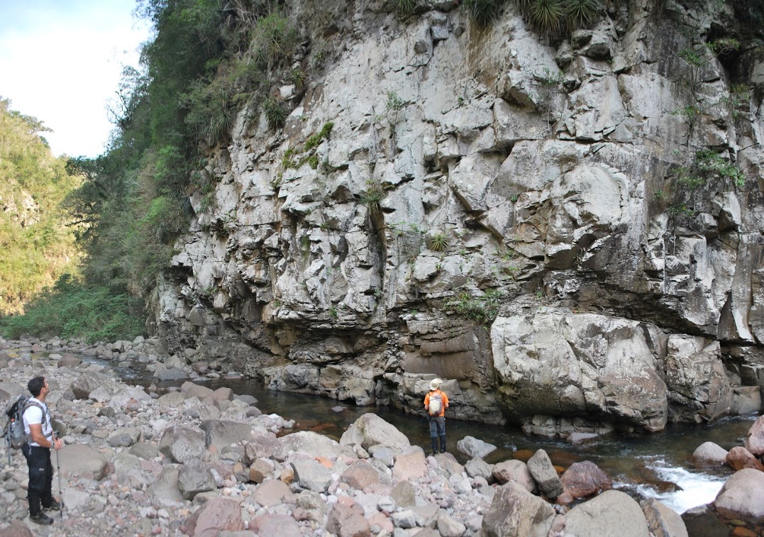
Ox river
The Rio do Boi ( Ox river ) geosite comprises a trail more than 8 km long inside the Itaimbezinho canyon, in the middle of the vertical walls of volcanic rocks which have been carved by the drainage system of the Peacock River (Rio do Pavão
The geosite also presents in its trail elements of cultural and historical value evidenced by the mud walls and the remains of a sugar cane mill, as well as the knowledge that this region was a route for troopers.
Visiting the geosite:
The access to the Rio do Boi track is located approximately 10 km from Praia Grande city downtown. The pedestrian path includes a 4,3 km track ( one way), of which 3,0 km is a dry trail through vegetation and 1,3 km is a wet trail along the river.
To hike the trail it is advisable to be accompanied by guides registered on ICMBio as a way to preserve the site and minimize the risk of accidents with visitors.
The Rio do Boi track has the capacity of 132 visitors per day, each group not exceeding 12 visitors/ guide


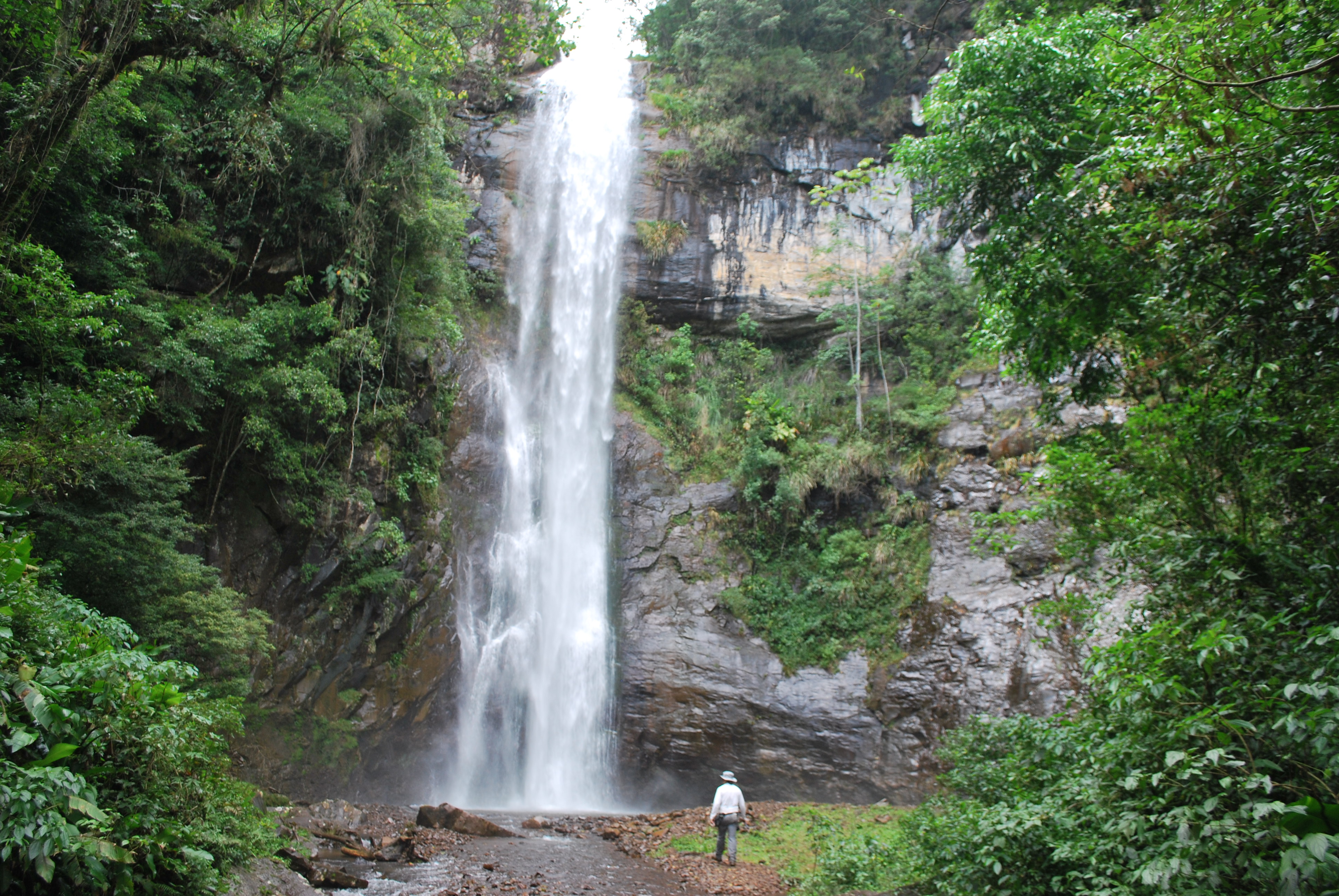
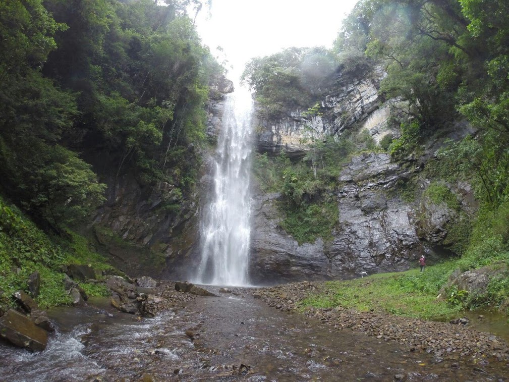
Cortina Waterfall
The Curtain waterfall geosite has a waterfall of approximately 40 m high and its formation associated with differentiation in the fluvial erosive process.
Locally, volcanic rocks present sub-horizontal discontinuity, being considered a rock fragility zone which facilitates erosion, mainly vesicles levels ( empty spaces resulting from gas bubbles in solidified lava), tonsils ( spheroidal structures with crystallization of minerals)and horizontal fracturing at the waterfall’s base. This condition starts less resistant rock overmining process, not supporting the upper level rock layer, provoking block of stones falls, in a process called degressive erosion.
Visiting the geosite:
The acess trail to the geosite is approximately 10,8 km from the centre of Timbe do sul town.
The pedestrian path that takes to the Curtain Waterfall comprises a total 26 km track ( round trip).
Armadillo Den
The Armadillo den (Toca do Tatu) is a 48,5 m paleoburrow developed in the sandstones from the Botucatu formation, formed bu two almost parallel tunnels that converge for more space inside. Its general internal morphology, and the existing claw marks on the wall showed in studies that the Paleoburow originated as an excavated shelter, probably by giant sloths during the Cenozoic period. Complementing the scientific relevance of this geosite, studies also feature rock grafitti of over 7 distinct geometric shapes, low relief drawings, associated with the recovery of the shelter by the pre- Columbian peoples. ( Pasqualon et al. 2012, Frank et al, 2012)
Visiting the geosite:
The trail to the geosite is located 7,3 km from the city of Timbe do Sul downtown.
The pedestrian path comprises a total route of 3,5 ( round trip), following the forest, parallel to the Rocinha river, with irregular relief.
The Armadillo Den ( Toca do Tatu ) geosite is part of a route known as the Palmiro Route that comprises the Rocinha river, natural Pools and waterfalls.
To acess the Geosite, it is necessary the company of a guide.
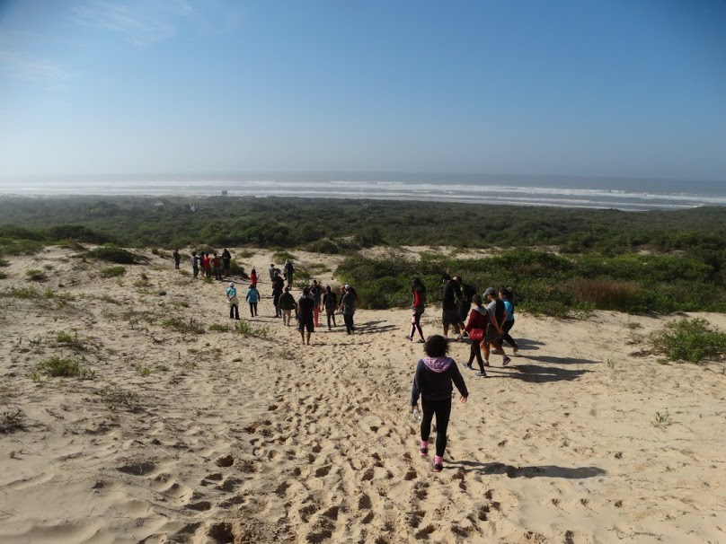
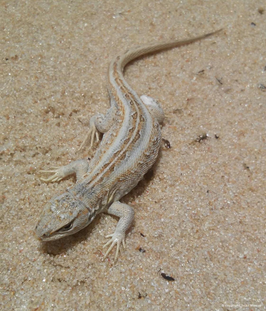
Itapeva State Park
Unique geosite on the coastal plain in the state of Rio Grande do Sul, made up of dunes approximately 4 km long, enclosed between rocky outcrops of the Serra Geral Formation.
It shelters in this environment restinga vegetation, dry and flooded fields, marchland and peat bogs and paludosa forest( forest formed on very humid soils ). This condition allowed the creation of the Itapeva State Park in 20002.A Conservation Unit fully protected and managed by SEMA - RS
Visiting the geosite:
It is possible to perform a trail in the park, with the accompaniment of a guide from the conservation unit. Visits to the park require prior booking through the contact below :
Phone ( 51 ) 3626 3561
E-mail: [email protected]
Adress : 479 Castelo Branco ave, , Torres - RS
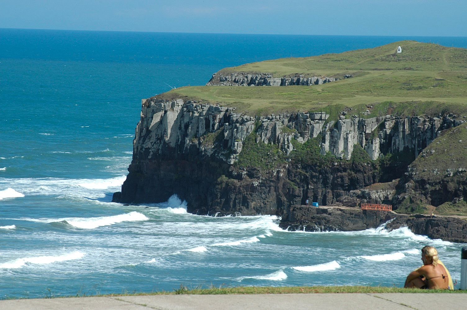
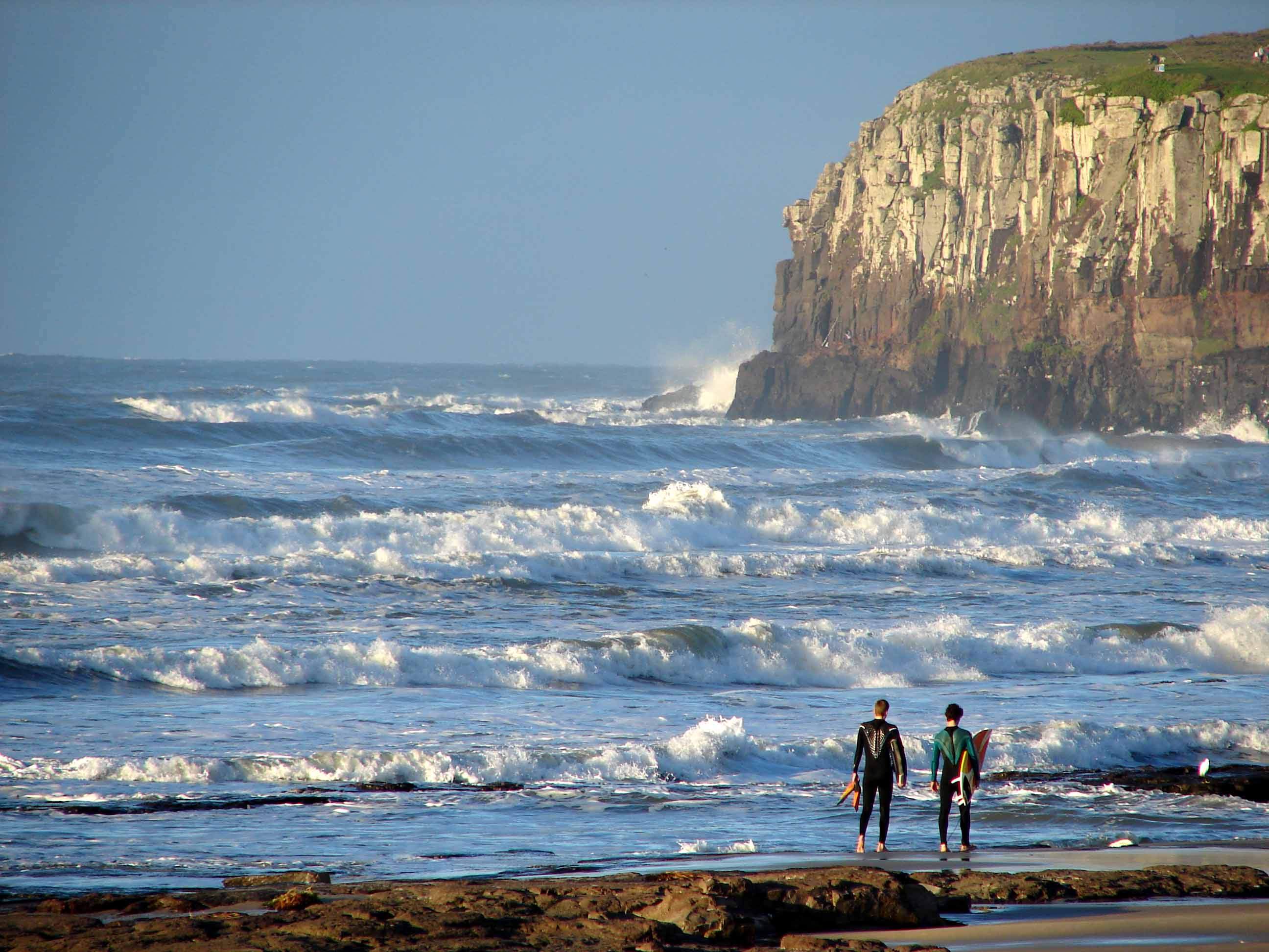
Guarita Statepark and Farol Hill
The Jose Lutzenberger Guarita State Park and the Lighthouse ( Farol) hill present unique geological features in the region, where volcanic cliffs meet the sea, suffering the action of its waves. Onthese hills, we can see the contacts between the Botucatu Sandstone and the Serra Geral Andesitic Basalts. At vvarious points, it is possible to observe the occurrence os peperites formed from the ineraction between the sands of the old desert and the volcanic lava that coveredd them.
Visiting the geosite:
Guarita Park is open 8:30 a.m. to 5:30 p.m. daily in low season (may to november) and 8 a.m to 8 p.m. in high season ( december to april).
Pedestrians do not pay and vehicles pay R$ 10,00
Os veículos emplacados no município de Torres são isentos desta cobrança.
O Morro do Farol tem acesso livre.
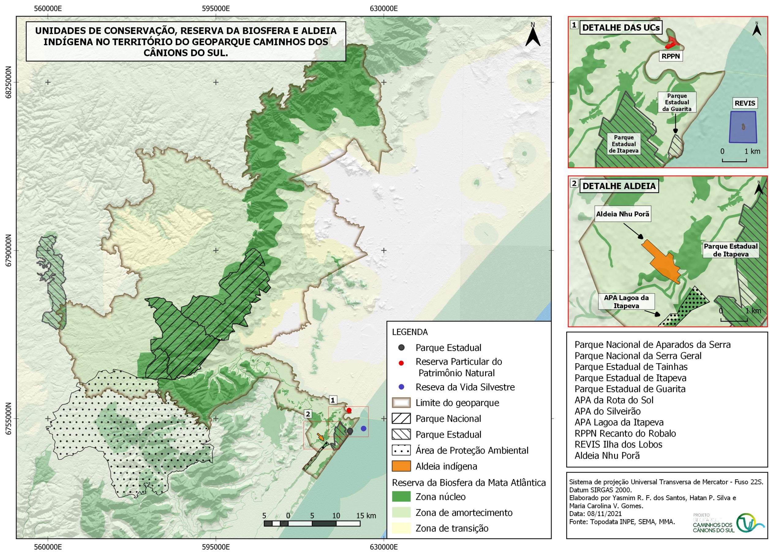
Below are some maps with important information about this territory