
Territory of unique natural aspects where geological and geomorphological diversity made possible the evolution of endemic ecosystems of particular importance in the Brazilian scenario.
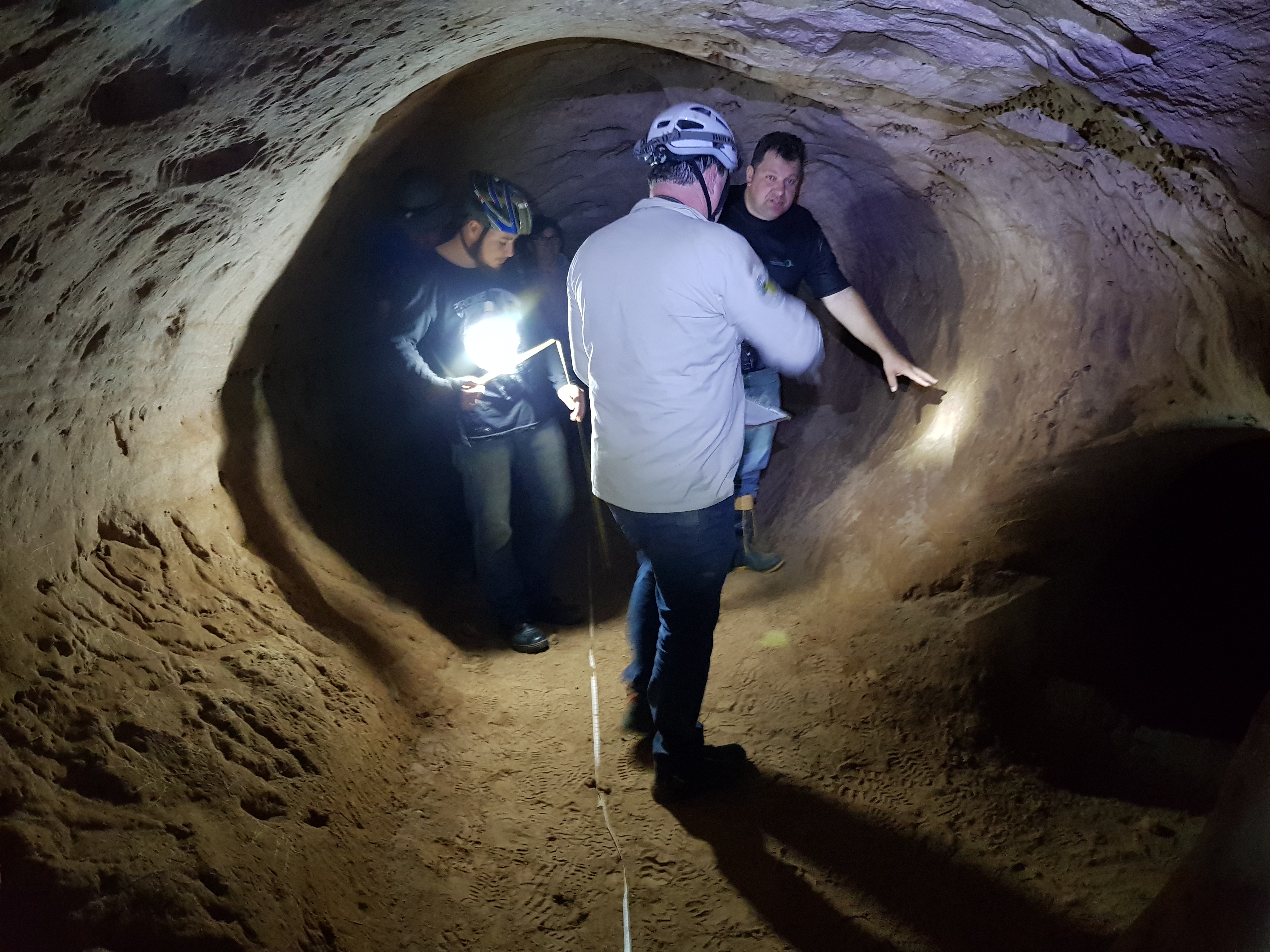
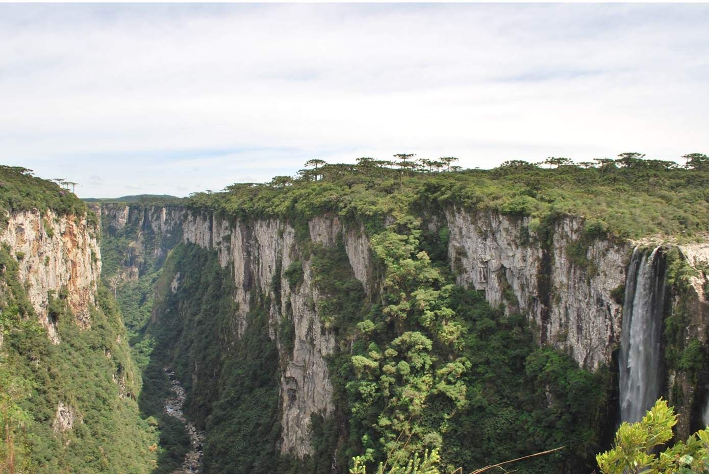
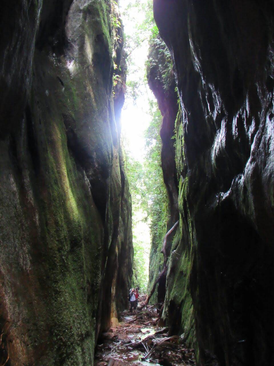
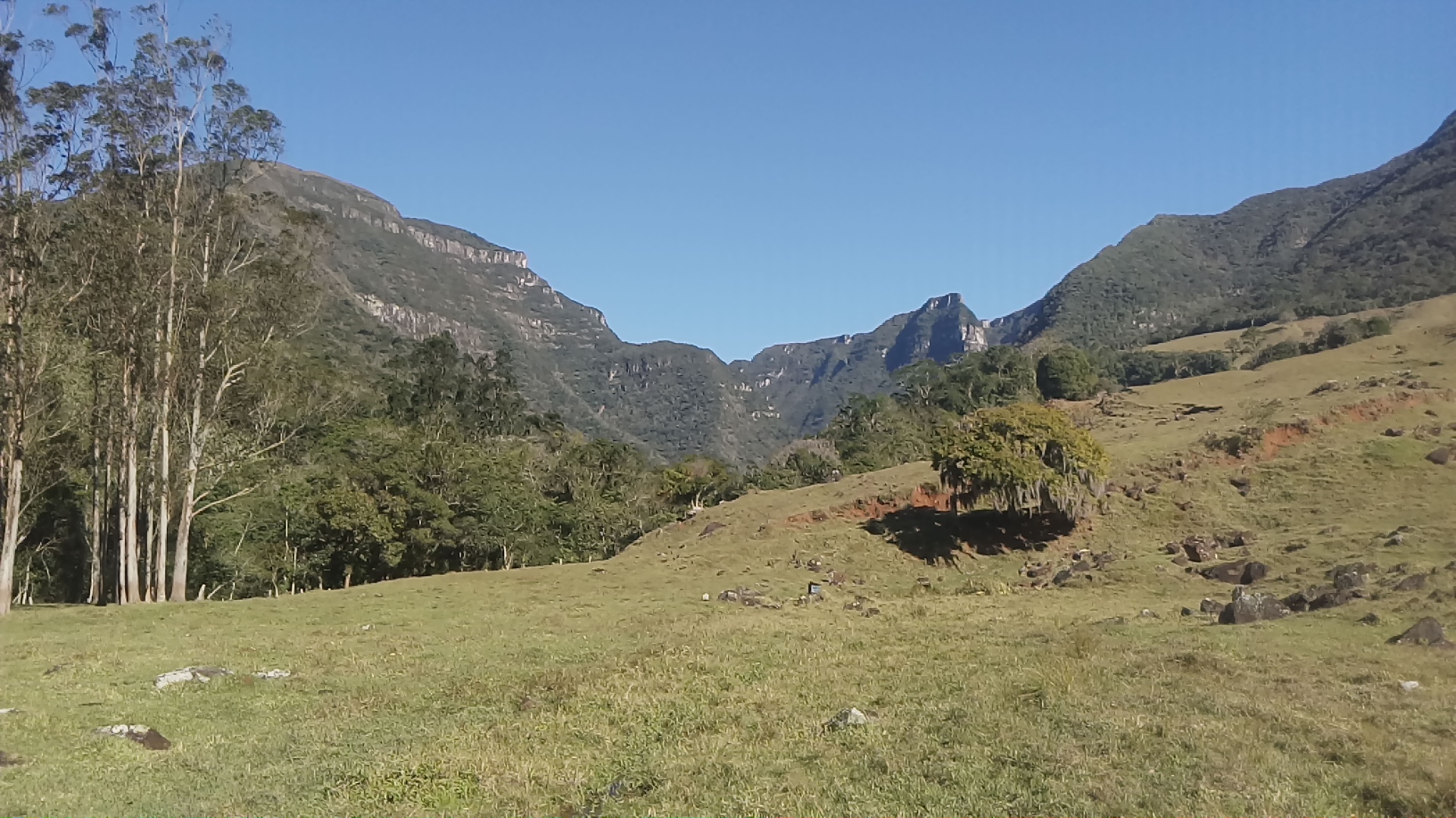
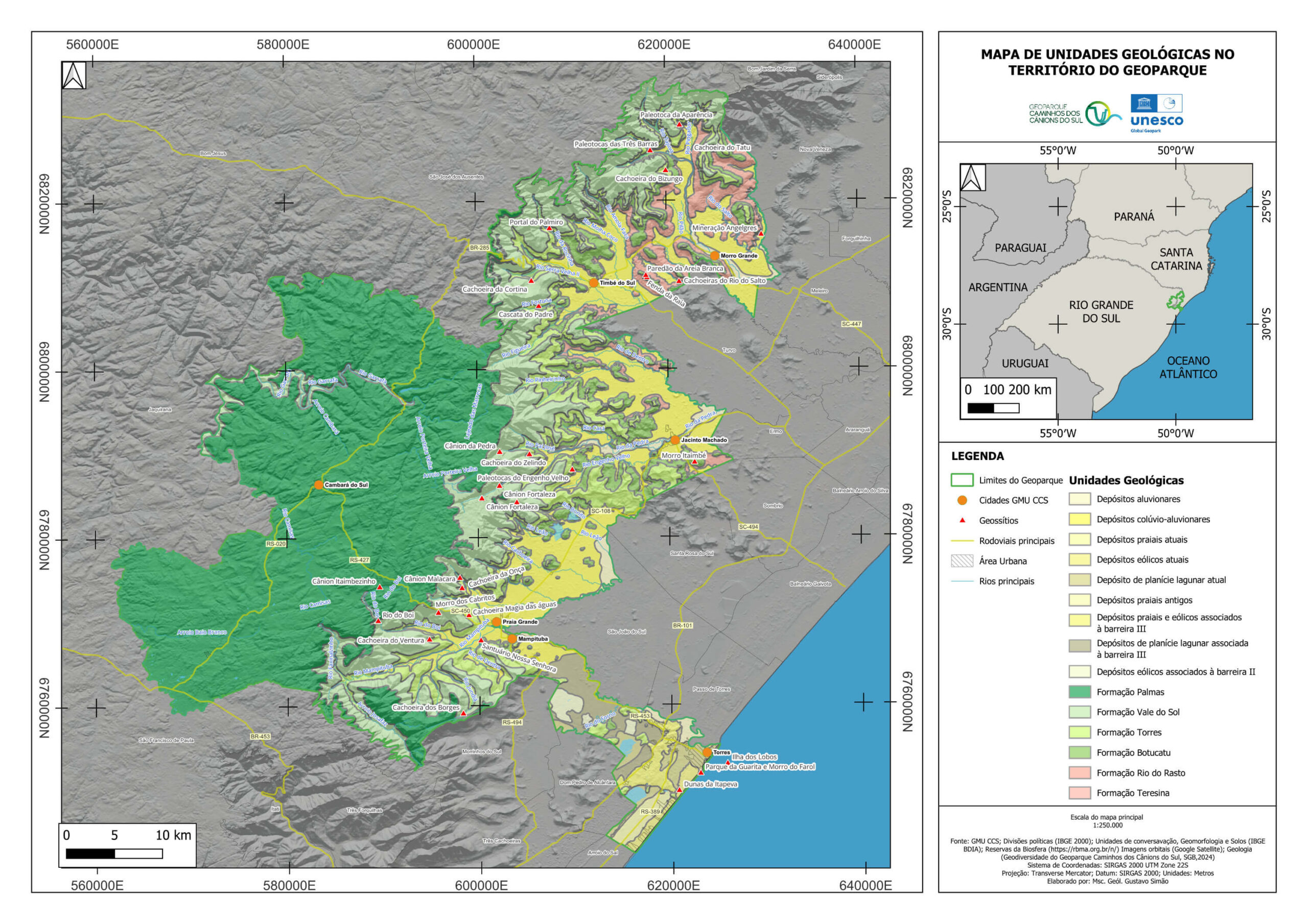
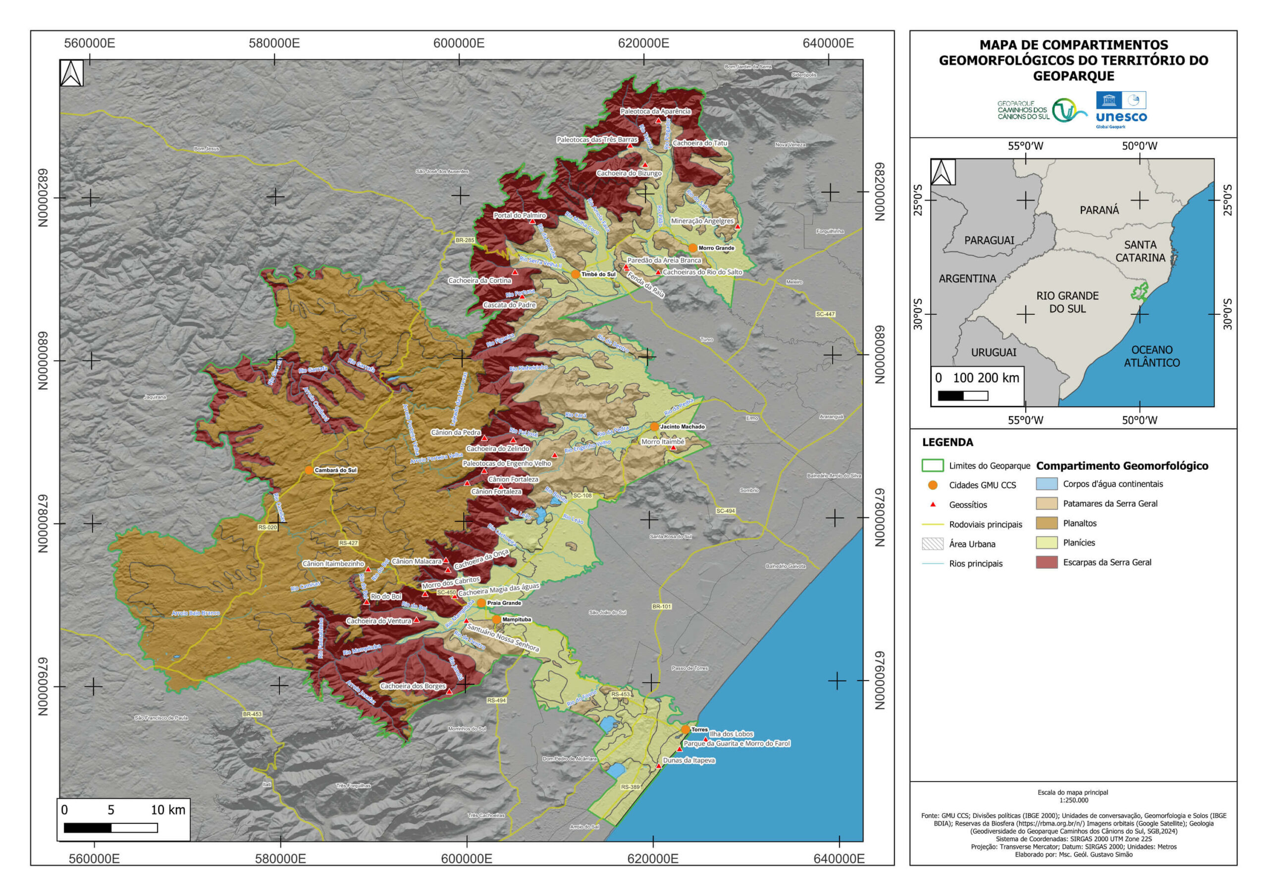
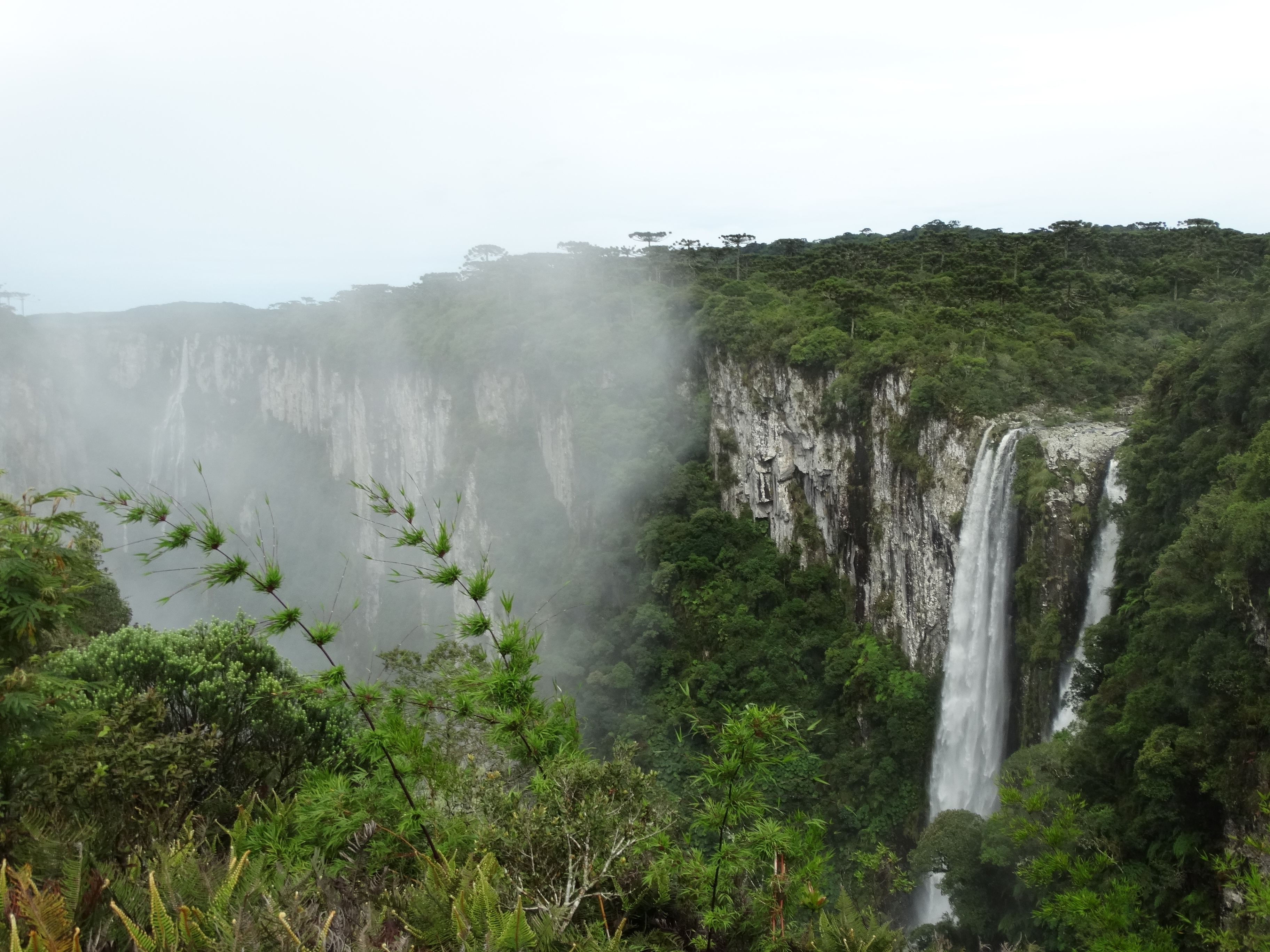
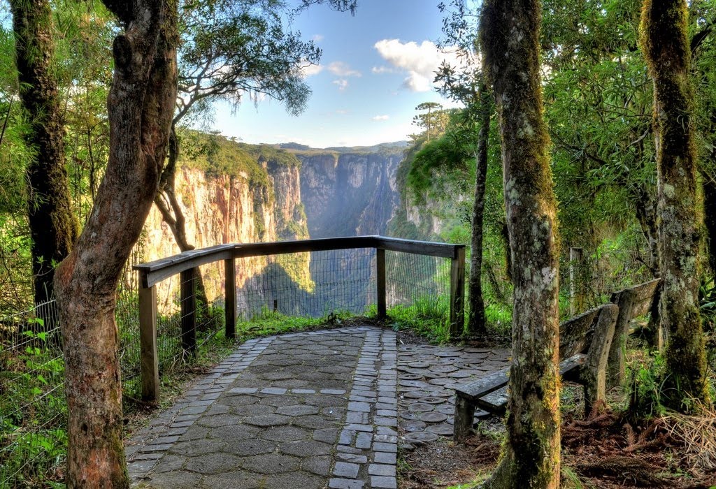
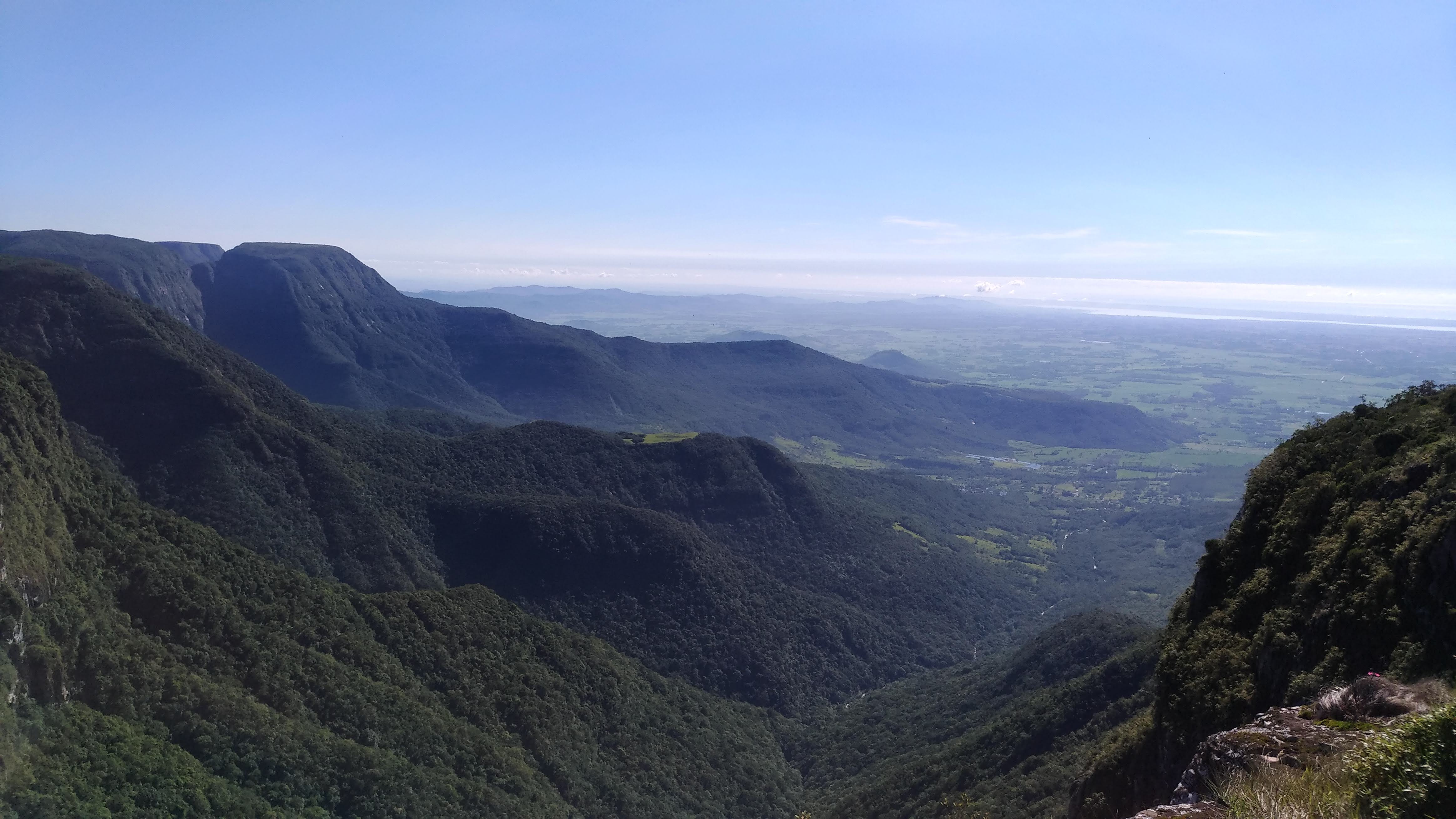
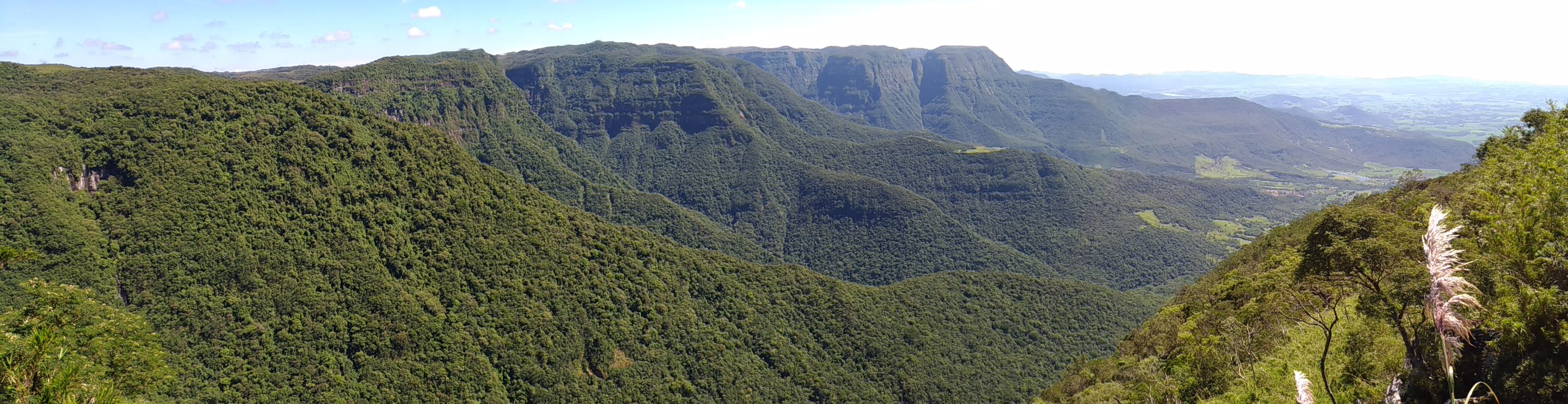
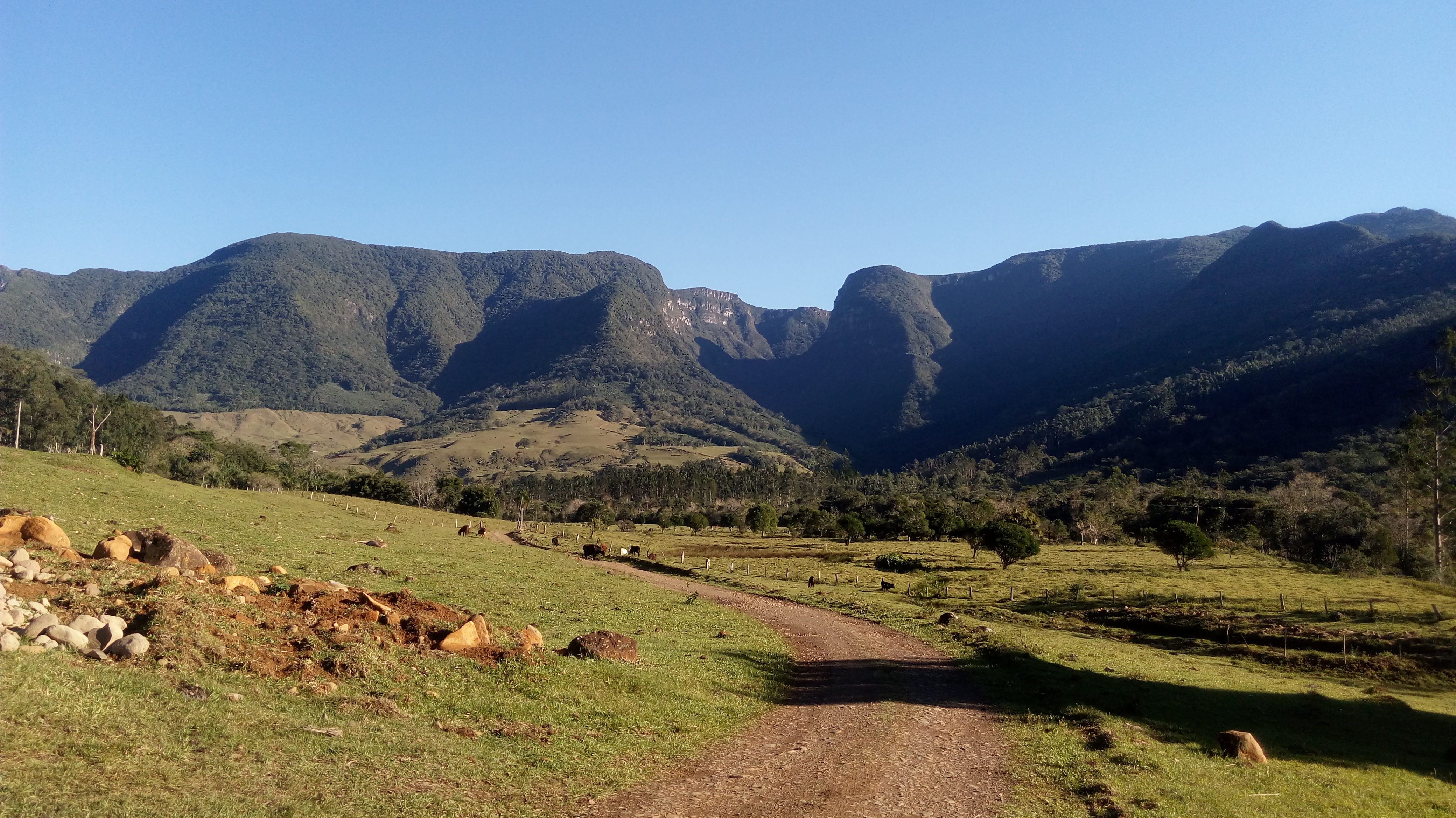
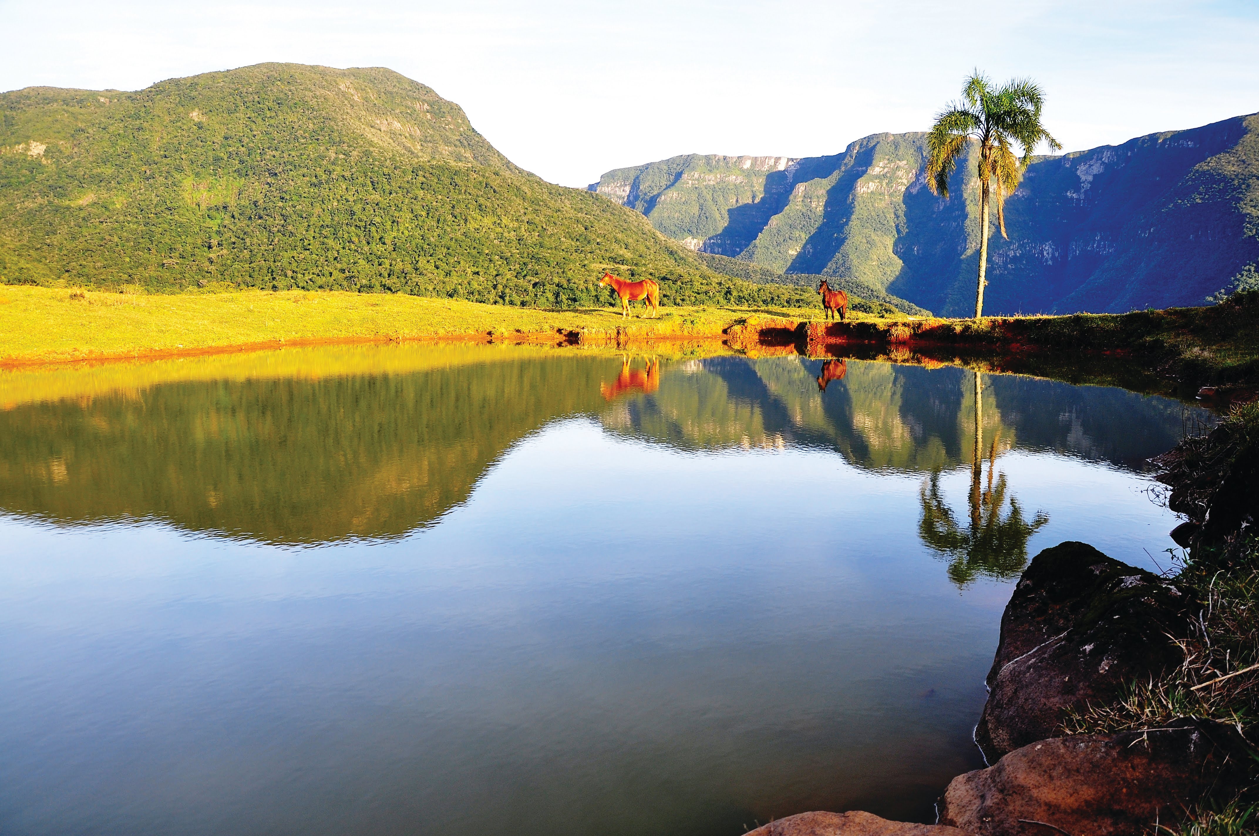
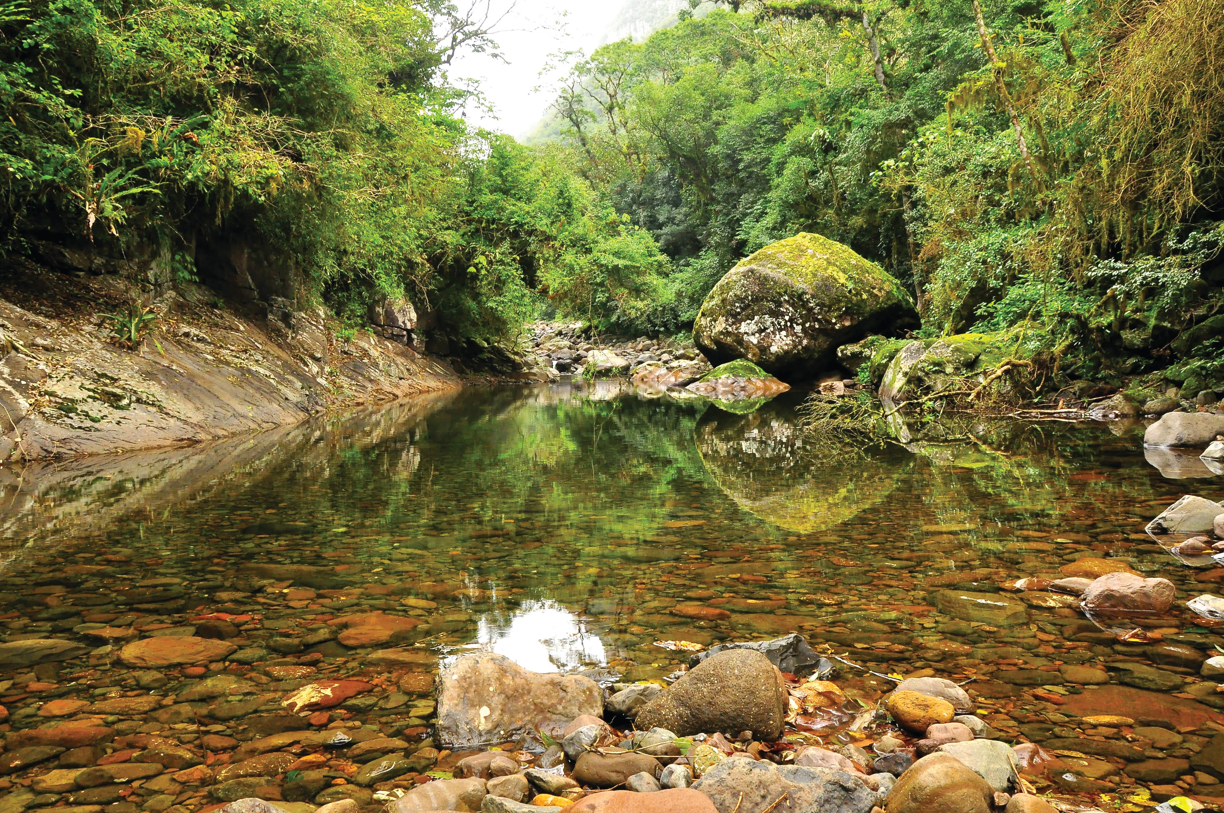
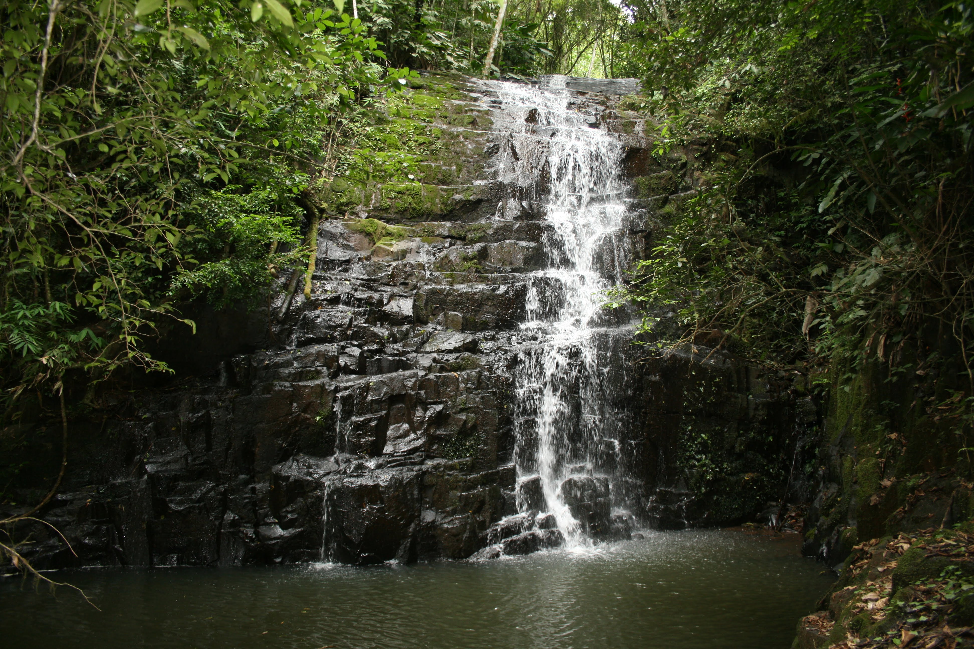
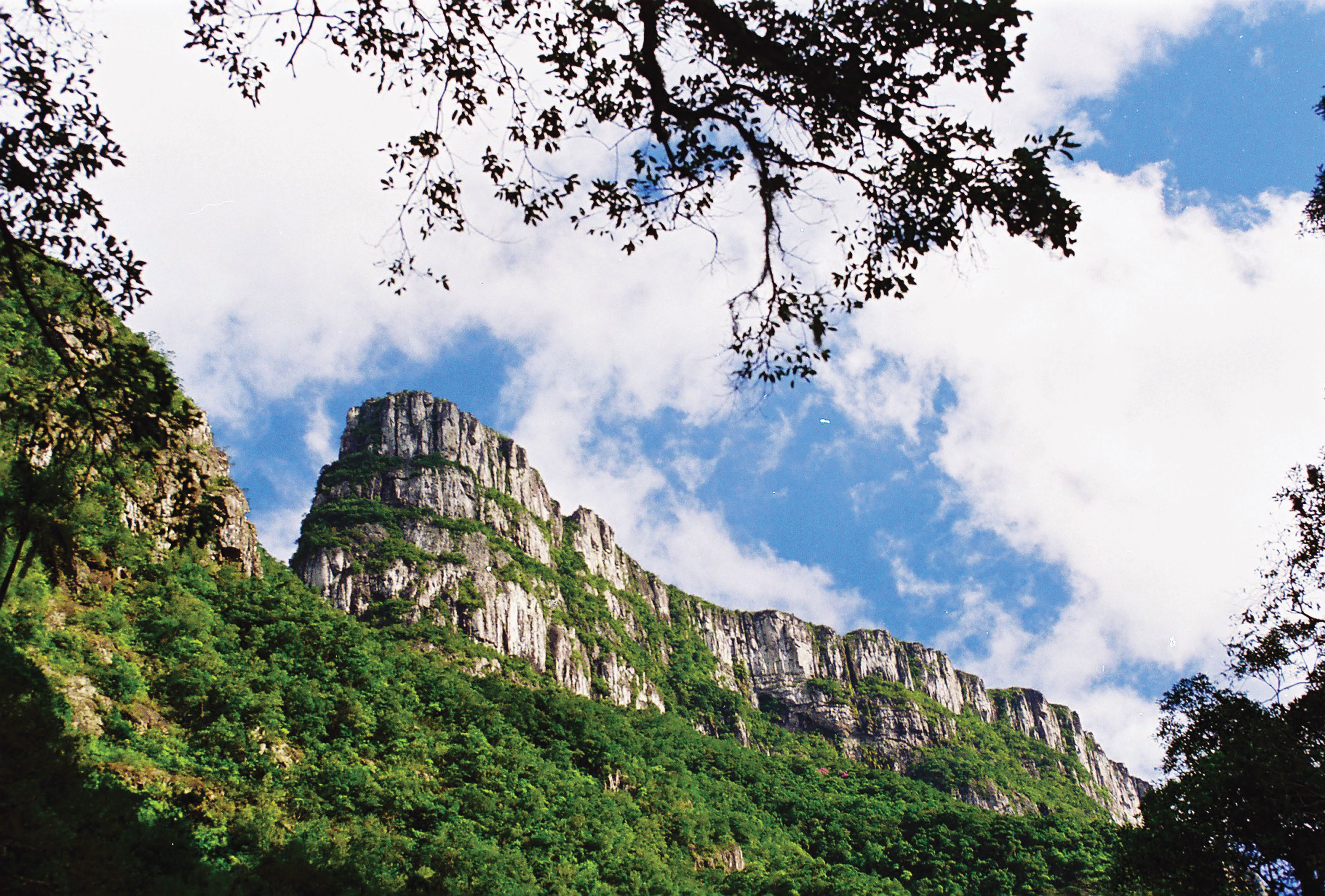
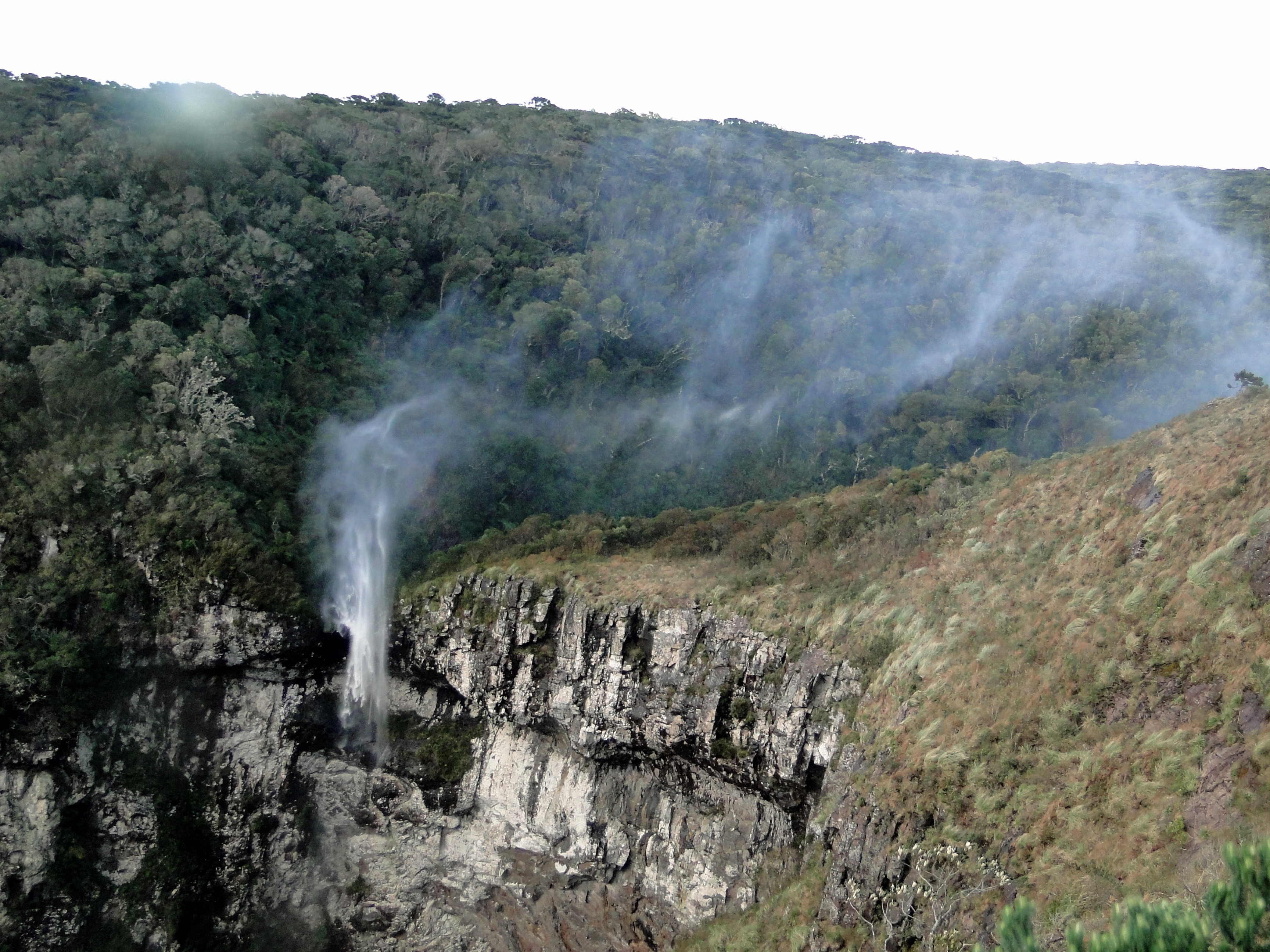
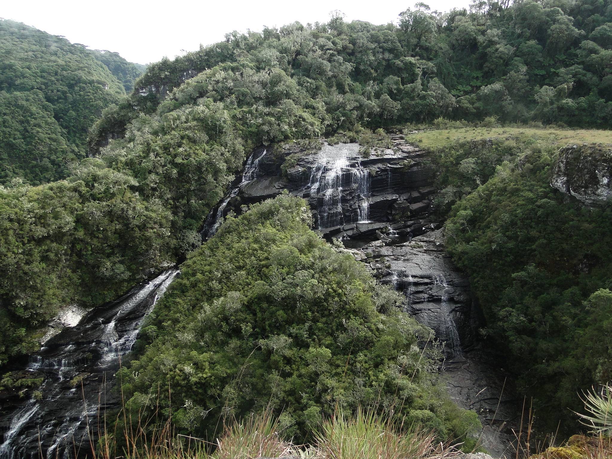
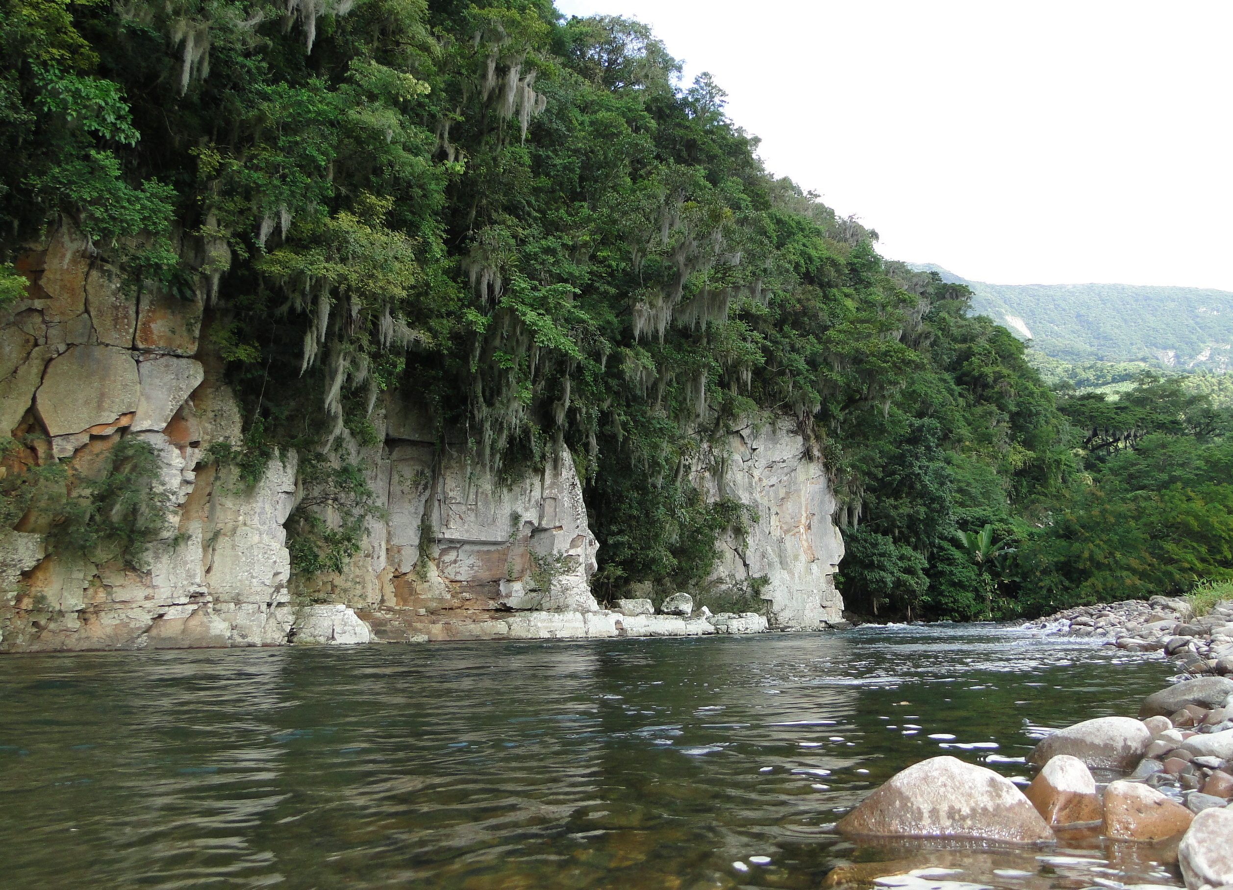
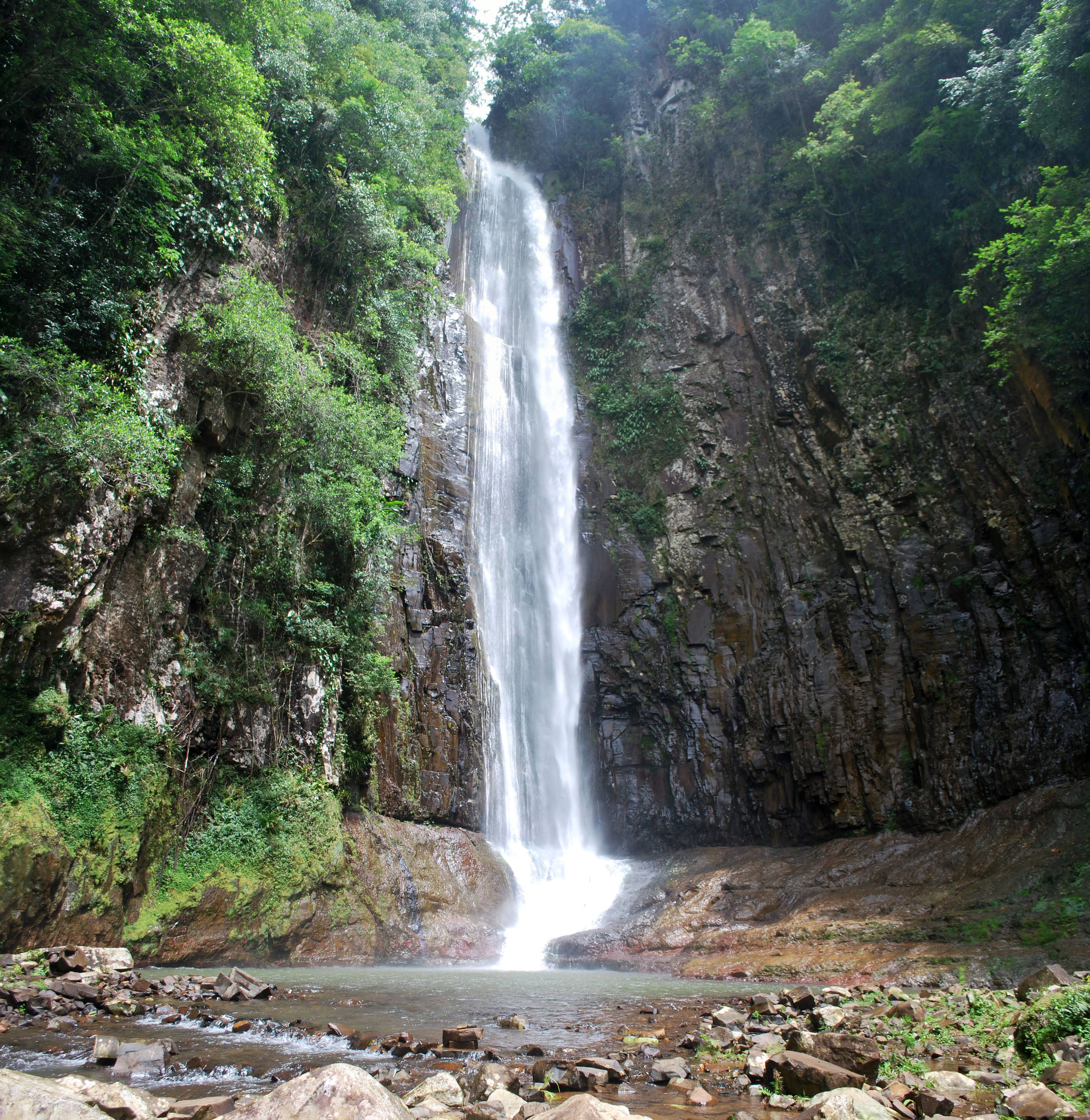
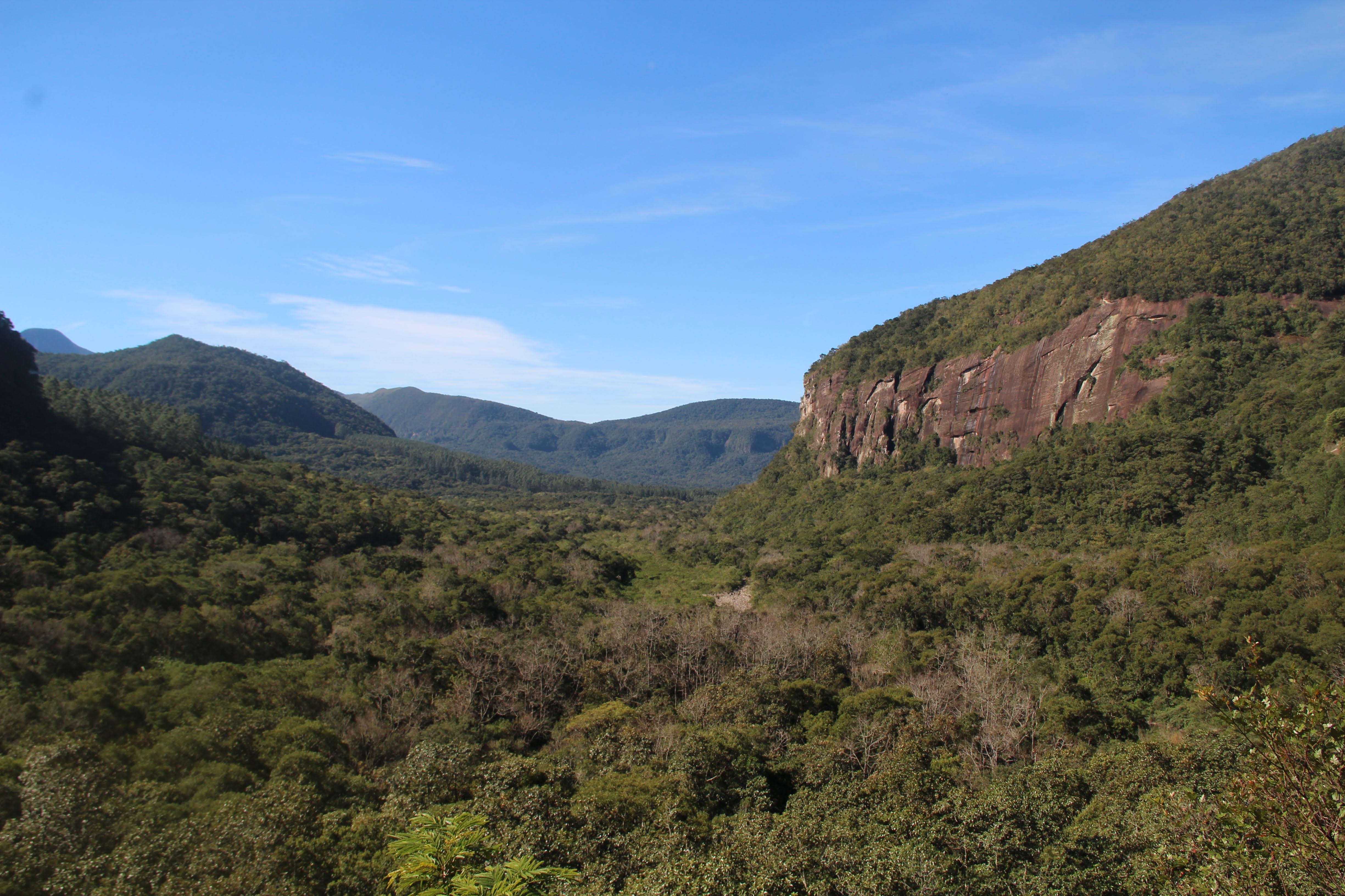
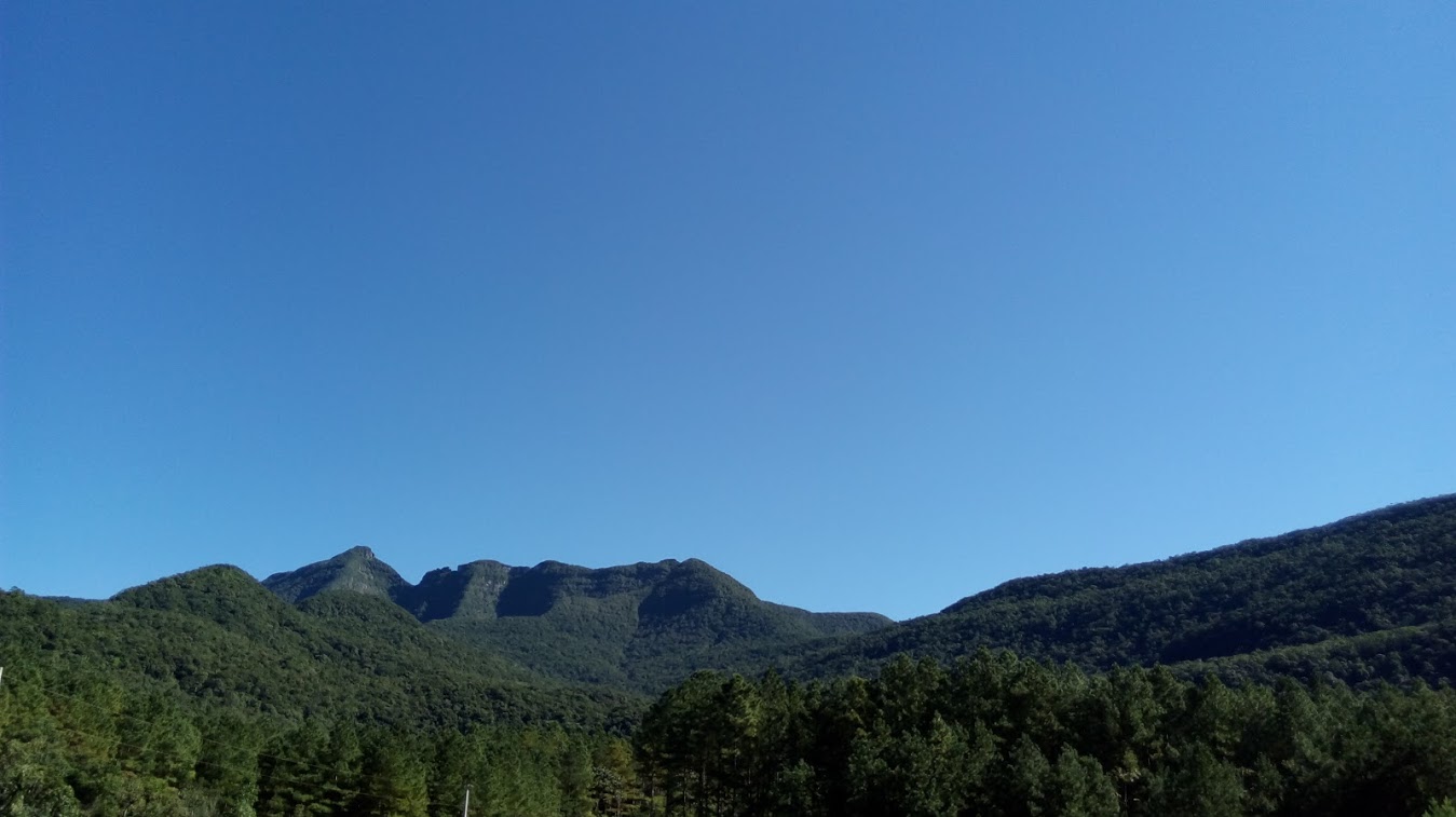
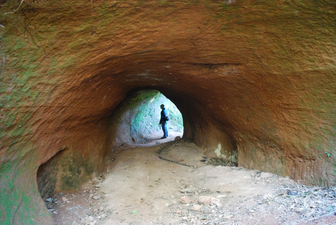
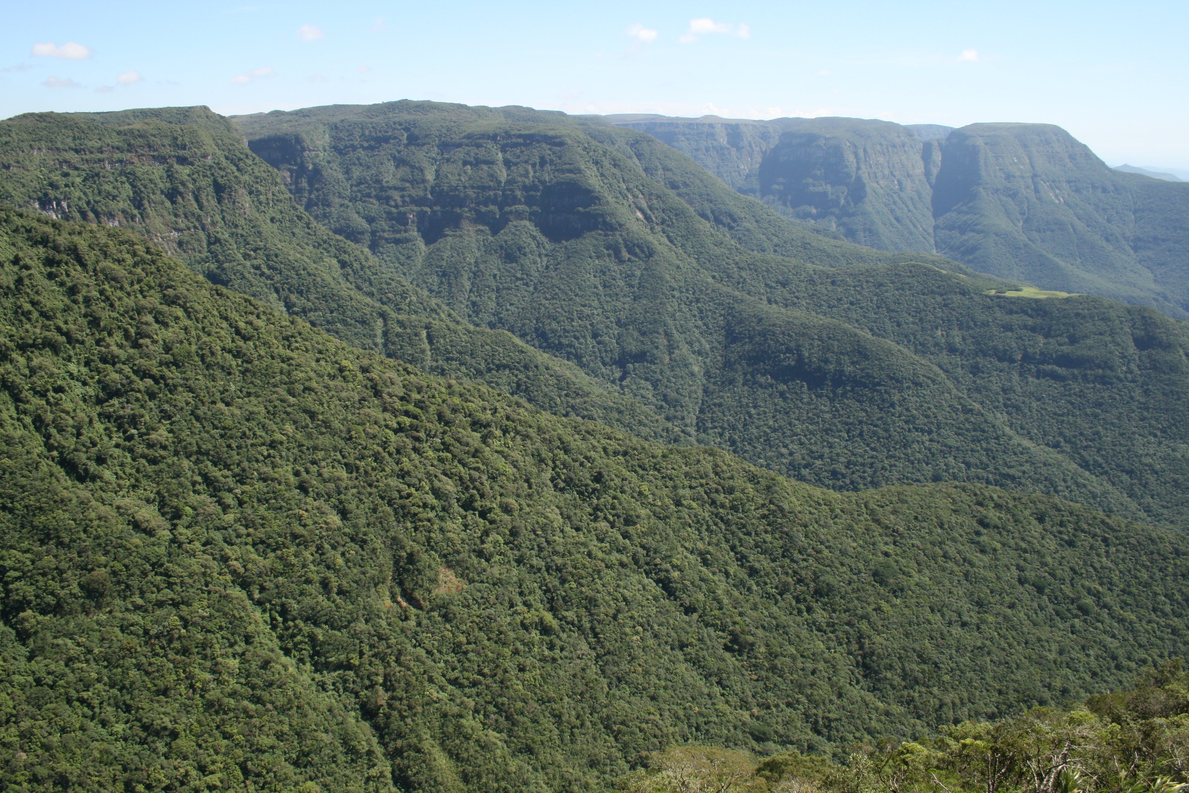
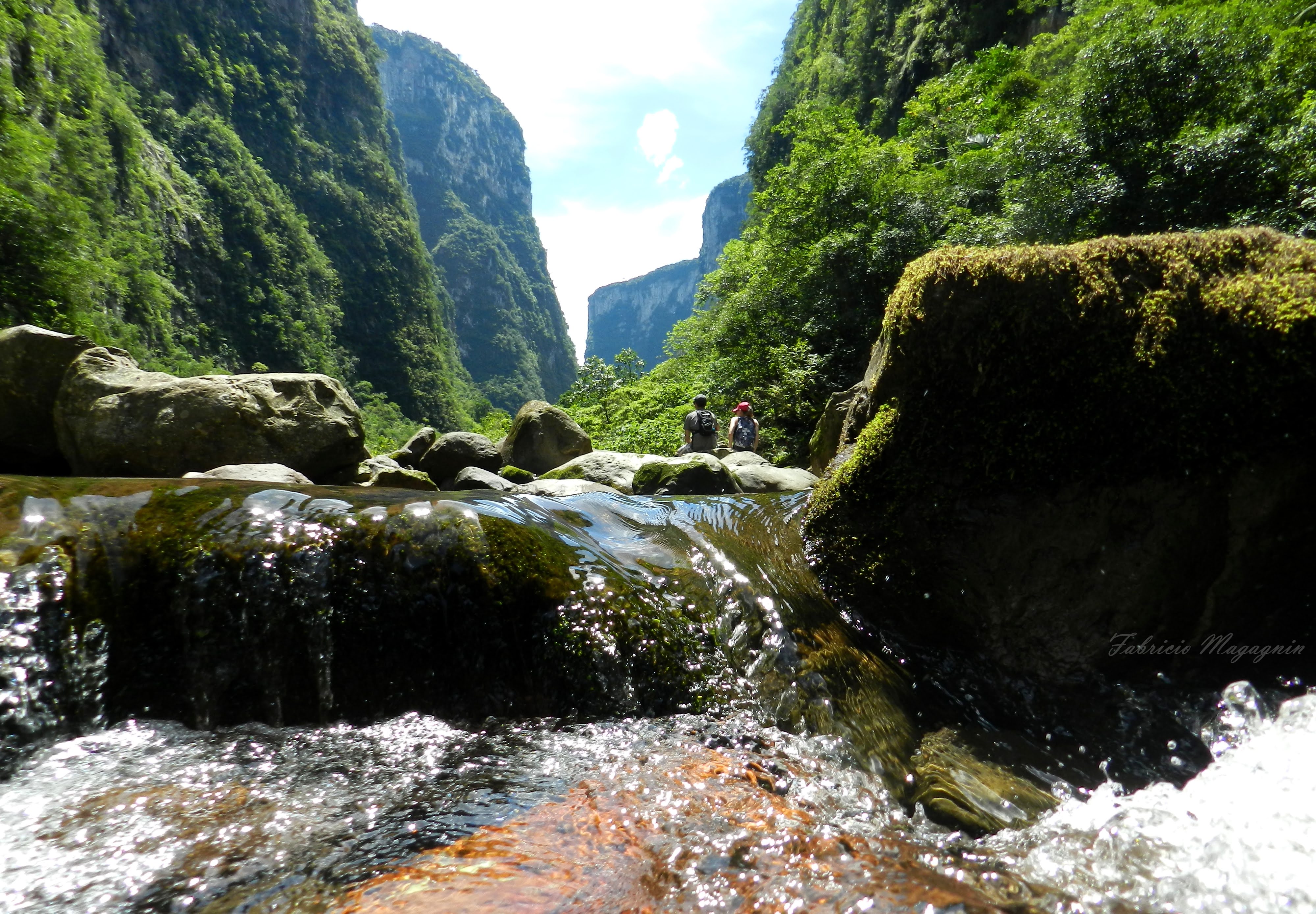
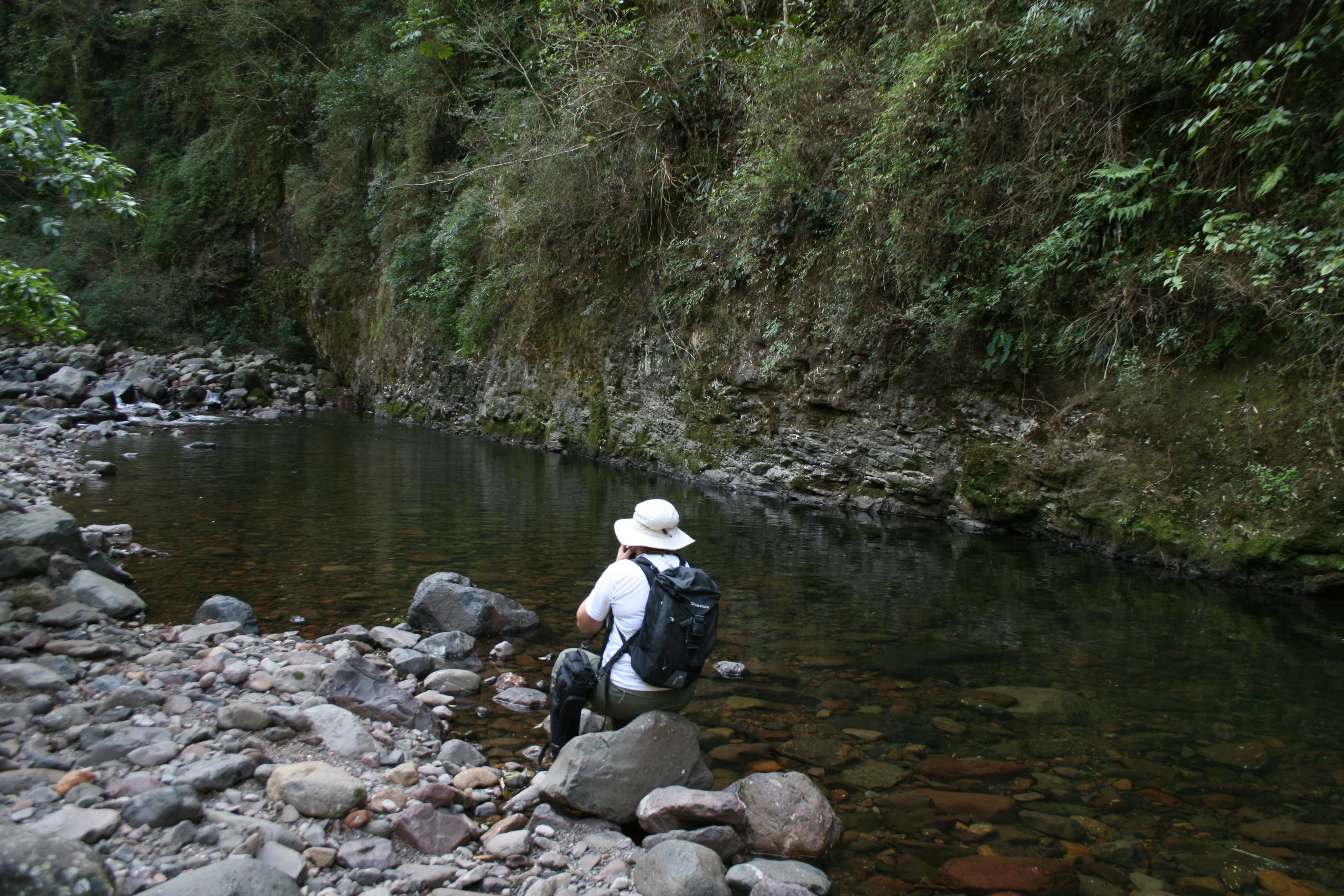
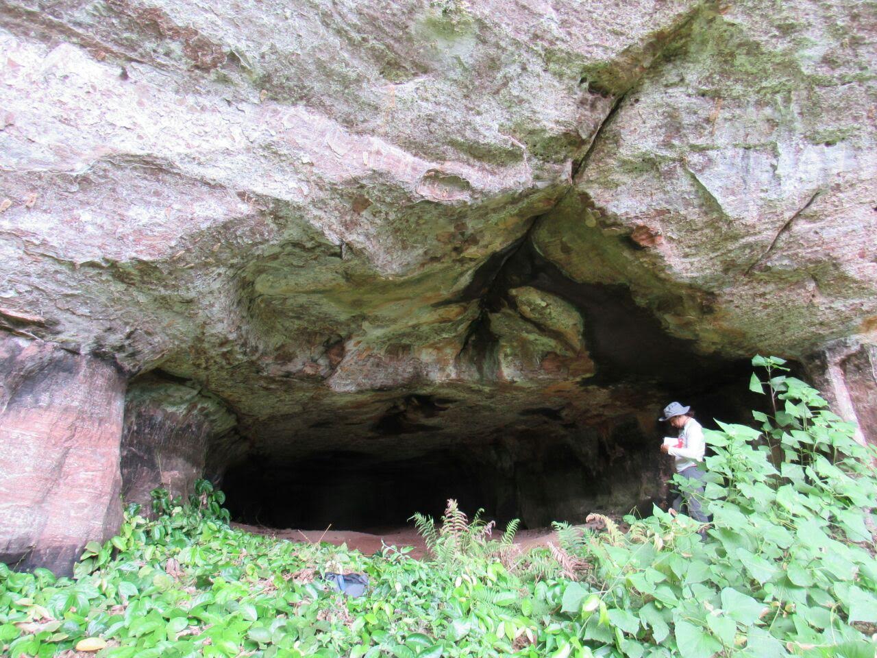
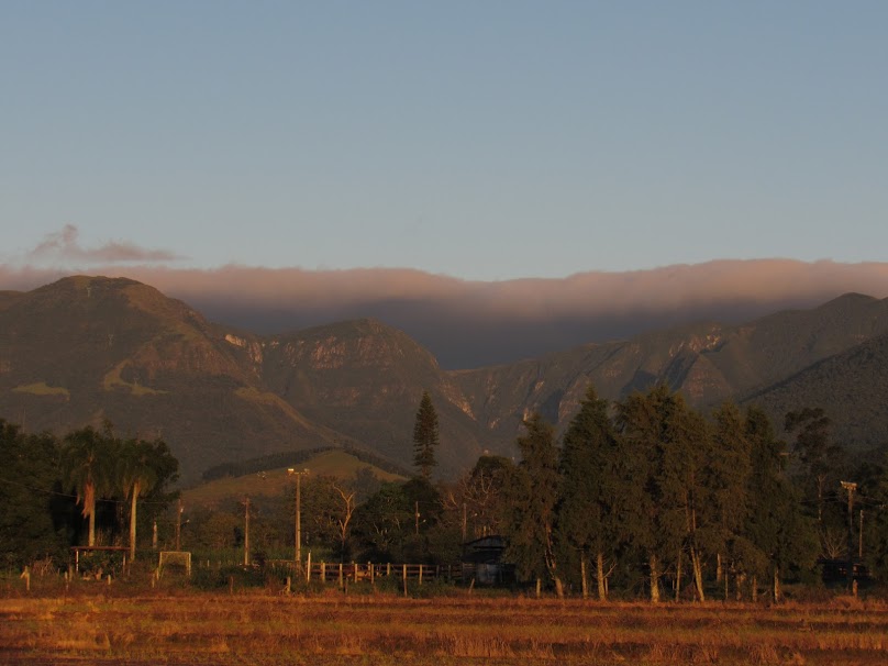
A landscape feature of great expression, between the states of Rio Grande do Sul and Santa Catarina in southern Brazil, known as Serra Geral, is the highlight of the territory. Formed by a long and winding escarpment that limits two compartments - the plateau and the coastal plain - it has height differences reaching 1,000 meters, located less than 50 kilometers from the sea, where a vigorous dissection process has been working over time, sculpting successions of very deep and beautiful canyons, full of waterfalls and natural pools. With practically all the springs in Serra Geral, the rivers of this region drain and shape a wide plain until reaching the sea, where the coastal zone completes the diversity and exuberance of this territory, where lagoon complexes interact with dune fields and sandy beaches. In this scenario of singular beauty, a still little known underground world enriches the region. Formed by dozens of paleoburrows, shelters excavated by extinct animals that lived for over 10,000 years.
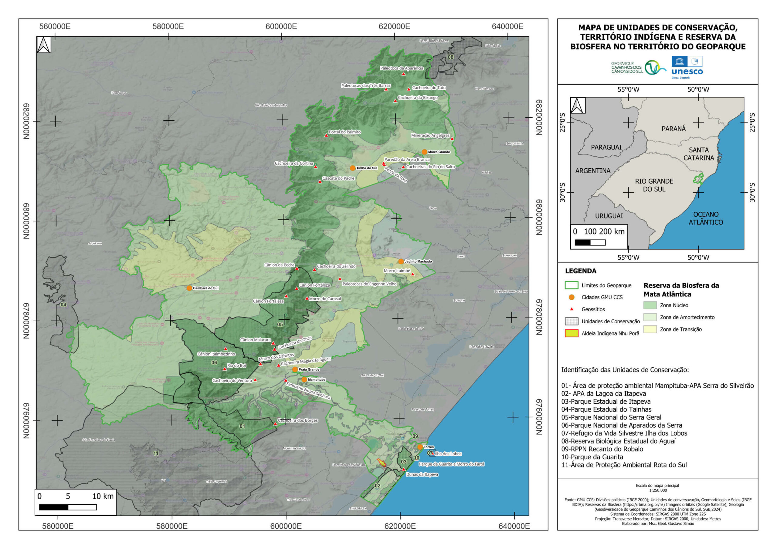
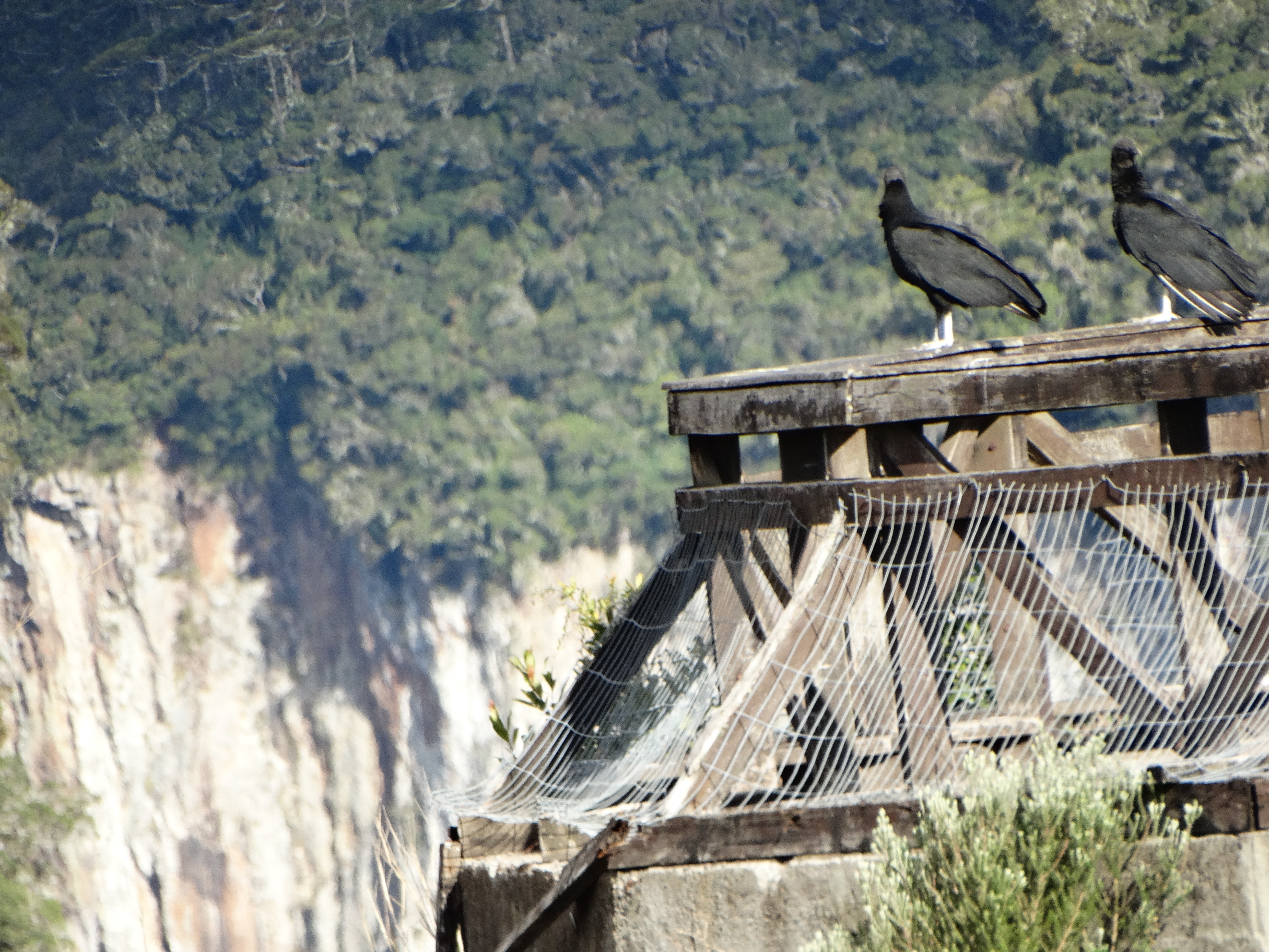
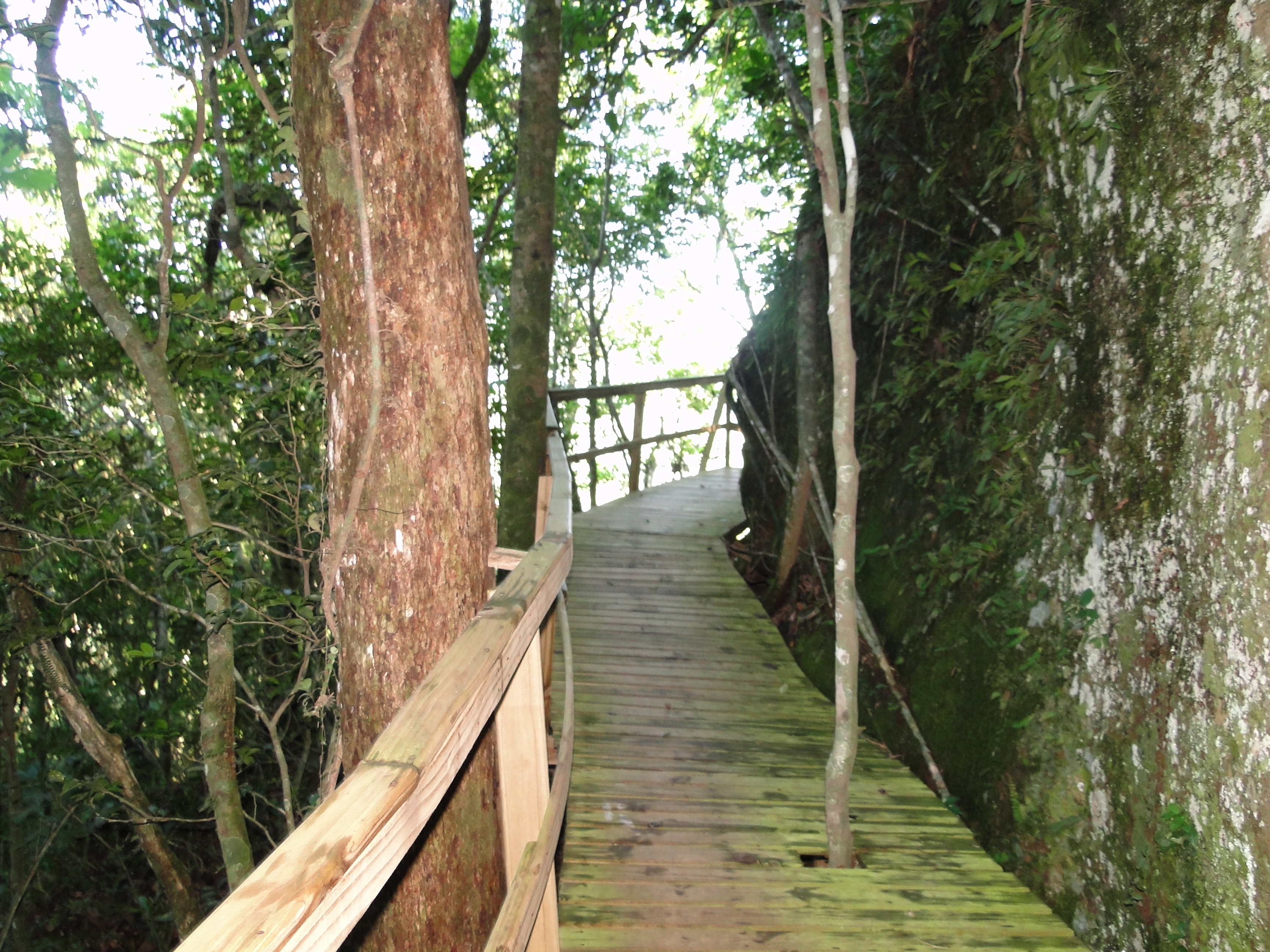
The lush biodiversity of the mountainsides completes the beauty of the place. Characterized by dense evergreen vegetation with many ferns, orchids, palm trees and trees that can reach 50m in height. In the highest portions occur Mata de Araucarias and in the portions of the plain lies the Mata Paludosa. All this diversity constitutes the Atlantic Forest biome, where the fauna is quite rich with significant number of endemic species such as Baio Lion (Felis concolor), Blue Rook (Cyanocorax careuleus), Red Belly Frog (Melanophryniscus dorsalis), Dune Gecko ( Liolaemus arambarensis), among others.
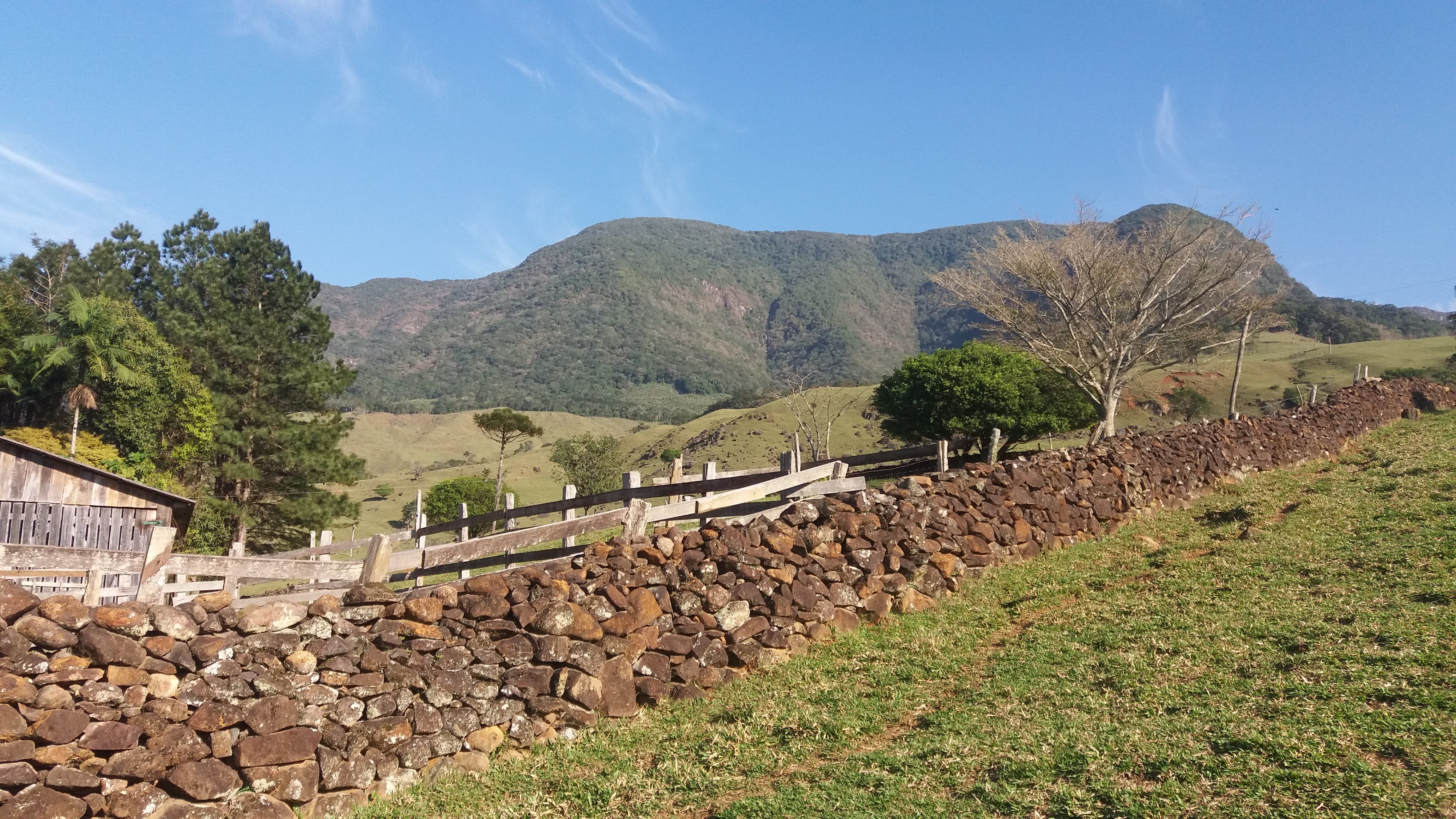
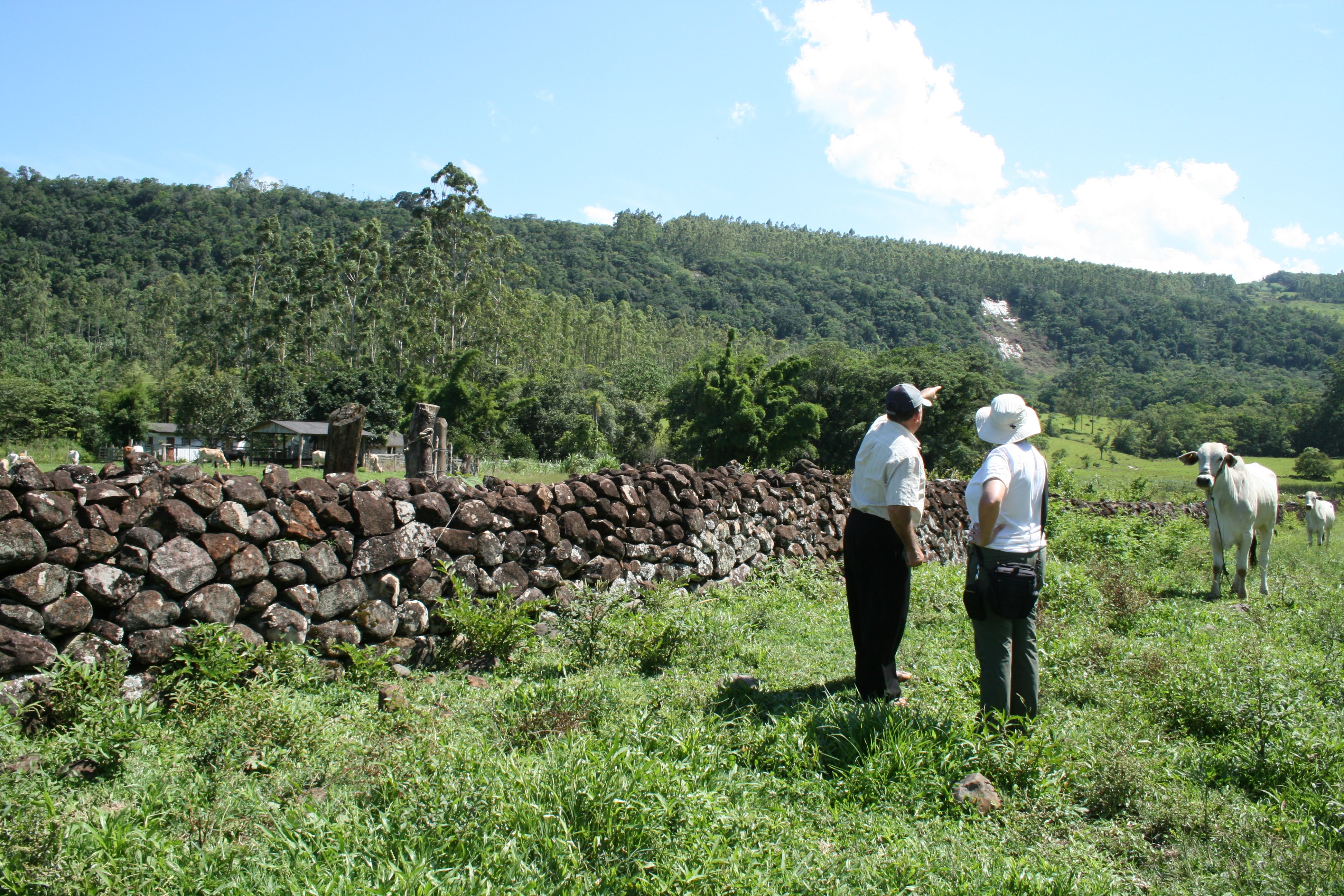
In synergy with this natural heritage, the territory also reveals a material and immaterial cultural heritage that allows us to learn about the past, traditions, history, customs, culture and identity of the people who inhabited and still inhabit this region, with particular emphasis to indigenous and quilombola cultures (African descendants of slaves) and Azorean, German and Italian immigrants, and the remarkable "trooper" movement in the region.
Bringing the natural and cultural heritage together, the Caminhos dos Cânions do Sul Geopark project has been building sound strategies to promote nature conservation, sustainability education and responsible tourism, in partnership with local public and private institutions for economic development within the territory.
Situated in southern Brazil, between the states of Santa Catarina and Rio Grande do Sul, the territory of the Geopark project is located 205 km from the state capital of Santa Catarina, Florianópolis, and 184 km from the state capital of Rio Grande do Sul, Porto Alegre.
Both capitals have airports with regular flights from major brazilian airlines.
The main accesses by highways are by the BR-101, which connects the coast of Santa Catarina and Rio Grande do Sul, and by the RS-020, by the mountainous region.
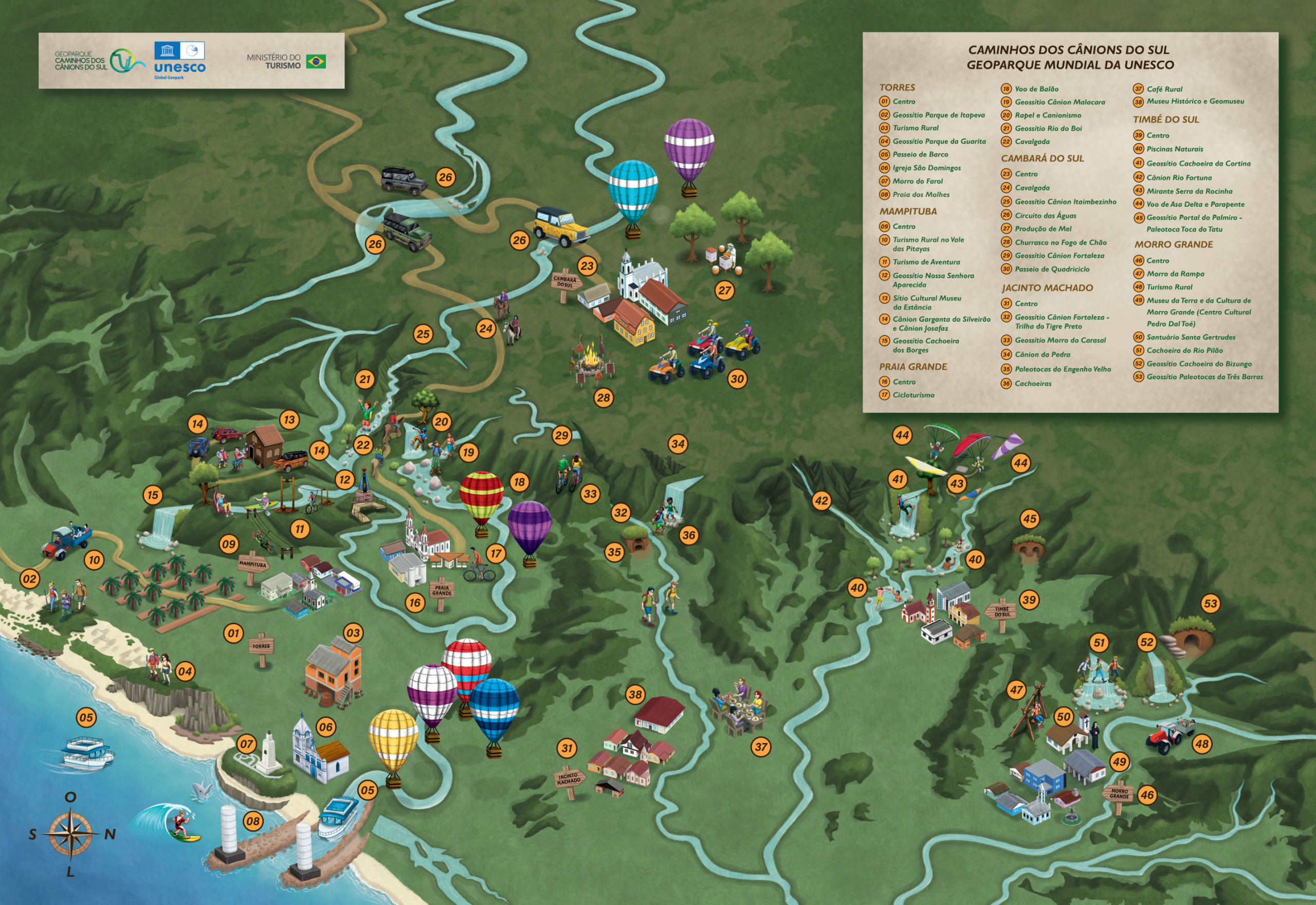
Below are some maps with important information about this territory
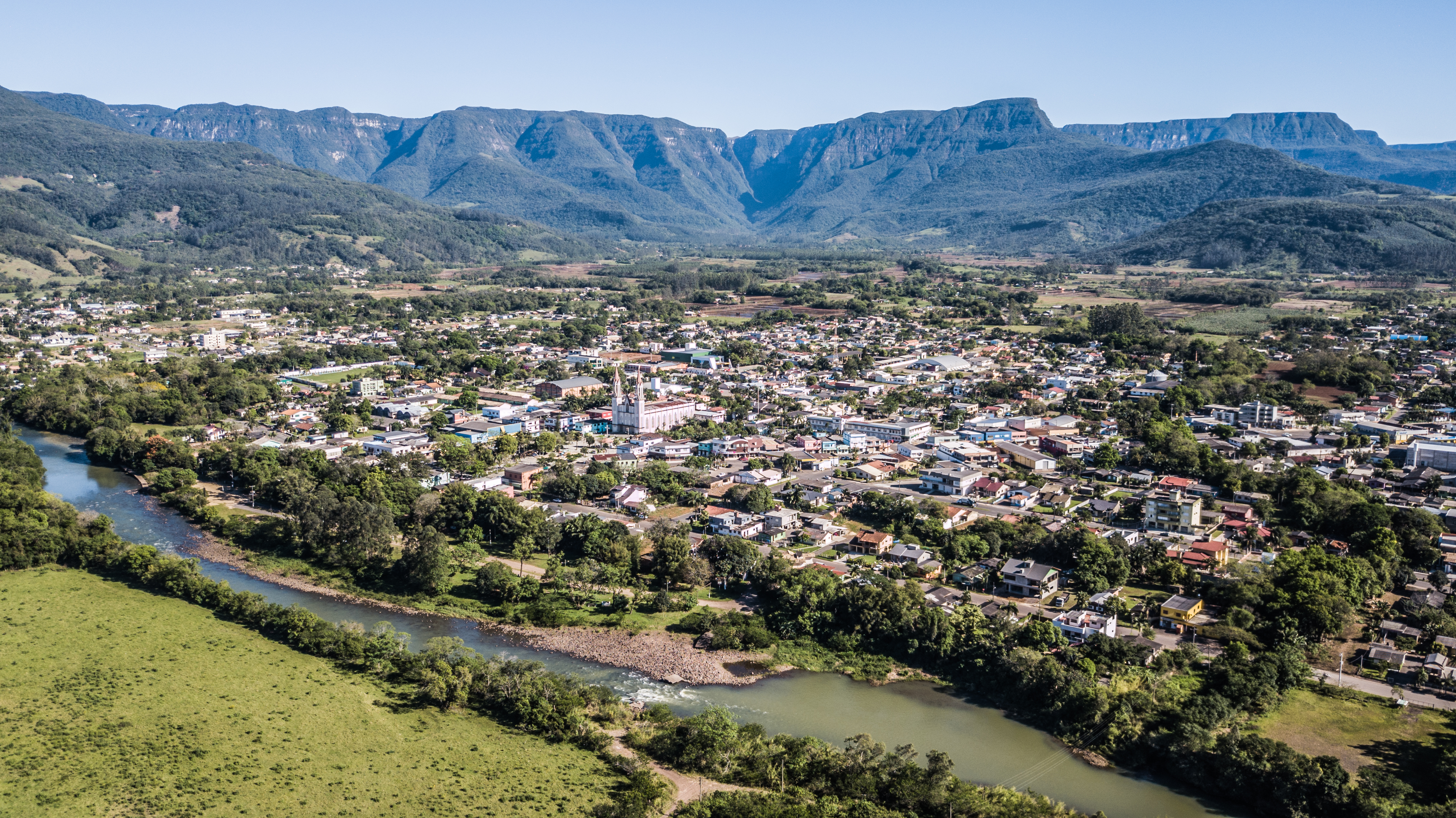
County located in the gaucho countryside consisting of a small town of 6,545 inhabitants. It draws attention and attracts visitors from various parts of Brazil and the world.
The quiet and welcoming city of Cambará do Sul serves as a starting point for visiting the largest canyon pool in South America, Fortaleza and Itaimbezinho. Tourism in Cambará do Sul and the canyons started to grow after television channels discovered that the region had perfect settings for their film productions.
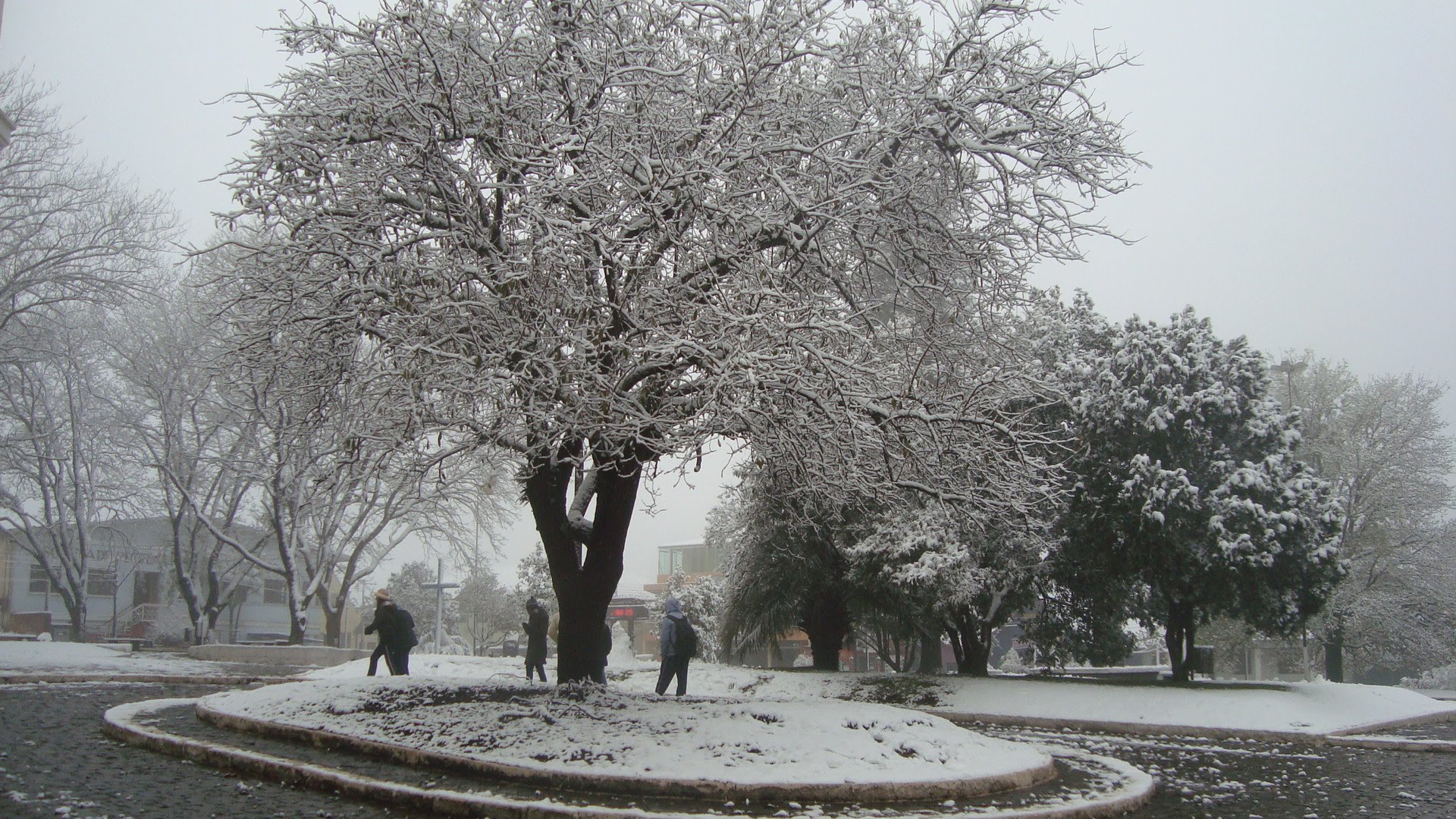
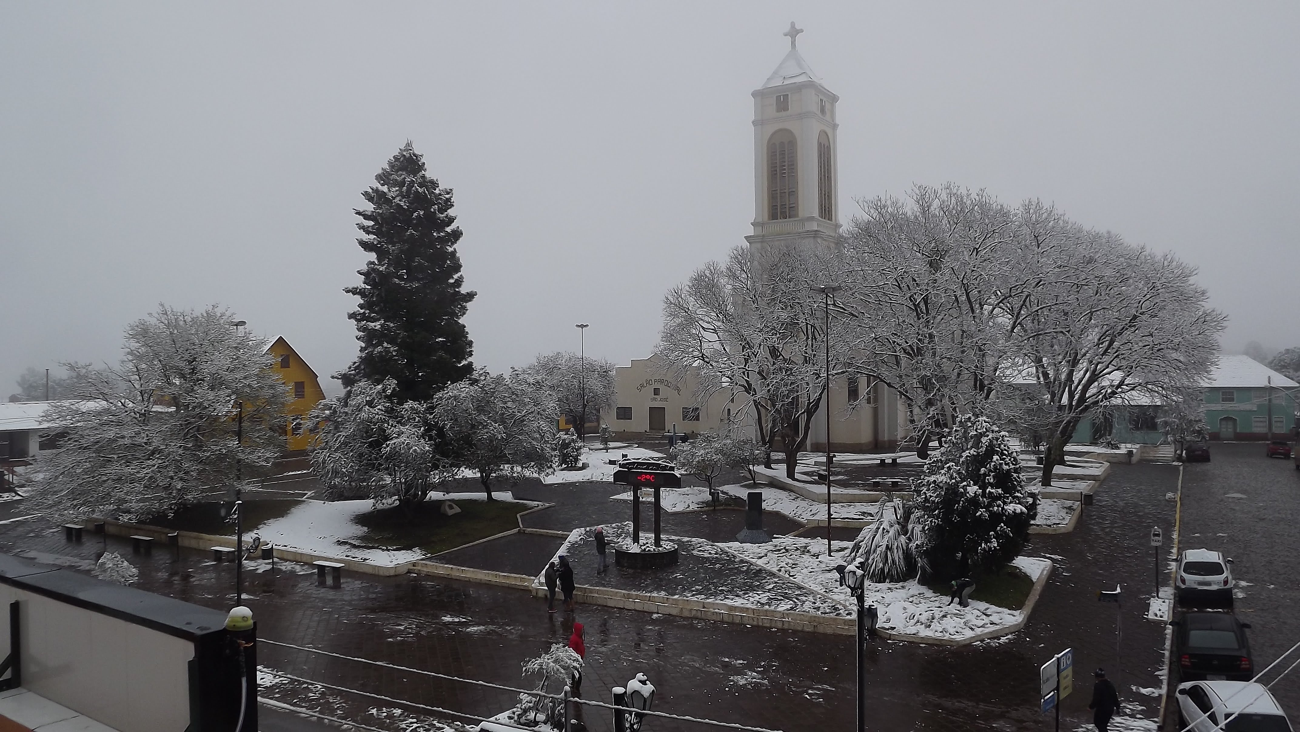
Cambará do Sul offers many attractions for lovers of adventure tourism and contemplation. The city is also known as the "Land of the Canyons". The small Cambará do Sul town is the low temperature king in Brazil, and its winter is always among the coldest places in the country.
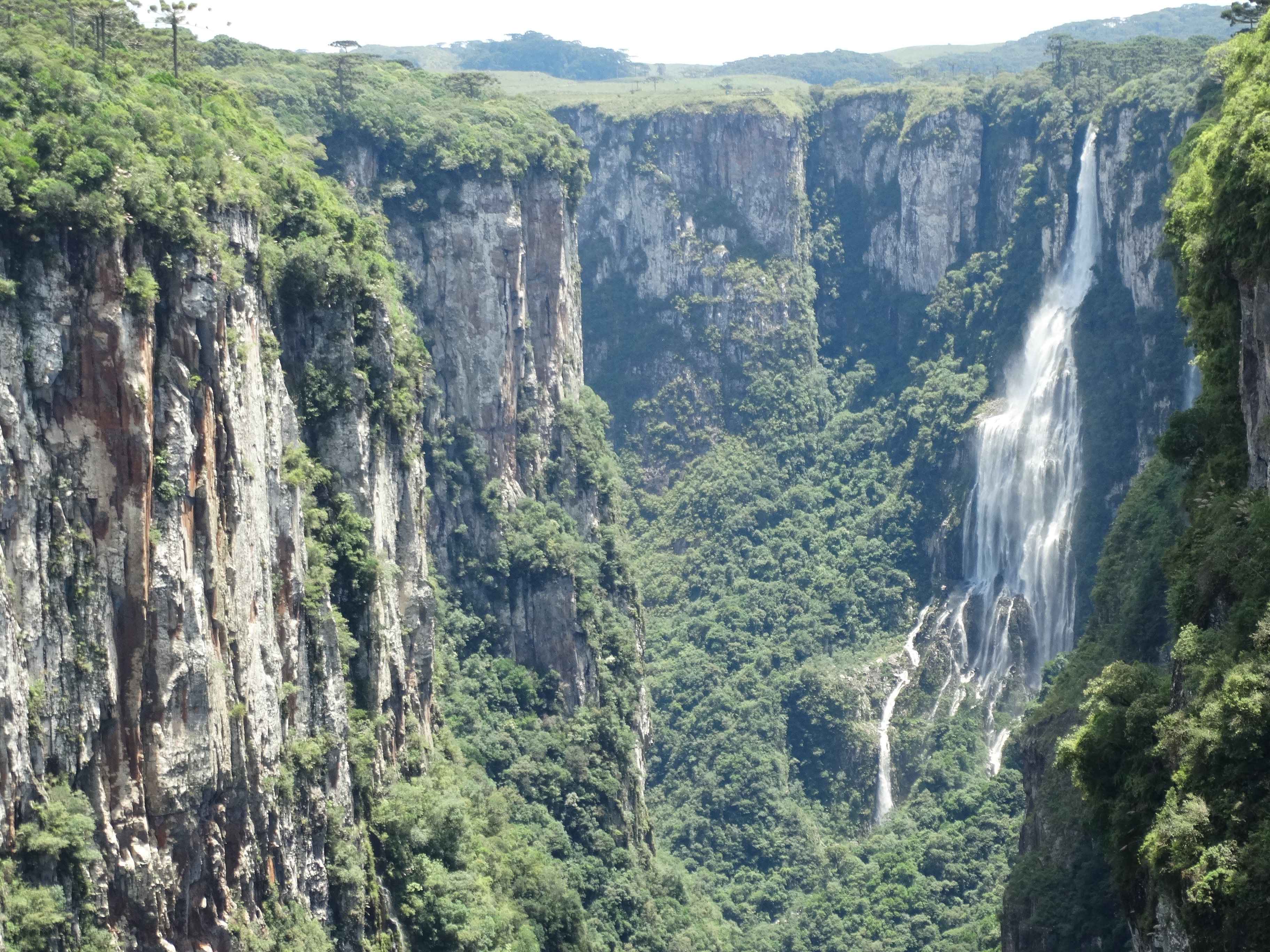
Santa Catarina's ecotourism has in Jacinto Machado, a city with 11 thousand inhabitants, one of its best destinations. The county is the main access to Fortaleza Canyon, the largest in the region and one of the largest in Brazil, with 7.5 km in length and up to 1,157 m in height.
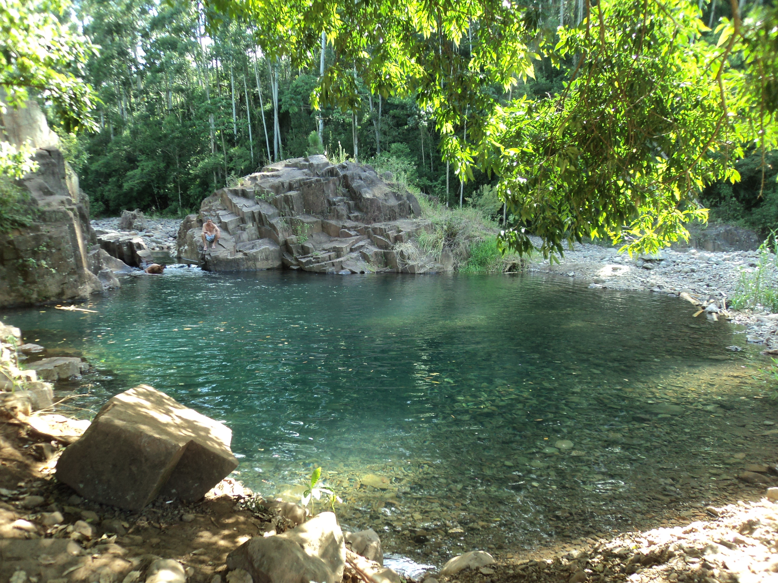
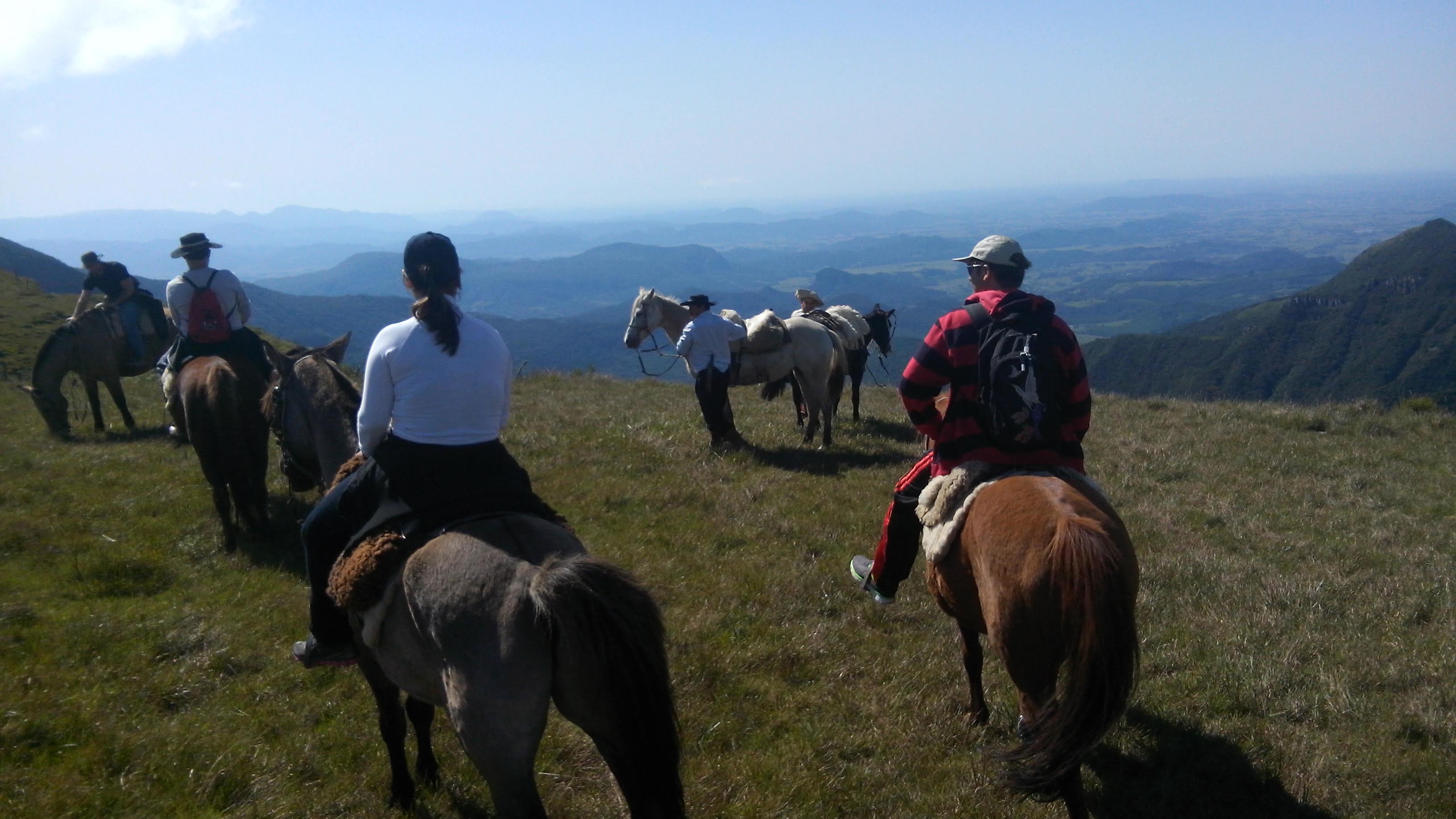
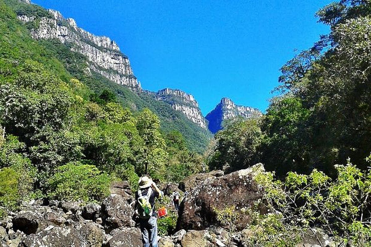
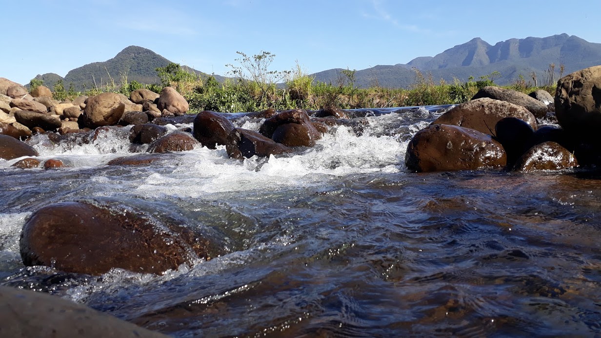
The trips to the countryside reserve centuries-old trails used by troopers a true adventure is made through waterfalls, natural pools, stony rivers and exuberating vegetation . Always reminding that trails must be done with acredited guides.
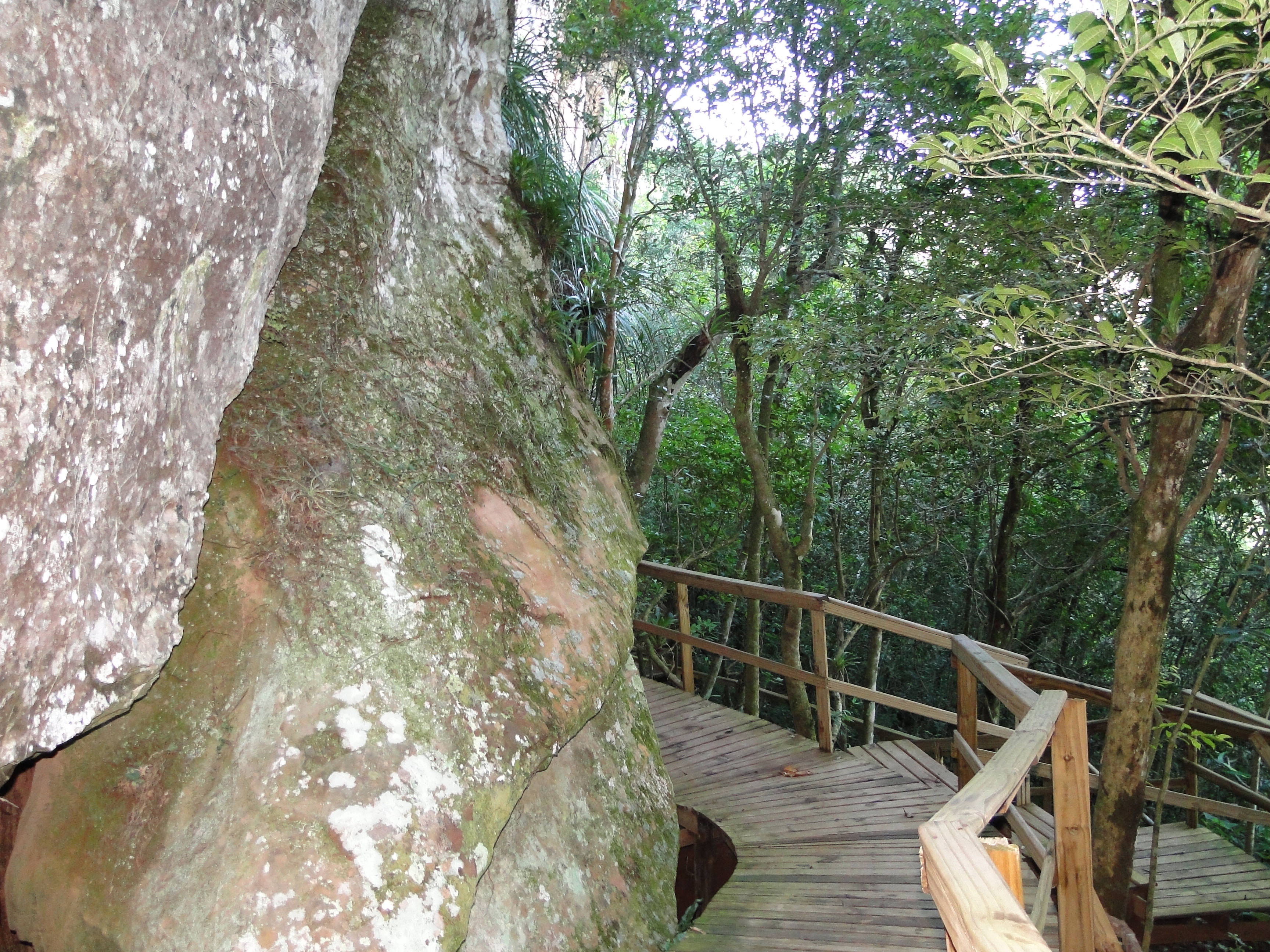
In the outskirts of the city, there are sandstone mountains with natural sculptures and seawalls that enchant all who walk the trails. In the center, the Municipal Historical Museum highlights the ancient pieces used by the indigenous population and settlers.
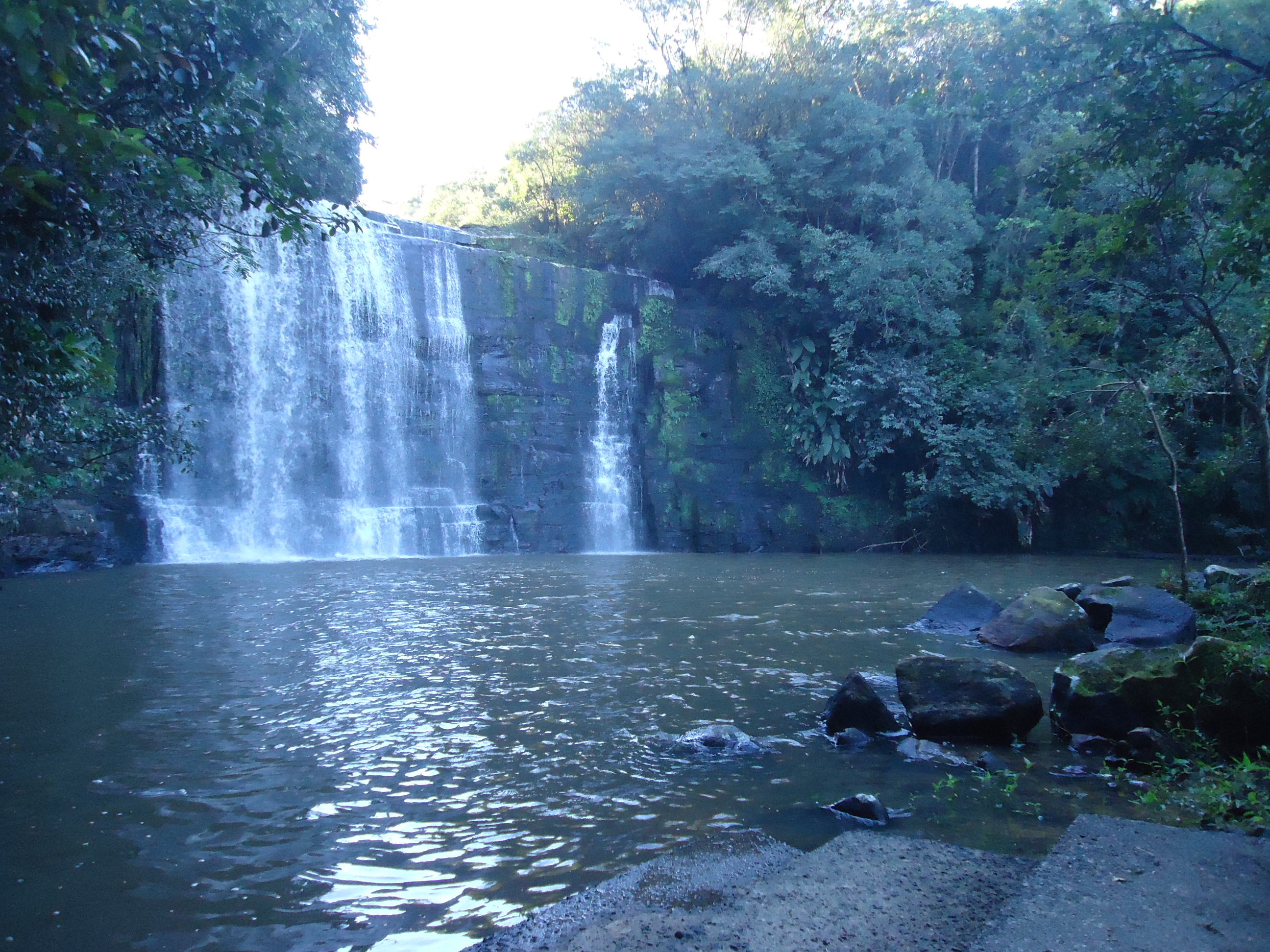
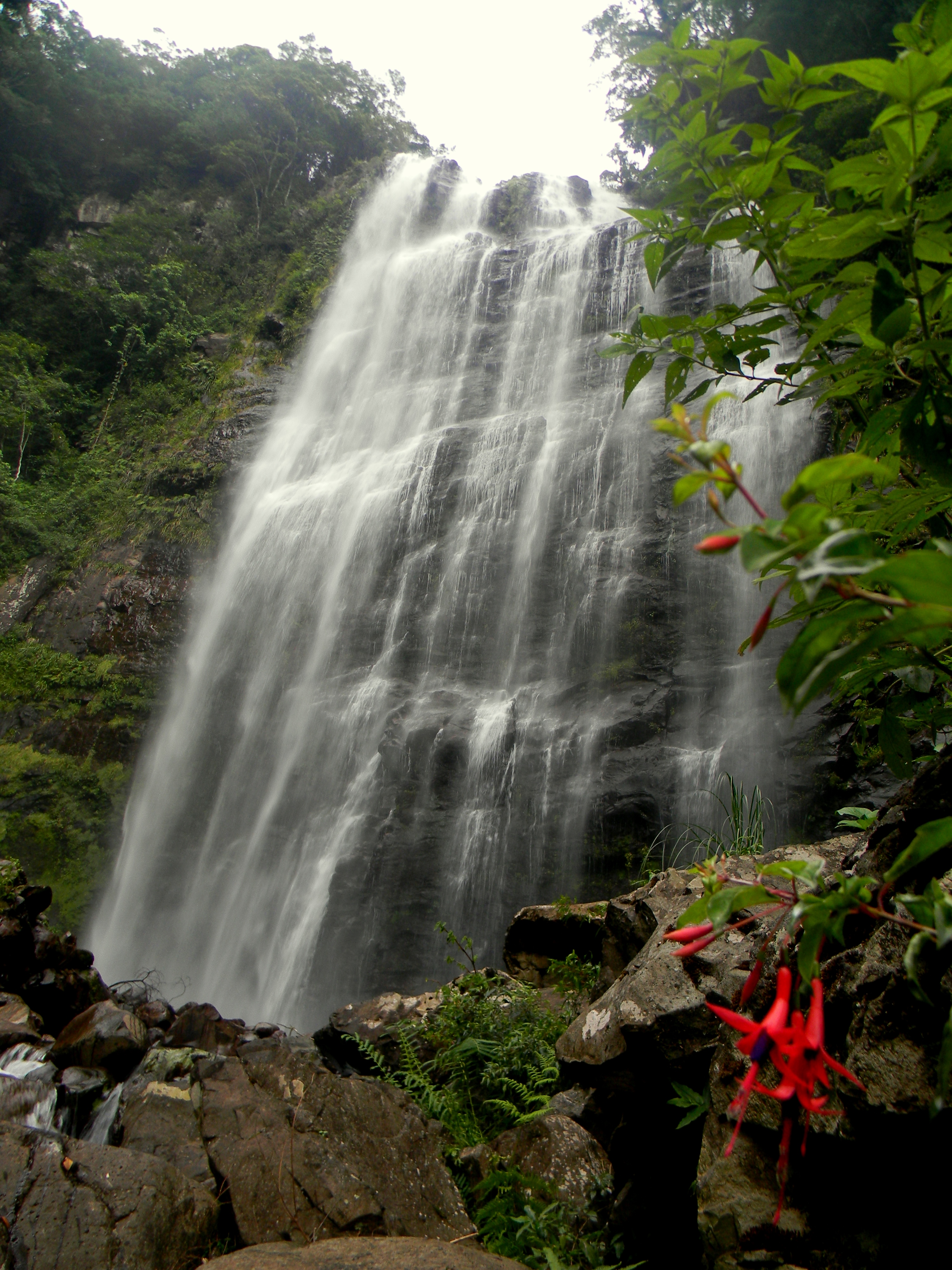
Among the charms of rural tourism Jacinto Machado, stand out the lush waterfalls scattered in the county's countryside, including: Anna Schiratta Waterfall, Gavea or Paulinos Waterfall, Burin Waterfall, Arco Íres Waterfall, Gruta Waterfall, Waterfall do Zelindo and Morro da Antena Waterfall. Also noteworthy are the Cambajuva Canyon, Canyon Fortaleza, Pedra Canyon, Moça Hill, Carasal Hill, Itaimbé Hill, Testa do Macaco Hill and rappelling activities, trails and paleoburrows.
The county of Mampituba is located on the hillside of Serra Geral with a lush landscape, rich in valleys and waterways. The main river of the region lent its name to the city and refers to its course formed by many curves.
Mampituba, with its approximately 3,000 inhabitants, is privileged for its natural beauty such as mountains, cliffs, seawalls and canyons, waterfalls, natural pools and belvederes with highlight to the Josafaz Canyon, Bicudo Hill Top, White Stone Top, Borges Waterfall, trails and adventure sports on the Mampituba River, making it a ideal place for tours and sightseeing.
The first settlements occurred around 1880, mostly from Azorean and German descent.
The city offers rural tourism options and stands out for its cuisine with local products. Traditional events in Mampituba are the Banana Municipal Festival, which takes place in June, celebrating the main economic activity of the municipality; Christmas in the Valleys and Cascades in December and other events at various times of the year. The natural beauty, the hospitality of the residents, the historical and cultural references, the organized and planned actions open horizons and, thus, tourism becomes a promising activity in the municipality.
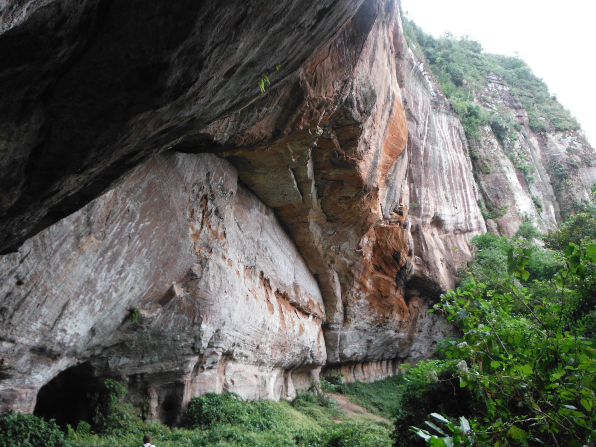
County with approximately 3,000 inhabitants, has a tourist structure that, alongside its natural cinematic beauties, fully justifies the visit. There are several caves known as "paleoburrows" structures excavated by animals of the mega fauna that went extinct more than 10,000 years ago, and later used by the Xoklengs and Bugres Indians who lived for a time in this region and used them to shelter, are curiosities. and a great paleontological, geological and archaeological heritage.
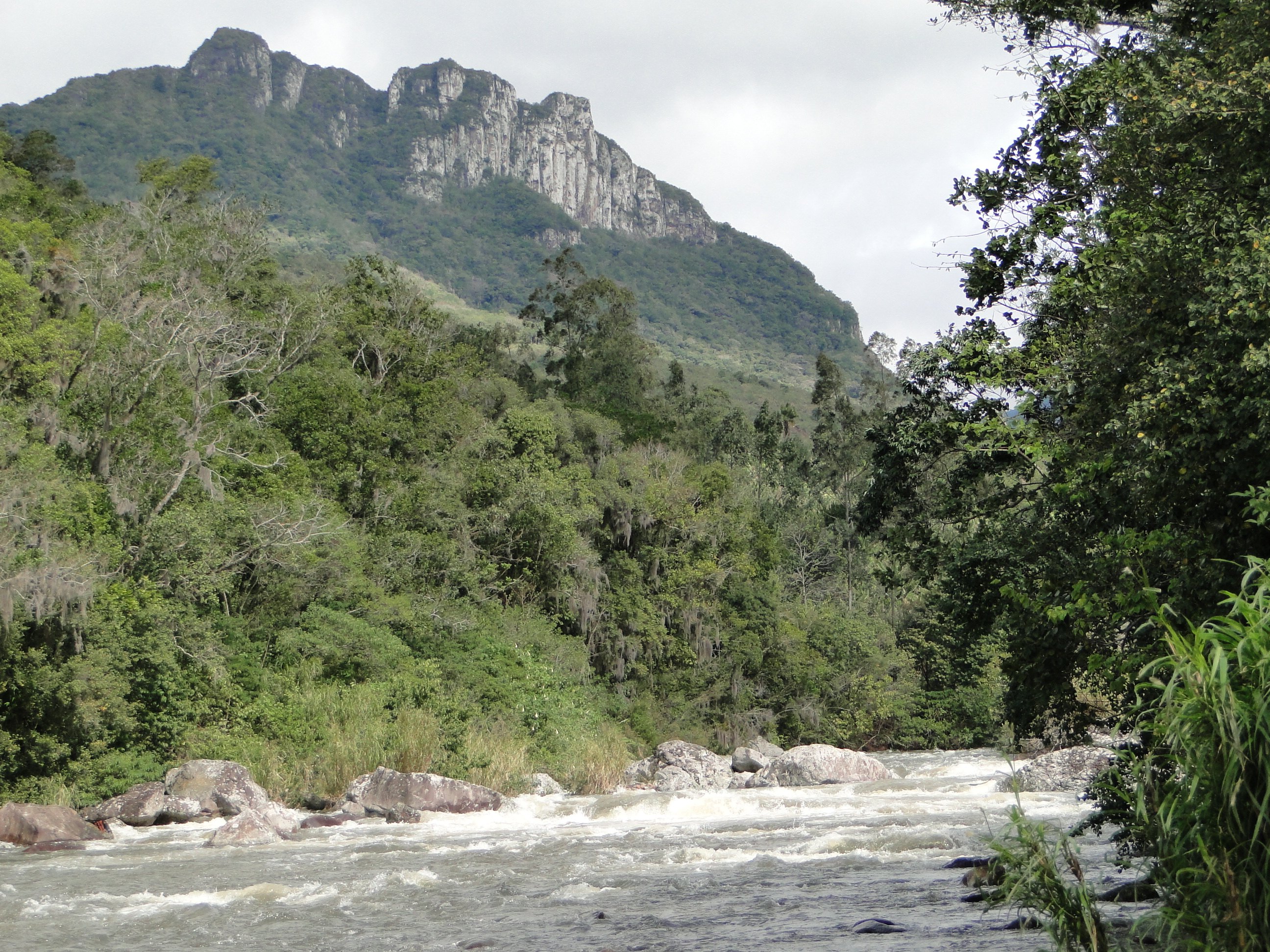
Realengo Hill is one of the most famous but challenging mountain trails in southern Brazil and is very popular with adventurers, climbers and hikers, a symbol of the city. Its access is by way of the old Tropeiros Trail, called Serra do Pilão which gives acess to Realengo Hill.
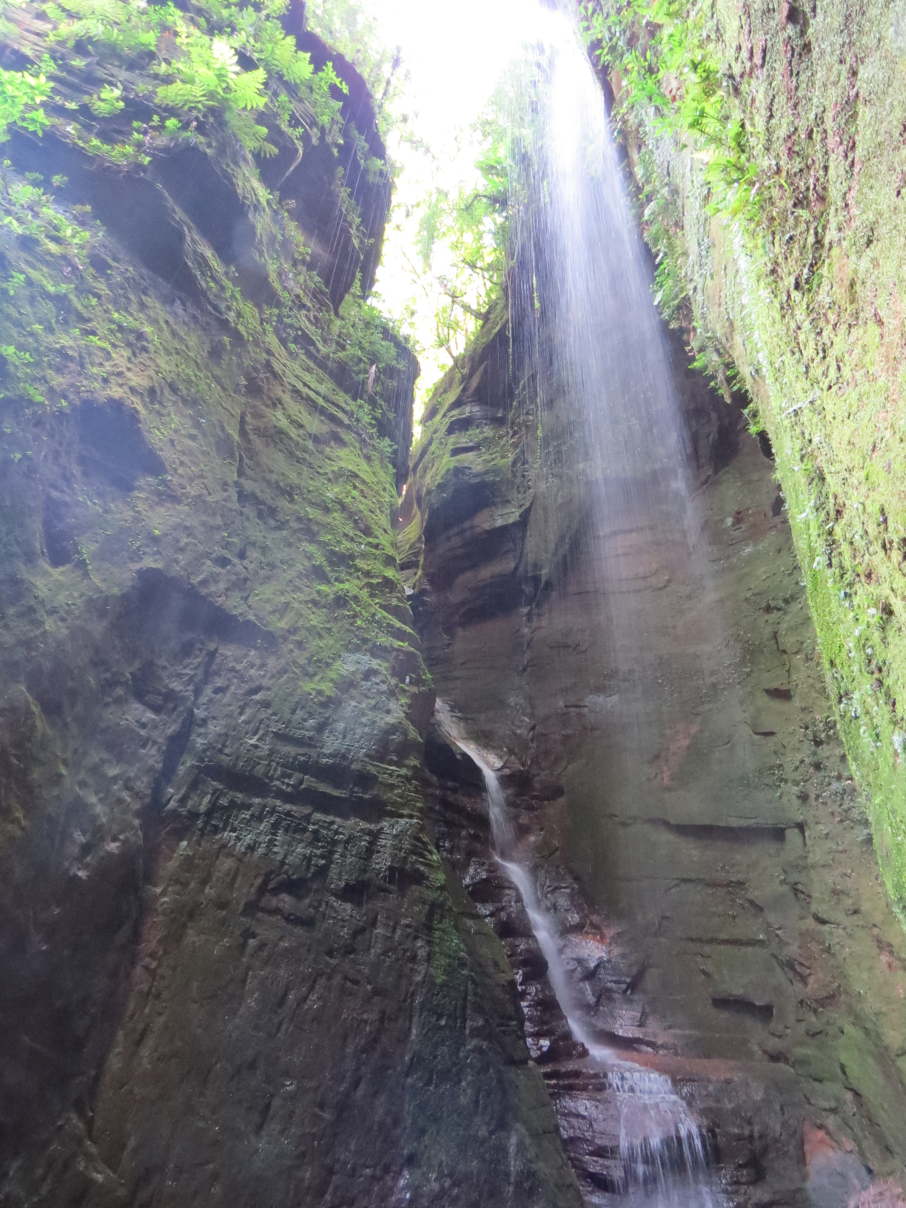
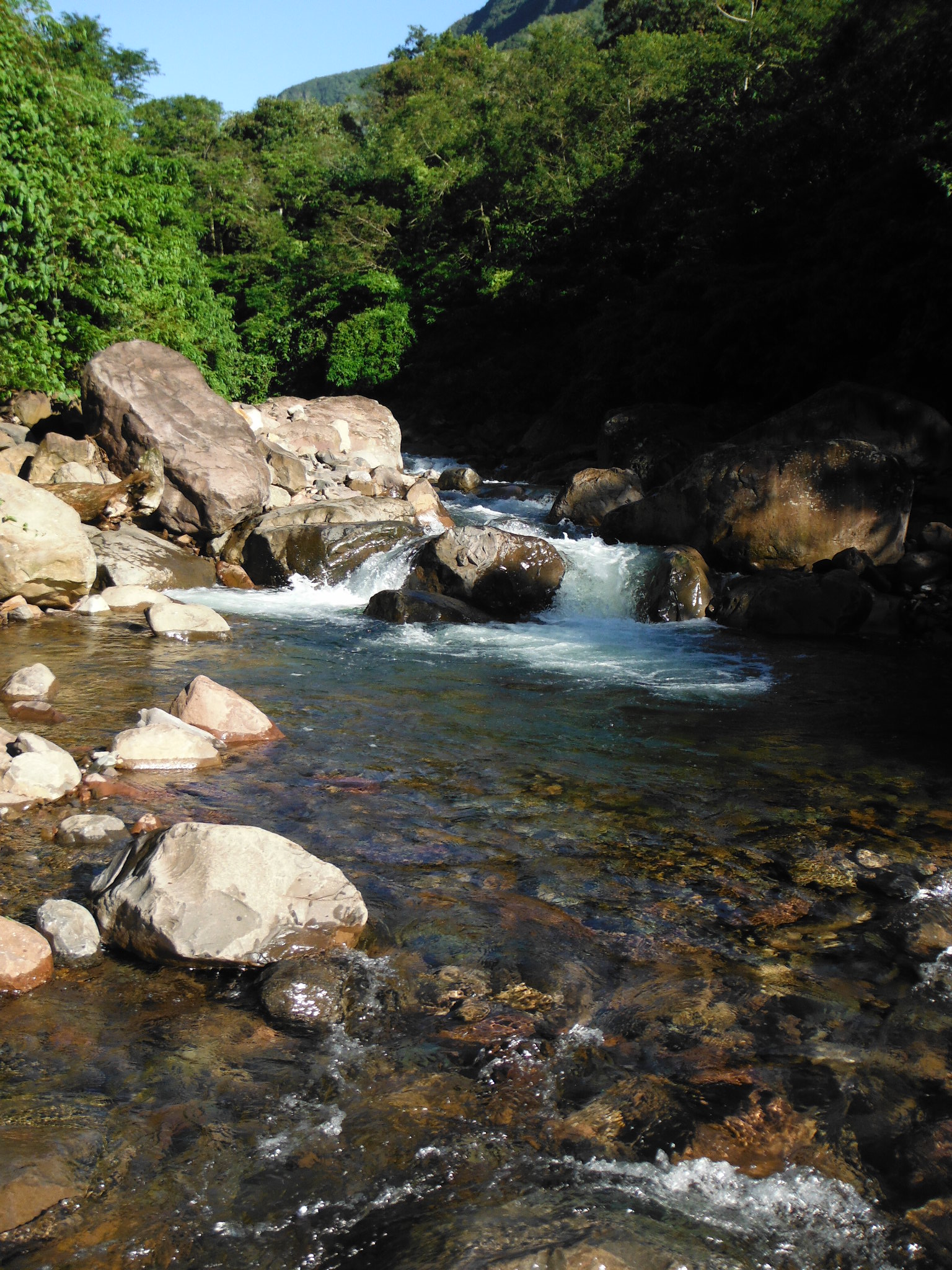
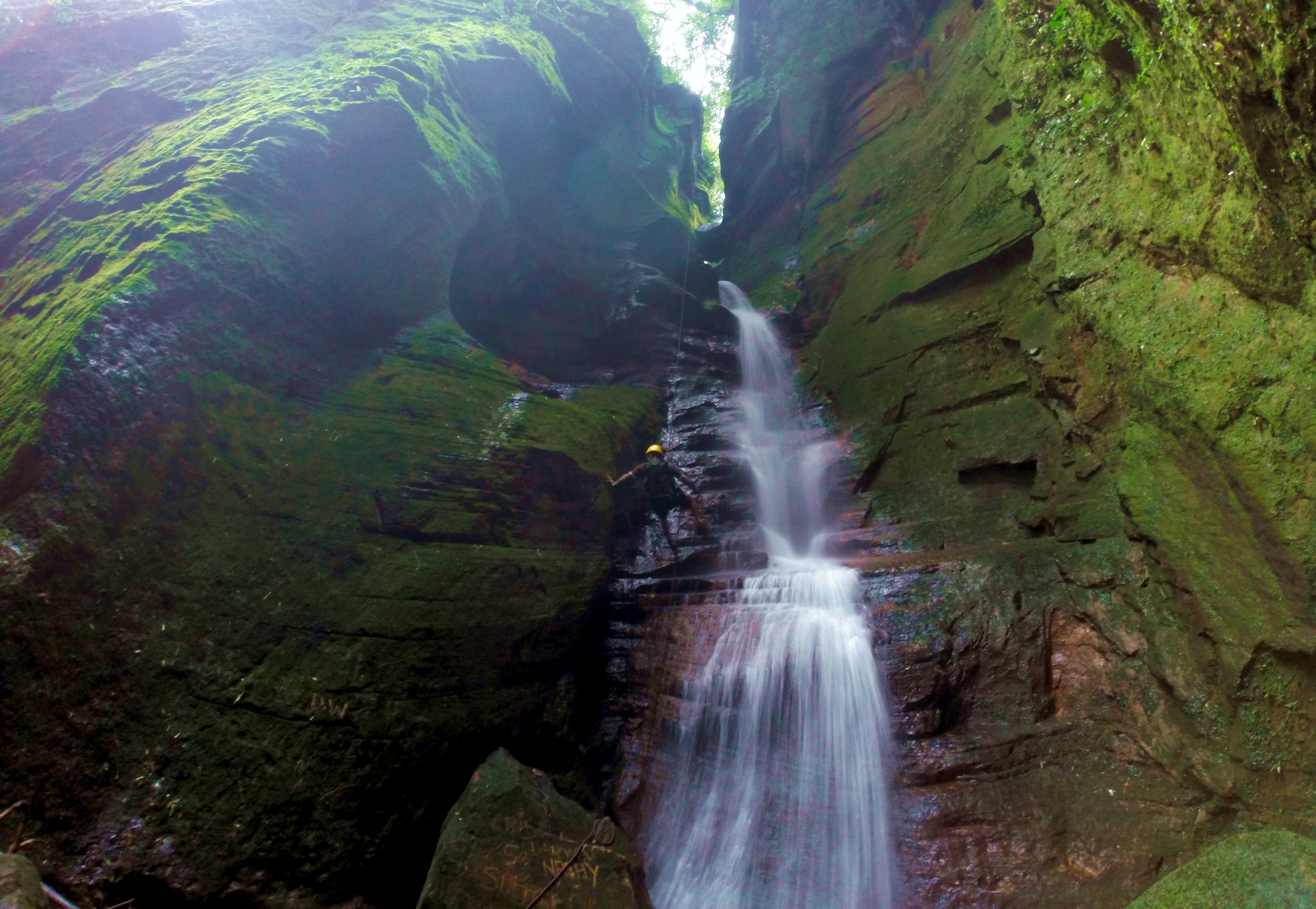
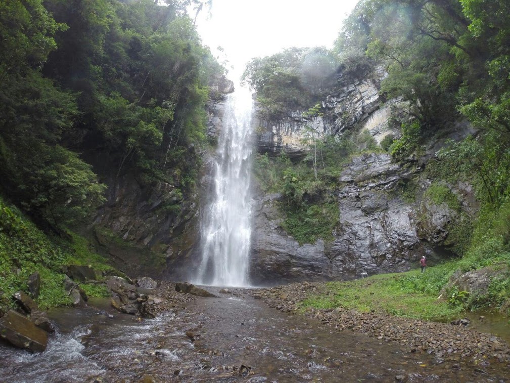
The rivers with natural pools of crystal clear waters are born on the slopes of the mountains, running and carving the canyons, valleys and grottos with spectacular waterfalls. The most visited are Bizungo Waterfall, Queda do Risco Waterfall, Rio do Pilão Waterfall, Pedra Branca Waterfall, Tatu Waterfall, Arco Iris Waterfall and Rio Saltinho Falls, among others still little explored in the Boa Vista and Monte Negro canyons. All attract tourists from various regions to enjoy a swim amid preserved nature and the practice of extreme sports such as abseiling. Religious tourism is also featured in the city.
Located in the extreme south of the state of Santa Catarina, it was colonized by descendants of Italians, Portuguese and Germans. Surrounded by the largest canyons in Brazil, Praia Grande is a mix of hills, rivers, waterfalls and natural pools, being one of the first counties of the Caminhos dos Canyons Region.
With 7,267 inhabitants (IBGE 2010), it is located between two National Parks, Serra Geral and Aparados da Serra. The economy is based on agriculture, represented by the cultivation of rice, corn, tobacco and bananas. Tourism has been an alternative for employment and income due to its touristic potential.
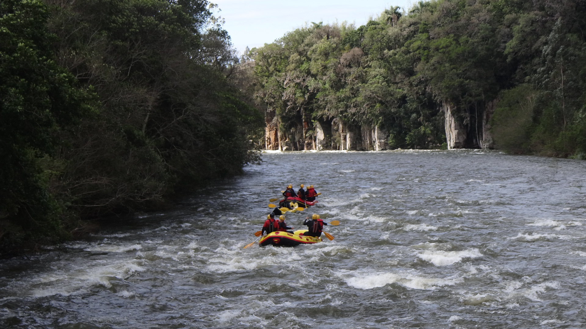
The two National Parks, Serra Geral and Aparados da Serra, are the main natural attractions of the county, where adventure tourism, extreme sports and ecotourism are the most developed. There are many trails that the canyon region offers, both on foot and by bike, and horseback riding along the ancient tropeiro routes. The freshwater resorts located around the municipality are a highlight, where boat descents are practiced in these rapids that cut the canyons. One of the most popular itineraries is the Rio do Boi Trail, which includes a path inside the Itaimbezinho Canyon, with river crossings, passing by beautiful waterfalls until reaching refreshing natural pools.
This typical countryside town the hillside of the Serra was a trooper passage, a landmark rooted in its culture. Its also home to the São Roque Quilombola Community. The county has several canyons, including: Índios Coroados Canyon, Molha Coco Canyon, Malacara Canyon, Churriado Canyon, Rio Seco Canyon, Rio Leão Canyon.
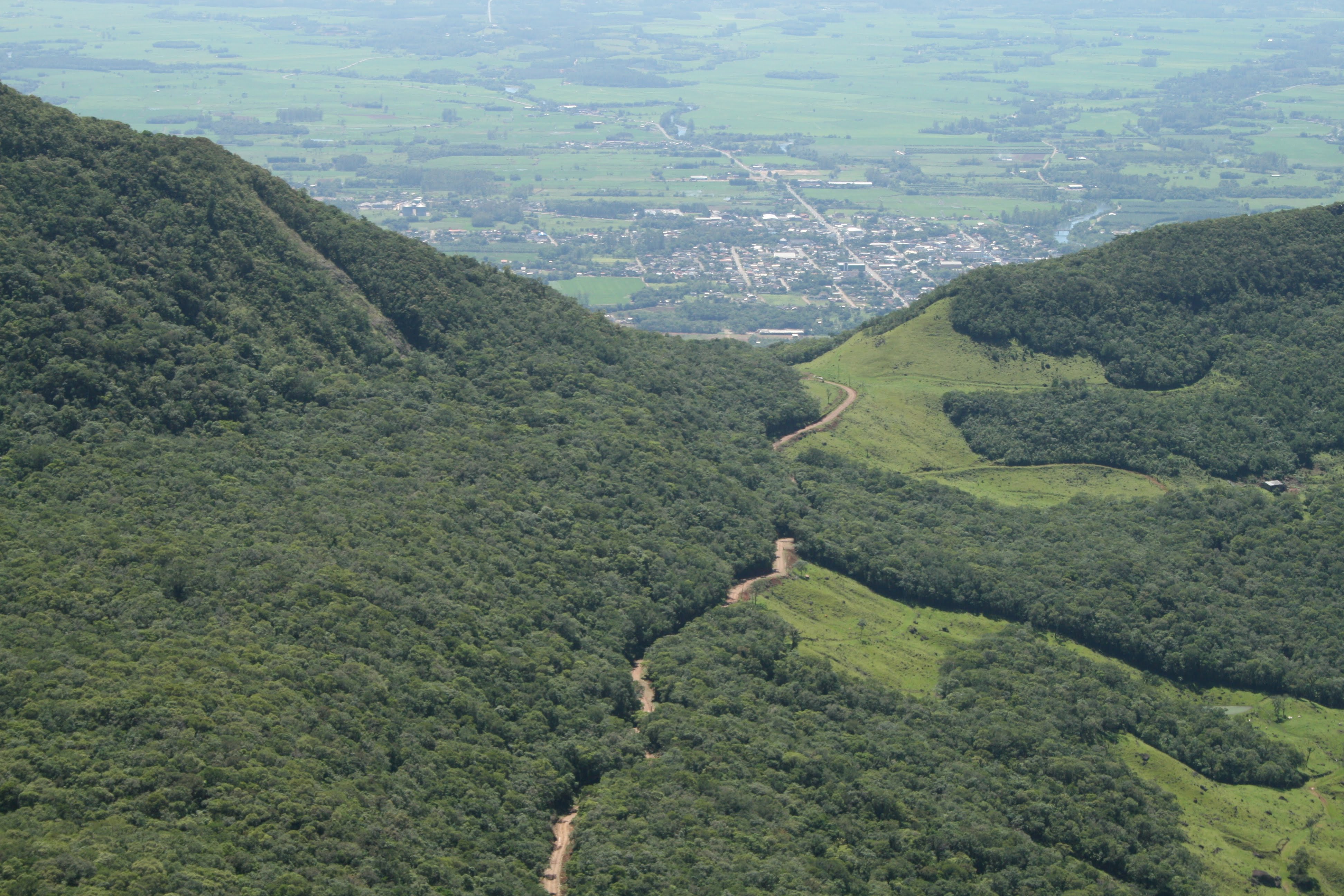
Timbé do Sul is located at the foot of the Serra Geral where you can see the exuberance and grandeur of the walls and canyons that make up the characteristic landscape of this region.
With numerous natural attractions such as rivers, waterfalls, canyons, as well as a vast biodiversity in fauna and flora, the countyy offers great potential in the segments of ecotourism, adventure tourism and rural tourism, strengthening its social, economic and cultural development. Ecotourism is the biggest attraction of Timbé do sul, a city with 5,300 inhabitants. The city's biggest events are the patron saint São Roque festival in August and the South Brazilian Free Flight Festival in October, but all year round ecotourists and adventurers have the opportunity to explore and practice extreme sports wwithin beautiful backdrops, such as Amola Faca Canyon, Cortina Waterfall, Poço do Caixão and Salto River.
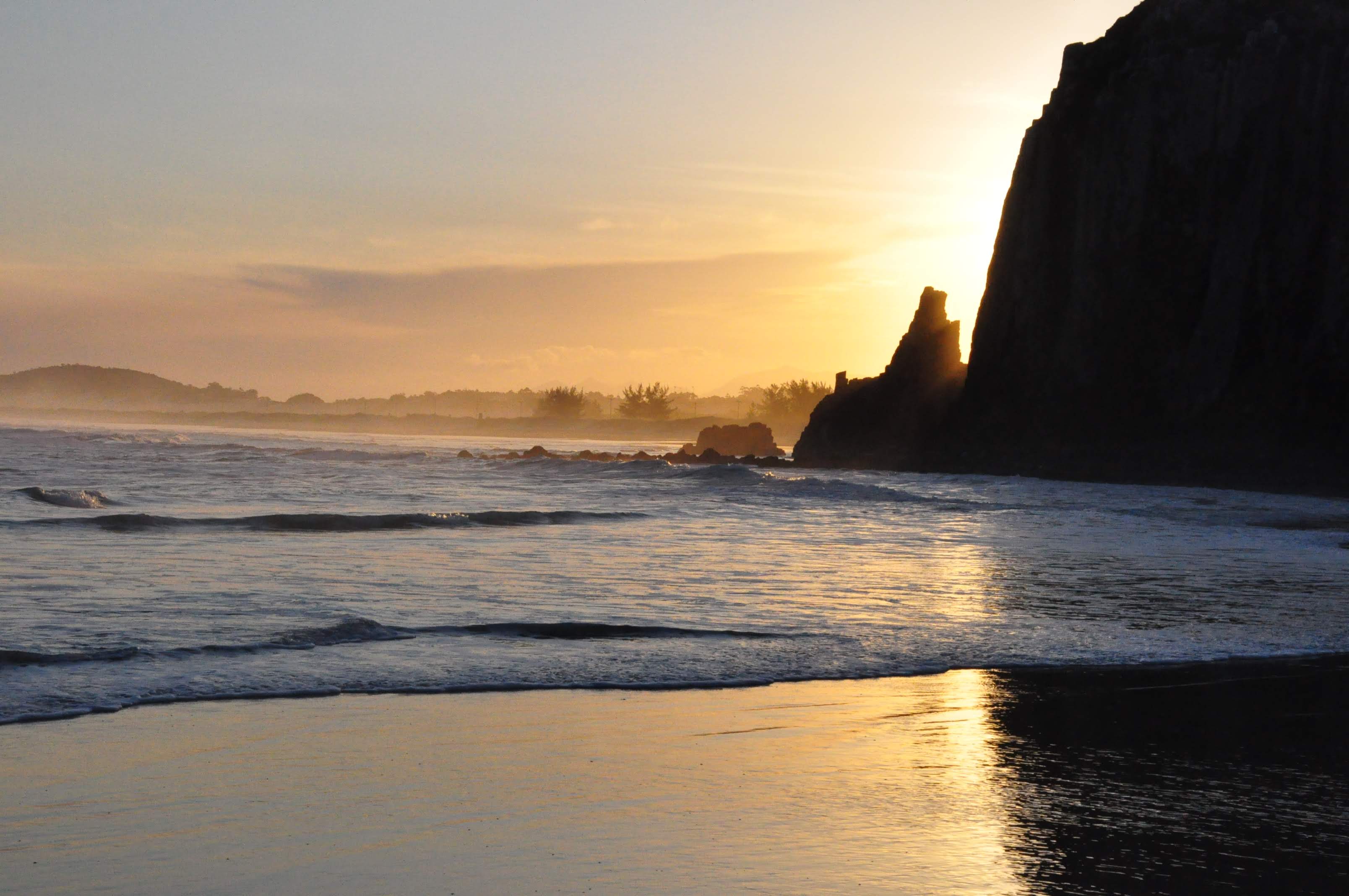
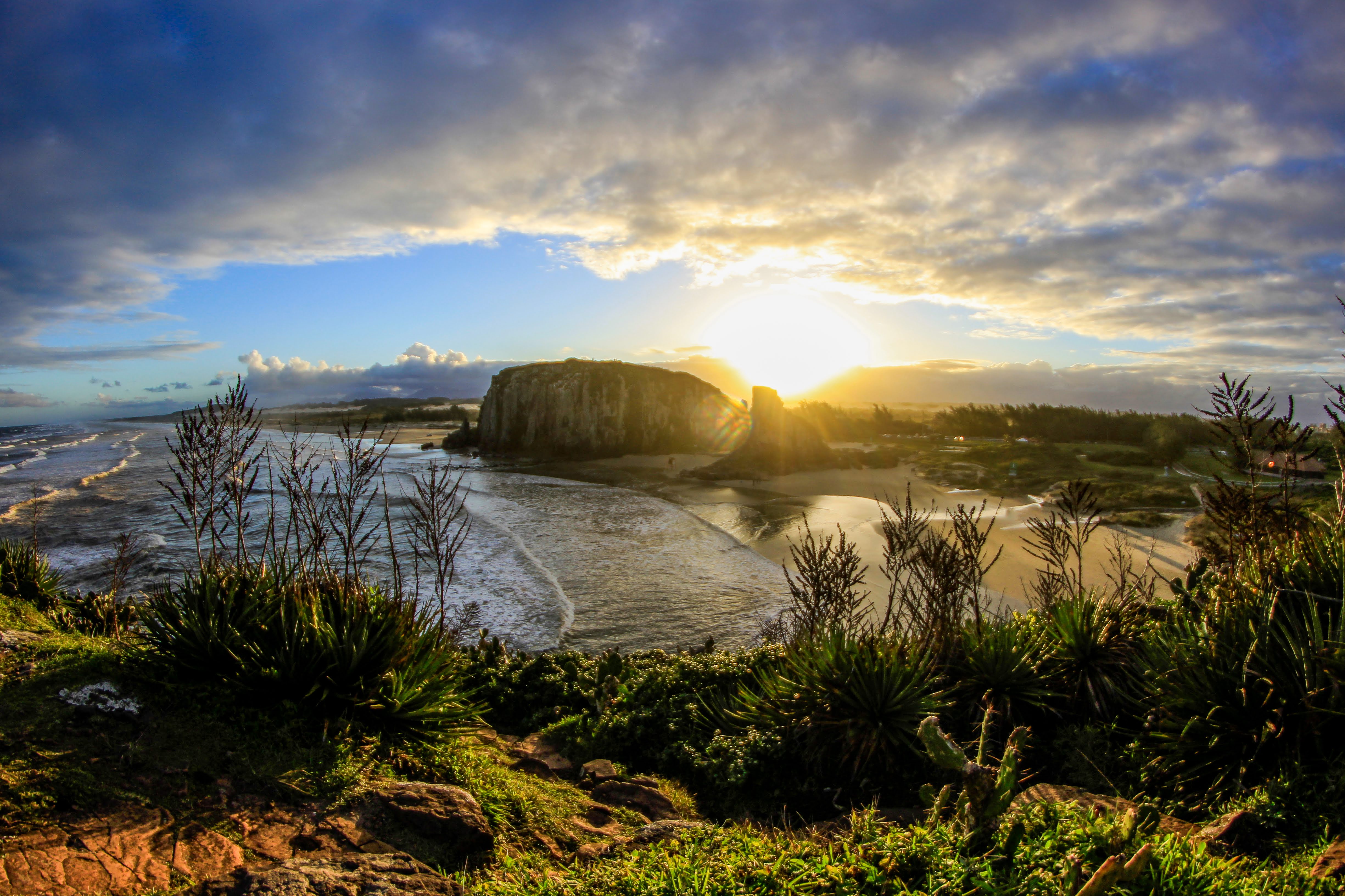
Torres is the main destination for the Rio Grande do Sul residents and thousands of visitors from neighboring countries, especially Uruguayans and Argentines in the summer months. It is a unique place, mixing beaches, hills, cliffs, caves, dunes, sea, island, river and lagoons. This gives it the title of the most beautiful beach in Rio Grande do Sul.
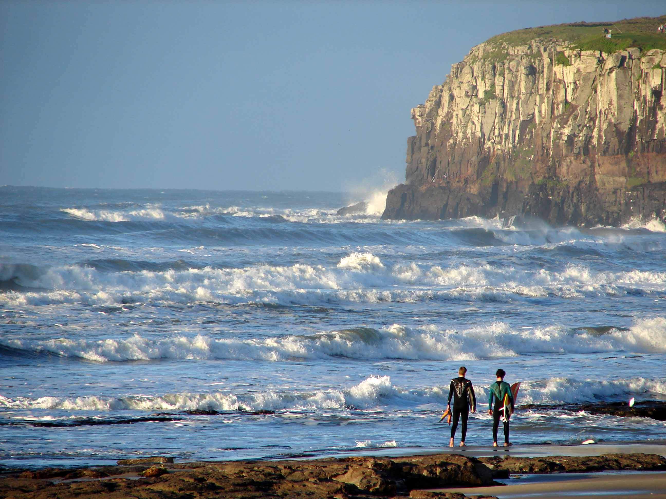
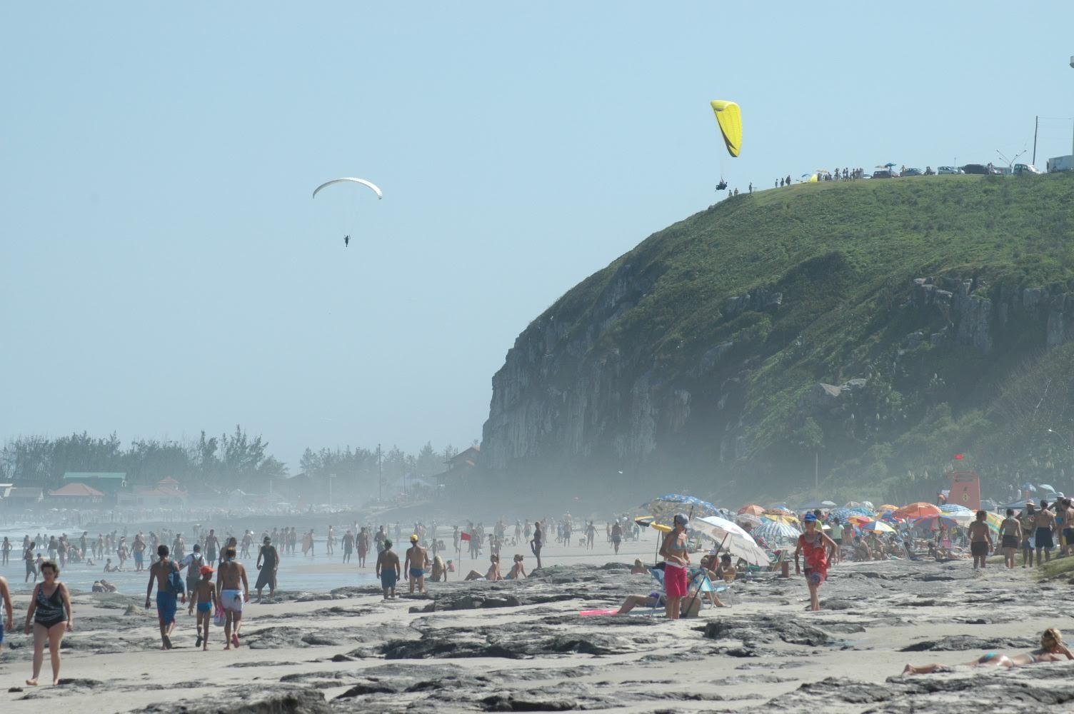
In summer, sun and sea tourism is preferred. For the whole year, Torres offers adventure tourism options and extreme sports, such as: surfing, kite surfing, canoeing, jet skiing, speed boating, rappelling, climbing, paragliding and balloon flight, among others, and event tourism has been growing each year. Torres has several tourist attractions, especially those that make up its peculiar landscape. It has two state parks and a wildlife refuge.
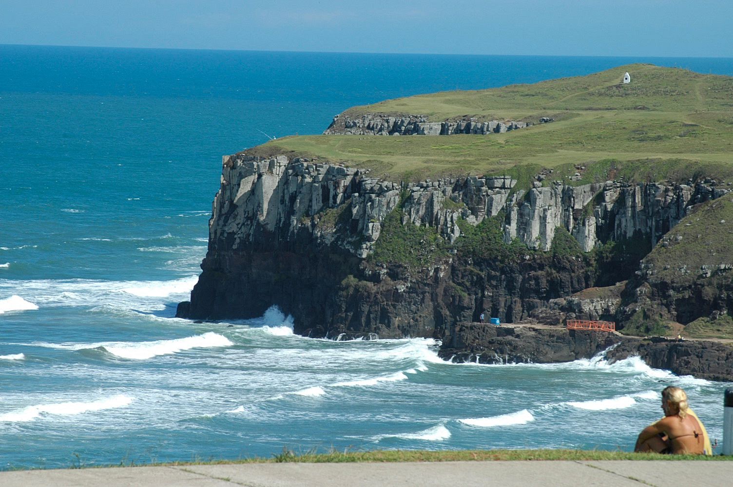
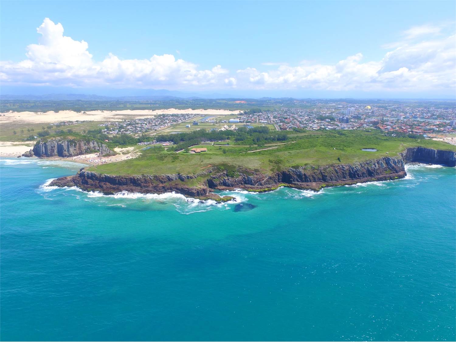
The Itapeva State Park, located in the southern part of the city, is comprised of dunes and Atlantic Forest. Next to Itapeva, towards the north is the Guarita State Park. Known as the main natural attraction of the north coast of Rio Grande do Sul and comprised of three cliffs by the sea, called the towers, which give the name to the city. Very popular with tourists and locals, who circulate its trails, to contemplate the beautiful view, or simply enjoy the beach.
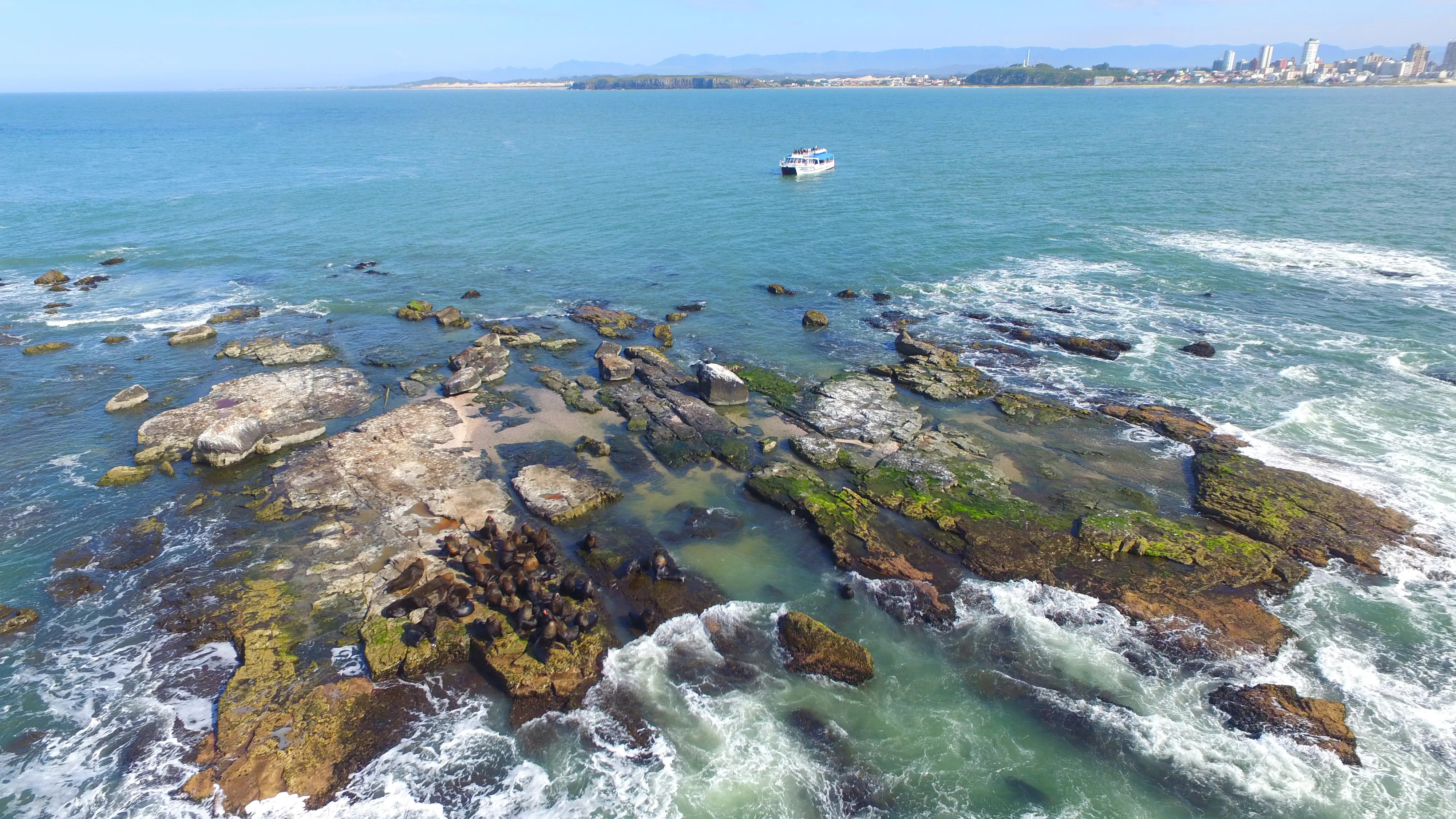
The third preservation area is Ilha dos Lobos, which can be visited by tourist boats. During the months of April to November is taken by sea lions and fur seals migrating from Patagonia. At this time its also possible to spot whales in the coastline. along with its offspring.
Still in the natural attractions, there are the resorts, Itapeva Beach, Cal Beach, Prainha Beach, Praia Grande and Molhes Beach, besides the banks of the Mampituba River, a favorite place for fishing.